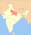
ಚಿತ್ರ:Uttar Pradesh district location map Jyotiba Phule Nagar.svg

Size of this PNG preview of this SVG file: ೫೩೦ × ೫೯೯ ಪಿಕ್ಸೆಲ್ಗಳು. ಇತರ ರೆಸಲ್ಯೂಶನ್ಗಳು: ೨೧೨ × ೨೪೦ ಪಿಕ್ಸೆಲ್ಗಳು | ೪೨೫ × ೪೮೦ ಪಿಕ್ಸೆಲ್ಗಳು | ೬೮೦ × ೭೬೮ ಪಿಕ್ಸೆಲ್ಗಳು | ೯೦೬ × ೧,೦೨೪ ಪಿಕ್ಸೆಲ್ಗಳು | ೧,೮೧೨ × ೨,೦೪೮ ಪಿಕ್ಸೆಲ್ಗಳು | ೧,೬೩೯ × ೧,೮೫೨ ಪಿಕ್ಸೆಲ್ಗಳು.
ಮೂಲ ಕಡತ (SVG ಫೈಲು, ಸುಮಾರಾಗಿ ೧,೬೩೯ × ೧,೮೫೨ ಚಿತ್ರಬಿಂದುಗಳು, ಫೈಲಿನ ಗಾತ್ರ: ೭೪೫ KB)
ಕಡತದ ಇತಿಹಾಸ
ದಿನ/ಕಾಲ ಒತ್ತಿದರೆ ಆ ಸಮಯದಲ್ಲಿ ಈ ಕಡತದ ವಸ್ತುಸ್ಥಿತಿ ತೋರುತ್ತದೆ.
| ದಿನ/ಕಾಲ | ಕಿರುನೋಟ | ಆಯಾಮಗಳು | ಬಳಕೆದಾರ | ಟಿಪ್ಪಣಿ | |
|---|---|---|---|---|---|
| ಪ್ರಸಕ್ತ | ೦೨:೫೧, ೧೮ ಅಕ್ಟೋಬರ್ ೨೦೦೮ |  | ೧,೬೩೯ × ೧,೮೫೨ (೭೪೫ KB) | Haros | {{Information |Description=Map showing location of district in Uttar Pradesh in India |Source=own work based on image:India Uttar Pradesh locator map.svg |Date=2008-10-17 |Author=User:Haros based on map created by w:user:Nichalp & [[w:user:Pl |
ಕಡತ ಬಳಕೆ
ಈ ಫೈಲನ್ನು ಬಳಸುವ ಯಾವ ಪುಟಗಳೂ ಇಲ್ಲ.
