
ಚಿತ್ರ:South Yorkshire UK location map.svg

Size of this PNG preview of this SVG file: ೮೦೦ × ೫೪೭ ಪಿಕ್ಸೆಲ್ಗಳು. ಇತರ ರೆಸಲ್ಯೂಶನ್ಗಳು: ೩೨೦ × ೨೧೯ ಪಿಕ್ಸೆಲ್ಗಳು | ೬೪೦ × ೪೩೭ ಪಿಕ್ಸೆಲ್ಗಳು | ೧,೦೨೪ × ೭೦೦ ಪಿಕ್ಸೆಲ್ಗಳು | ೧,೨೮೦ × ೮೭೫ ಪಿಕ್ಸೆಲ್ಗಳು | ೨,೫೬೦ × ೧,೭೫೦ ಪಿಕ್ಸೆಲ್ಗಳು | ೧,೪೨೫ × ೯೭೪ ಪಿಕ್ಸೆಲ್ಗಳು.
ಮೂಲ ಕಡತ (SVG ಫೈಲು, ಸುಮಾರಾಗಿ ೧,೪೨೫ × ೯೭೪ ಚಿತ್ರಬಿಂದುಗಳು, ಫೈಲಿನ ಗಾತ್ರ: ೧.೪೭ MB)
ಈ ಫೈಲು ವಿಕಿಮೀಡಿಯ ಕಾಮನ್ಸ್ನಲ್ಲಿ ಇರುವುದು. ಅಲ್ಲಿನ ವಿವರಣೆ ಪುಟವನ್ನೇ ಕೆಳಗೆ ತೋರಿಸಲಾಗಿದೆ. ಕಾಮನ್ಸ್ ಕೃತಿಸ್ವಾಮ್ಯತೆಯಿಂದ ಮುಕ್ತ ಫೈಲುಗಳ ಒಂದು ಆಗರ. ಅಲ್ಲಿ ನೀವೂ ಸಹಕರಿಸಬಹುದು. |
| ವಿವರ |
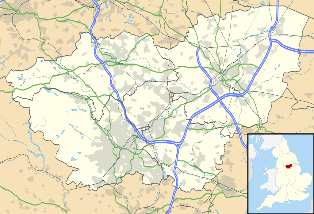
Map of South Yorkshire, UK with the following information shown:
Equirectangular map projection on WGS 84 datum, with N/S stretched 165% Geographic limits:
|
| ದಿನಾಂಕ | |
| ಆಕರ |
|
| ಕರ್ತೃ | Nilfanion, created using Ordnance Survey data |
| ಅನುಮತಿ (ಈ ಕಡತವನ್ನು ಮರುಬಳಕೆ ಮಾಡಲಾಗುತ್ತಿದೆ) |
ಈ ಕಡತ ಕ್ರಿಯೇಟಿವ್ ಕಾಮನ್ಸ್ Attribution
-Share Alike 3.0 Unported ಪರವಾನಗಿ ಹೊಂದಿದೆ. ವೈಶಿಷ್ಟ್ಯ: Contains Ordnance Survey data © Crown copyright and database right
|
| ಇತರೆ ಆವೃತ್ತಿಗಳು | File:South Yorkshire UK district map (blank).svg - Blank map |
| SVG genesis |
.svg)
ಕಡತದ ಇತಿಹಾಸ
ದಿನ/ಕಾಲ ಒತ್ತಿದರೆ ಆ ಸಮಯದಲ್ಲಿ ಈ ಕಡತದ ವಸ್ತುಸ್ಥಿತಿ ತೋರುತ್ತದೆ.
| ದಿನ/ಕಾಲ | ಕಿರುನೋಟ | ಆಯಾಮಗಳು | ಬಳಕೆದಾರ | ಟಿಪ್ಪಣಿ | |
|---|---|---|---|---|---|
| ಪ್ರಸಕ್ತ | ೦೦:೪೨, ೨೭ ಸೆಪ್ಟೆಂಬರ್ ೨೦೧೦ | | ೧,೪೨೫ × ೯೭೪ (೧.೪೭ MB) | Nilfanion | {{Information |Description=Map of South Yorkshire, UK with the following information shown: *Administrative borders *Coastline, lakes and rivers *Roads and railways *Urban areas Equirectangular map projection on WGS 84 datum, with N |
ಕಡತ ಬಳಕೆ
ಈ ಕೆಳಗಿನ ಪುಟವು ಈ ಚಿತ್ರಕ್ಕೆ ಸಂಪರ್ಕ ಹೊಂದಿದೆ:
ಜಾಗತಿಕ ಕಡತ ಉಪಯೋಗ
ಈ ಕಡತವನ್ನು ಕೆಳಗಿನ ಬೇರೆ ವಿಕಿಗಳೂ ಉಪಯೋಗಿಸುತ್ತಿವೆ:
- ar.wikipedia.org ಮೇಲೆ ಬಳಕೆ
- bg.wikipedia.org ಮೇಲೆ ಬಳಕೆ
- ceb.wikipedia.org ಮೇಲೆ ಬಳಕೆ
- en.wikipedia.org ಮೇಲೆ ಬಳಕೆ
- Sheffield
- Roche Abbey
- Wentworth Woodhouse
- Conisbrough Castle
- Conisbrough
- Doncaster
- Anston
- Battle of Orgreave
- Barnsley
- Dore, South Yorkshire
- Ecclesall
- Stocksbridge
- Bradfield, South Yorkshire
- Dinnington, South Yorkshire
- Great Sheffield Flood
- Dunford Bridge
- Sheffield Botanical Gardens
- Woodlands, South Yorkshire
- Sheffield City Hall
- Askern
- Penistone
- Weston Park Museum
- Bawtry
- Handsworth, South Yorkshire
- Grimethorpe
- Darton
- Thorne, South Yorkshire
- Tickhill
- Beauchief Abbey
- Green Moor
- Oxspring
- Darfield, South Yorkshire
- Woodsetts
- Firbeck
- Austerfield
- Finningley
- Blaxton
- Hatfield, South Yorkshire
- Dunsville
- Moorends
- Sykehouse
- Pincheon Green
- Norton, Doncaster
- Campsall
- Hampole
- Skelbrooke
- Hooton Pagnell
ಈ ಫೈಲ್ನ ಹೆಚ್ಚು ಜಾಗತಿಕ ಬಳಕೆಯನ್ನು ವೀಕ್ಷಿಸಿ.