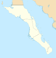
ಚಿತ್ರ:Mexico Baja California Sur location map.svg
ಗೋಚರ

Size of this PNG preview of this SVG file: ೫೮೬ × ೫೯೯ ಪಿಕ್ಸೆಲ್ಗಳು. ಇತರ ರೆಸಲ್ಯೂಶನ್ಗಳು: ೨೩೫ × ೨೪೦ ಪಿಕ್ಸೆಲ್ಗಳು | ೪೬೯ × ೪೮೦ ಪಿಕ್ಸೆಲ್ಗಳು | ೭೫೧ × ೭೬೮ ಪಿಕ್ಸೆಲ್ಗಳು | ೧,೦೦೧ × ೧,೦೨೪ ಪಿಕ್ಸೆಲ್ಗಳು | ೨,೦೦೨ × ೨,೦೪೮ ಪಿಕ್ಸೆಲ್ಗಳು | ೯೨೩ × ೯೪೪ ಪಿಕ್ಸೆಲ್ಗಳು.
ಮೂಲ ಕಡತ (SVG ಫೈಲು, ಸುಮಾರಾಗಿ ೯೨೩ × ೯೪೪ ಚಿತ್ರಬಿಂದುಗಳು, ಫೈಲಿನ ಗಾತ್ರ: ೩೭೪ KB)
ಕಡತದ ಇತಿಹಾಸ
ದಿನ/ಕಾಲ ಒತ್ತಿದರೆ ಆ ಸಮಯದಲ್ಲಿ ಈ ಕಡತದ ವಸ್ತುಸ್ಥಿತಿ ತೋರುತ್ತದೆ.
| ದಿನ/ಕಾಲ | ಕಿರುನೋಟ | ಆಯಾಮಗಳು | ಬಳಕೆದಾರ | ಟಿಪ್ಪಣಿ | |
|---|---|---|---|---|---|
| ಪ್ರಸಕ್ತ | ೦೧:೦೨, ೮ ಆಗಸ್ಟ್ ೨೦೧೧ |  | ೯೨೩ × ೯೪೪ (೩೭೪ KB) | Addicted04 | color |
| ೦೦:೫೮, ೮ ಆಗಸ್ಟ್ ೨೦೧೧ |  | ೯೨೩ × ೯೪೪ (೩೭೪ KB) | Battroid | {{ValidSVG}} {{Information |Description={{en|1=Own work as from the map of municipalities of INEGI and costs taken from OpenStreetMap.org (under Creative Commons Attribution-Share Alike 2.0 Generic Licence). Limits of map: * West : 115.50' W * Est : 109. | |
| ೦೩:೦೬, ೨೮ ಅಕ್ಟೋಬರ್ ೨೦೦೯ |  | ೯೨೩ × ೯೪೪ (೩೭೪ KB) | Spischot | Fix: Isla de Cedros to Baja California | |
| ೦೨:೪೨, ೨೮ ಅಕ್ಟೋಬರ್ ೨೦೦೯ |  | ೯೨೩ × ೯೪೪ (೩೬೩ KB) | Spischot | {{Information |Description={{en|1=Own work as from the map of municipalities of INEGI and costs taken from OpenStreetMap.org (under Creative Commons Attribution-Share Alike 2.0 Generic Licence). Limits of map: * West : 115º 5' W * Est : 109º W * Nort |
ಕಡತ ಬಳಕೆ
ಈ ಕೆಳಗಿನ ಪುಟವು ಈ ಚಿತ್ರಕ್ಕೆ ಸಂಪರ್ಕ ಹೊಂದಿದೆ:
ಜಾಗತಿಕ ಕಡತ ಉಪಯೋಗ
ಈ ಕಡತವನ್ನು ಕೆಳಗಿನ ಬೇರೆ ವಿಕಿಗಳೂ ಉಪಯೋಗಿಸುತ್ತಿವೆ:
- ar.wikipedia.org ಮೇಲೆ ಬಳಕೆ
- ba.wikipedia.org ಮೇಲೆ ಬಳಕೆ
- bg.wikipedia.org ಮೇಲೆ ಬಳಕೆ
- ceb.wikipedia.org ಮೇಲೆ ಬಳಕೆ
- ce.wikipedia.org ಮೇಲೆ ಬಳಕೆ
- cs.wikipedia.org ಮೇಲೆ ಬಳಕೆ
- de.wikipedia.org ಮೇಲೆ ಬಳಕೆ
- La Paz (Baja California Sur)
- Loreto (Baja California Sur)
- Guerrero Negro
- Mulegé
- San Ignacio (Baja California Sur)
- Isla Espíritu Santo
- Isla Santa Catalina (Mexiko)
- Santa Rosalía
- Benutzer:Spischot/Bilder
- Aguajito
- Wikipedia:Kartenwerkstatt/Positionskarten/Nordamerika
- Cabo San Lucas
- San Bruno (Baja California Sur)
- Todos Santos (Mexiko)
- Isla Santa Margarita
- Vorlage:Positionskarte Mexiko Baja California Sur
- Tortuga (Mexiko)
- Isla Natividad
- Isla Carmen
- Isla Monserrat
- Isla Coronados
- Isla San Marcos
- Isla Santa Cruz (Mexiko)
- Isla San Diego
- Isla Danzante
- Isla San Francisco
- Bahía Magdalena
- San José del Cabo
- Nationalpark Cabo Pulmo
- Estadio Guaycura
- Ciudad Constitución (Mexiko)
- en.wikipedia.org ಮೇಲೆ ಬಳಕೆ
ಈ ಫೈಲ್ನ ಹೆಚ್ಚು ಜಾಗತಿಕ ಬಳಕೆಯನ್ನು ವೀಕ್ಷಿಸಿ.

