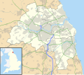
ಚಿತ್ರ:Tyne and Wear UK location map.svg
ಗೋಚರ

Size of this PNG preview of this SVG file: ೬೮೨ × ೫೯೯ ಪಿಕ್ಸೆಲ್ಗಳು. ಇತರ ರೆಸಲ್ಯೂಶನ್ಗಳು: ೨೭೩ × ೨೪೦ ಪಿಕ್ಸೆಲ್ಗಳು | ೫೪೬ × ೪೮೦ ಪಿಕ್ಸೆಲ್ಗಳು | ೮೭೪ × ೭೬೮ ಪಿಕ್ಸೆಲ್ಗಳು | ೧,೧೬೬ × ೧,೦೨೪ ಪಿಕ್ಸೆಲ್ಗಳು | ೨,೩೩೧ × ೨,೦೪೮ ಪಿಕ್ಸೆಲ್ಗಳು | ೧,೪೨೫ × ೧,೨೫೨ ಪಿಕ್ಸೆಲ್ಗಳು.
ಮೂಲ ಕಡತ (SVG ಫೈಲು, ಸುಮಾರಾಗಿ ೧,೪೨೫ × ೧,೨೫೨ ಚಿತ್ರಬಿಂದುಗಳು, ಫೈಲಿನ ಗಾತ್ರ: ೧.೦೯ MB)
ಕಡತದ ಇತಿಹಾಸ
ದಿನ/ಕಾಲ ಒತ್ತಿದರೆ ಆ ಸಮಯದಲ್ಲಿ ಈ ಕಡತದ ವಸ್ತುಸ್ಥಿತಿ ತೋರುತ್ತದೆ.
| ದಿನ/ಕಾಲ | ಕಿರುನೋಟ | ಆಯಾಮಗಳು | ಬಳಕೆದಾರ | ಟಿಪ್ಪಣಿ | |
|---|---|---|---|---|---|
| ಪ್ರಸಕ್ತ | ೦೦:೪೬, ೨೭ ಸೆಪ್ಟೆಂಬರ್ ೨೦೧೦ |  | ೧,೪೨೫ × ೧,೨೫೨ (೧.೦೯ MB) | Nilfanion | {{Information |Description=Map of Tyne and Wear, UK with the following information shown: *Administrative borders *Coastline, lakes and rivers *Roads and railways *Urban areas Equirectangular map projection on WGS 84 datum, with N/S s |
ಕಡತ ಬಳಕೆ
ಈ ಕೆಳಗಿನ ಪುಟವು ಈ ಚಿತ್ರಕ್ಕೆ ಸಂಪರ್ಕ ಹೊಂದಿದೆ:
ಜಾಗತಿಕ ಕಡತ ಉಪಯೋಗ
ಈ ಕಡತವನ್ನು ಕೆಳಗಿನ ಬೇರೆ ವಿಕಿಗಳೂ ಉಪಯೋಗಿಸುತ್ತಿವೆ:
- ar.wikipedia.org ಮೇಲೆ ಬಳಕೆ
- azb.wikipedia.org ಮೇಲೆ ಬಳಕೆ
- bg.wikipedia.org ಮೇಲೆ ಬಳಕೆ
- ceb.wikipedia.org ಮೇಲೆ ಬಳಕೆ
- de.wikipedia.org ಮೇಲೆ ಬಳಕೆ
- en.wikipedia.org ಮೇಲೆ ಬಳಕೆ
- WWT Washington
- Wallsend
- Jarrow
- Washington, Tyne and Wear
- Sunderland
- Gateshead
- Newcastle International Airport
- Angel of the North
- South Shields
- Whitley Bay
- Tynemouth
- Killingworth
- Jesmond Dene
- Hetton-le-Hole
- Houghton-le-Spring
- Tynemouth Priory and Castle
- North Shields
- Baltic Centre for Contemporary Art
- The Castle, Newcastle
- Bessie Surtees House
- Bill Quay
- Monkseaton
- Ryhope
- Seaburn
- Roker
- Blaydon
- Throckley
- Earsdon
- Newbottle, Tyne and Wear
- Penshaw Monument
- Penshaw
- Easington Lane
- Felling, Tyne and Wear
- Fenham
- Civil parishes in Tyne and Wear
- Jingling Geordie's Hole
- Ashbrooke
- Cullercoats
- Rowlands Gill
- Gibside
- Marsden, Tyne and Wear
- Byker Wall
- MetroCentre railway station
- The Boldons
ಈ ಫೈಲ್ನ ಹೆಚ್ಚು ಜಾಗತಿಕ ಬಳಕೆಯನ್ನು ವೀಕ್ಷಿಸಿ.
