ಚಿತ್ರ:Surrey UK location map.svg
ಗೋಚರ

Size of this PNG preview of this SVG file: ೭೯೦ × ೫೯೯ ಪಿಕ್ಸೆಲ್ಗಳು. ಇತರ ರೆಸಲ್ಯೂಶನ್ಗಳು: ೩೧೭ × ೨೪೦ ಪಿಕ್ಸೆಲ್ಗಳು | ೬೩೩ × ೪೮೦ ಪಿಕ್ಸೆಲ್ಗಳು | ೧,೦೧೩ × ೭೬೮ ಪಿಕ್ಸೆಲ್ಗಳು | ೧,೨೮೦ × ೯೭೧ ಪಿಕ್ಸೆಲ್ಗಳು | ೨,೫೬೦ × ೧,೯೪೨ ಪಿಕ್ಸೆಲ್ಗಳು | ೧,೪೨೫ × ೧,೦೮೧ ಪಿಕ್ಸೆಲ್ಗಳು.
ಮೂಲ ಕಡತ (SVG ಫೈಲು, ಸುಮಾರಾಗಿ ೧,೪೨೫ × ೧,೦೮೧ ಚಿತ್ರಬಿಂದುಗಳು, ಫೈಲಿನ ಗಾತ್ರ: ೧.೯೩ MB)
ಕಡತದ ಇತಿಹಾಸ
ದಿನ/ಕಾಲ ಒತ್ತಿದರೆ ಆ ಸಮಯದಲ್ಲಿ ಈ ಕಡತದ ವಸ್ತುಸ್ಥಿತಿ ತೋರುತ್ತದೆ.
| ದಿನ/ಕಾಲ | ಕಿರುನೋಟ | ಆಯಾಮಗಳು | ಬಳಕೆದಾರ | ಟಿಪ್ಪಣಿ | |
|---|---|---|---|---|---|
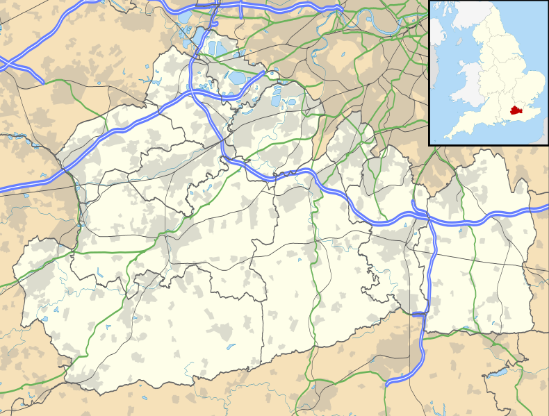
| ಪ್ರಸಕ್ತ | ೦೦:೪೫, ೨೭ ಸೆಪ್ಟೆಂಬರ್ ೨೦೧೦ |  | ೧,೪೨೫ × ೧,೦೮೧ (೧.೯೩ MB) | Nilfanion | {{Information |Description=Map of Surrey, UK with the following information shown: *Administrative borders *Coastline, lakes and rivers *Roads and railways *Urban areas Equirectangular map projection on WGS 84 datum, with N/S stretched 160% |
ಕಡತ ಬಳಕೆ
ಈ ಕೆಳಗಿನ ಪುಟವು ಈ ಚಿತ್ರಕ್ಕೆ ಸಂಪರ್ಕ ಹೊಂದಿದೆ:
ಜಾಗತಿಕ ಕಡತ ಉಪಯೋಗ
ಈ ಕಡತವನ್ನು ಕೆಳಗಿನ ಬೇರೆ ವಿಕಿಗಳೂ ಉಪಯೋಗಿಸುತ್ತಿವೆ:
- ar.wikipedia.org ಮೇಲೆ ಬಳಕೆ
- bg.wikipedia.org ಮೇಲೆ ಬಳಕೆ
- ceb.wikipedia.org ಮೇಲೆ ಬಳಕೆ
- en.wikipedia.org ಮೇಲೆ ಬಳಕೆ
- Staines-upon-Thames
- Dorking
- Guildford
- Effingham, Surrey
- Farnham
- Ashtead
- Leatherhead
- Epsom
- Wisley
- Cobham, Surrey
- Hindhead
- Fetcham
- Great Bookham
- East Horsley
- Cranleigh
- Oatlands, Surrey
- Little Bookham
- Godalming
- Reigate
- Camberley
- Milford, Surrey
- Dunsfold
- Winkworth Arboretum
- Weybridge
- Haslemere
- Redhill, Surrey
- Bramley, Surrey
- Haxted Watermill
- Ockham, Surrey
- Egham
- Esher
- Virginia Water
- Sunbury-on-Thames
- Pirbright
- Abinger Hammer
- Epsom railway station
- Send, Surrey
- Lingfield, Surrey
- Shalford, Surrey
- Waverley Abbey
- Ashford, Surrey
- Tadworth
- Church of St Peter & St Paul, Godalming
- Wormley, Surrey
- Guildford Cathedral
- Witley
- Hambledon, Surrey
ಈ ಫೈಲ್ನ ಹೆಚ್ಚು ಜಾಗತಿಕ ಬಳಕೆಯನ್ನು ವೀಕ್ಷಿಸಿ.
