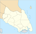
ಚಿತ್ರ:Johor location map.svg

Size of this PNG preview of this SVG file: ೬೨೯ × ೫೯೯ ಪಿಕ್ಸೆಲ್ಗಳು. ಇತರ ರೆಸಲ್ಯೂಶನ್ಗಳು: ೨೫೨ × ೨೪೦ ಪಿಕ್ಸೆಲ್ಗಳು | ೫೦೪ × ೪೮೦ ಪಿಕ್ಸೆಲ್ಗಳು | ೮೦೬ × ೭೬೮ ಪಿಕ್ಸೆಲ್ಗಳು | ೧,೦೭೫ × ೧,೦೨೪ ಪಿಕ್ಸೆಲ್ಗಳು | ೨,೧೫೦ × ೨,೦೪೮ ಪಿಕ್ಸೆಲ್ಗಳು | ೧,೦೩೫ × ೯೮೬ ಪಿಕ್ಸೆಲ್ಗಳು.
ಮೂಲ ಕಡತ (SVG ಫೈಲು, ಸುಮಾರಾಗಿ ೧,೦೩೫ × ೯೮೬ ಚಿತ್ರಬಿಂದುಗಳು, ಫೈಲಿನ ಗಾತ್ರ: ೬೫ KB)
ಕಡತದ ಇತಿಹಾಸ
ದಿನ/ಕಾಲ ಒತ್ತಿದರೆ ಆ ಸಮಯದಲ್ಲಿ ಈ ಕಡತದ ವಸ್ತುಸ್ಥಿತಿ ತೋರುತ್ತದೆ.
| ದಿನ/ಕಾಲ | ಕಿರುನೋಟ | ಆಯಾಮಗಳು | ಬಳಕೆದಾರ | ಟಿಪ್ಪಣಿ | |
|---|---|---|---|---|---|
| ಪ್ರಸಕ್ತ | ೧೮:೪೨, ೧೩ ಜನವರಿ ೨೦೧೮ |  | ೧,೦೩೫ × ೯೮೬ (೬೫ KB) | Goran tek-en | {{Information |description ={{en|1=A map showing districts and PBT (local authorities) of Johor (blank version)<br> Approximate geographic limits of the map: *N 3.108806 *W 102.365112 *S 1.270019 *E 104.61731}} |date =20180113 |source... |
ಕಡತ ಬಳಕೆ
ಈ ಫೈಲನ್ನು ಬಳಸುವ ಯಾವ ಪುಟಗಳೂ ಇಲ್ಲ.
ಜಾಗತಿಕ ಕಡತ ಉಪಯೋಗ
ಈ ಕಡತವನ್ನು ಕೆಳಗಿನ ಬೇರೆ ವಿಕಿಗಳೂ ಉಪಯೋಗಿಸುತ್ತಿವೆ:
- en.wikipedia.org ಮೇಲೆ ಬಳಕೆ
- Johor Bahru
- Pasir Gudang
- Rawa Island
- Pemanggil Island
- Besar Island, Johor
- Kukup
- Mersing
- Labis
- Senai International Airport
- Iskandar Puteri
- Ayer Hitam
- Yong Peng
- Sultan Abu Bakar State Mosque
- Pasir Pelangi Royal Mosque
- Sultan Ibrahim Jamek Mosque
- Pasir Gudang Jamek Mosque
- Jementah
- Parit Raja
- Bandar Tenggara
- Tampoi, Johor
- Perling
- Bukit Kepong incident
- Air Panas
- Kempas
- Mengkibol
- Tenggaroh
- Sagil
- Sungai Mati
- Parit Bakar
- Semerah
- Sri Medan
- Sungai Balang
- Sultan Ismail Jamek Mosque
- Bandar Baru UDA Jamek Mosque
- Tanjung Kupang
- Gemas Baru
- Tongkang Pechah
- Ungku Tun Aminah Jamek Mosque
- Kolam Ayer Mosque
- Lima Kedai
- Senggarang, Johor
- Sri Gading
- Wikipedia:WikiProject Malaysia/Cartography
- Seelong
- Kukup Island
- Kangkar Pulai
- Tebrau
- Pulau Merambong
- Taman Sri Lambak
- Batu Pahat (town)
ಈ ಫೈಲ್ನ ಹೆಚ್ಚು ಜಾಗತಿಕ ಬಳಕೆಯನ್ನು ವೀಕ್ಷಿಸಿ.
