
ಚಿತ್ರ:West Sussex UK location map.svg

Size of this PNG preview of this SVG file: ೮೦೦ × ೫೫೯ ಪಿಕ್ಸೆಲ್ಗಳು. ಇತರ ರೆಸಲ್ಯೂಶನ್ಗಳು: ೩೨೦ × ೨೨೩ ಪಿಕ್ಸೆಲ್ಗಳು | ೬೪೦ × ೪೪೭ ಪಿಕ್ಸೆಲ್ಗಳು | ೧,೦೨೪ × ೭೧೫ ಪಿಕ್ಸೆಲ್ಗಳು | ೧,೨೮೦ × ೮೯೪ ಪಿಕ್ಸೆಲ್ಗಳು | ೨,೫೬೦ × ೧,೭೮೮ ಪಿಕ್ಸೆಲ್ಗಳು | ೧,೪೨೫ × ೯೯೫ ಪಿಕ್ಸೆಲ್ಗಳು.
ಮೂಲ ಕಡತ (SVG ಫೈಲು, ಸುಮಾರಾಗಿ ೧,೪೨೫ × ೯೯೫ ಚಿತ್ರಬಿಂದುಗಳು, ಫೈಲಿನ ಗಾತ್ರ: ೧.೪೯ MB)
ಈ ಫೈಲು ವಿಕಿಮೀಡಿಯ ಕಾಮನ್ಸ್ನಲ್ಲಿ ಇರುವುದು. ಅಲ್ಲಿನ ವಿವರಣೆ ಪುಟವನ್ನೇ ಕೆಳಗೆ ತೋರಿಸಲಾಗಿದೆ. ಕಾಮನ್ಸ್ ಕೃತಿಸ್ವಾಮ್ಯತೆಯಿಂದ ಮುಕ್ತ ಫೈಲುಗಳ ಒಂದು ಆಗರ. ಅಲ್ಲಿ ನೀವೂ ಸಹಕರಿಸಬಹುದು. |
| ವಿವರ |
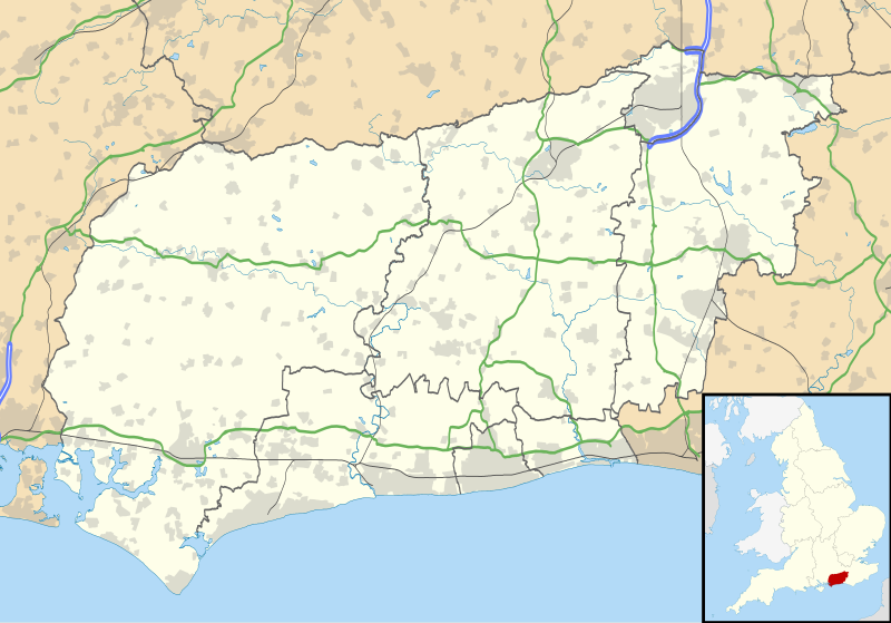
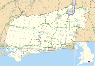
Map of West Sussex, UK with the following information shown:
Equirectangular map projection on WGS 84 datum, with N/S stretched 155% Geographic limits:
|
| ದಿನಾಂಕ | |
| ಆಕರ |
|
| ಕರ್ತೃ | Nilfanion, created using Ordnance Survey data |
| ಅನುಮತಿ (ಈ ಕಡತವನ್ನು ಮರುಬಳಕೆ ಮಾಡಲಾಗುತ್ತಿದೆ) |
ಈ ಕಡತ ಕ್ರಿಯೇಟಿವ್ ಕಾಮನ್ಸ್ Attribution
-Share Alike 3.0 Unported ಪರವಾನಗಿ ಹೊಂದಿದೆ. ವೈಶಿಷ್ಟ್ಯ: Contains Ordnance Survey data © Crown copyright and database right
|
| ಇತರೆ ಆವೃತ್ತಿಗಳು | File:West Sussex UK district map (blank).svg - Blank map |
| SVG genesis |
.svg)
ಕಡತದ ಇತಿಹಾಸ
ದಿನ/ಕಾಲ ಒತ್ತಿದರೆ ಆ ಸಮಯದಲ್ಲಿ ಈ ಕಡತದ ವಸ್ತುಸ್ಥಿತಿ ತೋರುತ್ತದೆ.
| ದಿನ/ಕಾಲ | ಕಿರುನೋಟ | ಆಯಾಮಗಳು | ಬಳಕೆದಾರ | ಟಿಪ್ಪಣಿ | |
|---|---|---|---|---|---|
| ಪ್ರಸಕ್ತ | ೦೦:೪೮, ೨೭ ಸೆಪ್ಟೆಂಬರ್ ೨೦೧೦ | | ೧,೪೨೫ × ೯೯೫ (೧.೪೯ MB) | Nilfanion | {{Information |Description=Map of West Sussex, UK with the following information shown: *Administrative borders *Coastline, lakes and rivers *Roads and railways *Urban areas Equirectangular map projection on WGS 84 datum, with N/S stret |
ಕಡತ ಬಳಕೆ
ಈ ಕೆಳಗಿನ ಪುಟವು ಈ ಚಿತ್ರಕ್ಕೆ ಸಂಪರ್ಕ ಹೊಂದಿದೆ:
ಜಾಗತಿಕ ಕಡತ ಉಪಯೋಗ
ಈ ಕಡತವನ್ನು ಕೆಳಗಿನ ಬೇರೆ ವಿಕಿಗಳೂ ಉಪಯೋಗಿಸುತ್ತಿವೆ:
- ar.wikipedia.org ಮೇಲೆ ಬಳಕೆ
- bg.wikipedia.org ಮೇಲೆ ಬಳಕೆ
- ceb.wikipedia.org ಮೇಲೆ ಬಳಕೆ
- en.wikipedia.org ಮೇಲೆ ಬಳಕೆ
- Fishbourne Roman Palace
- Chichester Cathedral
- Gatwick Airport
- WWT Arundel
- Amberley Museum & Heritage Centre
- Arundel
- Burgess Hill
- Shoreham-by-Sea
- Lancing, West Sussex
- Littlehampton
- East Grinstead
- Horsted Keynes
- Haywards Heath
- Bognor Regis
- Chichester
- Petworth
- Three Bridges, West Sussex
- Pease Pottage
- Southgate, West Sussex
- Pound Hill
- West Green, West Sussex
- Angmering
- Midhurst
- Broadfield, West Sussex
- Goring-by-Sea
- Tilgate
- RAF Tangmere
- Clapham, West Sussex
- Cuckfield
- Steyning
- Washington, West Sussex
- Pagham
- Chichester Cross
- Standen
- Gatwick Airport railway station
- Hurstpierpoint
- Bewbush
- Ifield, West Sussex
- Gossops Green
- Furnace Green
- Northgate, West Sussex
- Langley Green, West Sussex
- Manor Royal
- Maidenbower
- Worth, West Sussex
- Elmer, West Sussex
ಈ ಫೈಲ್ನ ಹೆಚ್ಚು ಜಾಗತಿಕ ಬಳಕೆಯನ್ನು ವೀಕ್ಷಿಸಿ.