
ಚಿತ್ರ:West Midlands UK location map.svg

Size of this PNG preview of this SVG file: ೮೦೦ × ೫೪೭ ಪಿಕ್ಸೆಲ್ಗಳು. ಇತರ ರೆಸಲ್ಯೂಶನ್ಗಳು: ೩೨೦ × ೨೧೯ ಪಿಕ್ಸೆಲ್ಗಳು | ೬೪೦ × ೪೩೭ ಪಿಕ್ಸೆಲ್ಗಳು | ೧,೦೨೪ × ೭೦೦ ಪಿಕ್ಸೆಲ್ಗಳು | ೧,೨೮೦ × ೮೭೫ ಪಿಕ್ಸೆಲ್ಗಳು | ೨,೫೬೦ × ೧,೭೫೦ ಪಿಕ್ಸೆಲ್ಗಳು | ೧,೪೨೫ × ೯೭೪ ಪಿಕ್ಸೆಲ್ಗಳು.
ಮೂಲ ಕಡತ (SVG ಫೈಲು, ಸುಮಾರಾಗಿ ೧,೪೨೫ × ೯೭೪ ಚಿತ್ರಬಿಂದುಗಳು, ಫೈಲಿನ ಗಾತ್ರ: ೧.೩೫ MB)
ಈ ಫೈಲು ವಿಕಿಮೀಡಿಯ ಕಾಮನ್ಸ್ನಲ್ಲಿ ಇರುವುದು. ಅಲ್ಲಿನ ವಿವರಣೆ ಪುಟವನ್ನೇ ಕೆಳಗೆ ತೋರಿಸಲಾಗಿದೆ. ಕಾಮನ್ಸ್ ಕೃತಿಸ್ವಾಮ್ಯತೆಯಿಂದ ಮುಕ್ತ ಫೈಲುಗಳ ಒಂದು ಆಗರ. ಅಲ್ಲಿ ನೀವೂ ಸಹಕರಿಸಬಹುದು. |
| ವಿವರ |
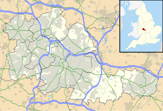
Map of the West Midlands, UK with the following information shown:
Equirectangular map projection on WGS 84 datum, with N/S stretched 160% Geographic limits:
|
| ದಿನಾಂಕ | |
| ಆಕರ |
|
| ಕರ್ತೃ | Nilfanion, created using Ordnance Survey data |
| ಅನುಮತಿ (ಈ ಕಡತವನ್ನು ಮರುಬಳಕೆ ಮಾಡಲಾಗುತ್ತಿದೆ) |
ಈ ಕಡತ ಕ್ರಿಯೇಟಿವ್ ಕಾಮನ್ಸ್ Attribution
-Share Alike 3.0 Unported ಪರವಾನಗಿ ಹೊಂದಿದೆ. ವೈಶಿಷ್ಟ್ಯ: Contains Ordnance Survey data © Crown copyright and database right
|
| ಇತರೆ ಆವೃತ್ತಿಗಳು | File:West Midlands UK district map (blank).svg - Blank map |
.svg)
ಕಡತದ ಇತಿಹಾಸ
ದಿನ/ಕಾಲ ಒತ್ತಿದರೆ ಆ ಸಮಯದಲ್ಲಿ ಈ ಕಡತದ ವಸ್ತುಸ್ಥಿತಿ ತೋರುತ್ತದೆ.
| ದಿನ/ಕಾಲ | ಕಿರುನೋಟ | ಆಯಾಮಗಳು | ಬಳಕೆದಾರ | ಟಿಪ್ಪಣಿ | |
|---|---|---|---|---|---|
| ಪ್ರಸಕ್ತ | ೦೦:೪೭, ೨೭ ಸೆಪ್ಟೆಂಬರ್ ೨೦೧೦ | | ೧,೪೨೫ × ೯೭೪ (೧.೩೫ MB) | Nilfanion | {{Information |Description=Map of the West Midlands, UK with the following information shown: *Administrative borders *Coastline, lakes and rivers *Roads and railways *Urban areas Equirectangular map projection on WGS 84 datu |
ಕಡತ ಬಳಕೆ
ಈ ಕೆಳಗಿನ ಪುಟವು ಈ ಚಿತ್ರಕ್ಕೆ ಸಂಪರ್ಕ ಹೊಂದಿದೆ:
ಜಾಗತಿಕ ಕಡತ ಉಪಯೋಗ
ಈ ಕಡತವನ್ನು ಕೆಳಗಿನ ಬೇರೆ ವಿಕಿಗಳೂ ಉಪಯೋಗಿಸುತ್ತಿವೆ:
- ar.wikipedia.org ಮೇಲೆ ಬಳಕೆ
- ast.wikipedia.org ಮೇಲೆ ಬಳಕೆ
- bg.wikipedia.org ಮೇಲೆ ಬಳಕೆ
- ceb.wikipedia.org ಮೇಲೆ ಬಳಕೆ
- en.wikipedia.org ಮೇಲೆ ಬಳಕೆ
- Moseley
- Moseley and Kings Heath (ward)
- Coventry Cathedral
- Coventry Transport Museum
- 2002–03 FA Premier League
- 2003–04 FA Premier League
- Walsall
- West Bromwich
- Dudley
- Tipton
- Birmingham Airport
- Soho House
- Aston
- Smethwick
- Oldbury, West Midlands
- Rowley Regis
- Birmingham Town Hall
- Birmingham Museum and Art Gallery
- Aldridge
- Sutton Coldfield
- Bilston
- Sutton Park, West Midlands
- Blackheath, West Midlands
- Black Country Living Museum
- Dudley Castle
- Willenhall
- Halesowen
- Knowle, West Midlands
- Stourbridge
- Brierley Hill
- Brownhills
- Hampton in Arden
- Spaghetti Junction, Birmingham
- Edgbaston
- Sedgley
- Harborne
- Soho, West Midlands
- Birmingham Botanical Gardens, England
- 2004–05 FA Premier League
- Thinktank, Birmingham Science Museum
- Bournville
- Hall Green
- Northfield, Birmingham
ಈ ಫೈಲ್ನ ಹೆಚ್ಚು ಜಾಗತಿಕ ಬಳಕೆಯನ್ನು ವೀಕ್ಷಿಸಿ.