
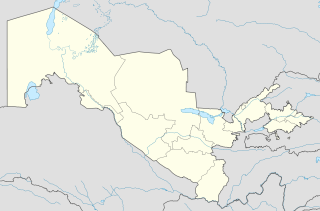
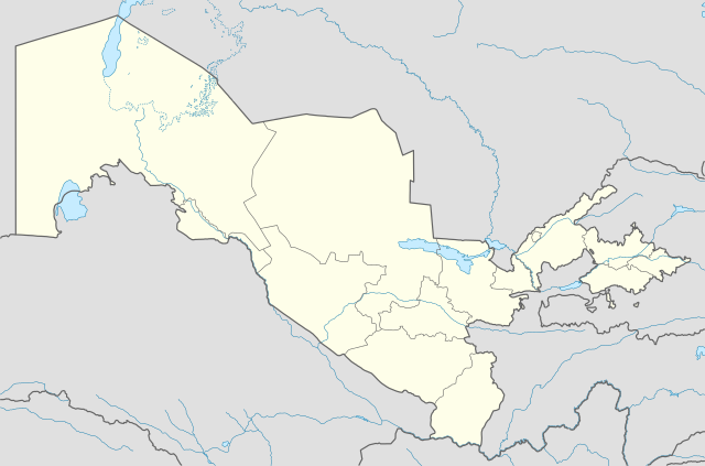
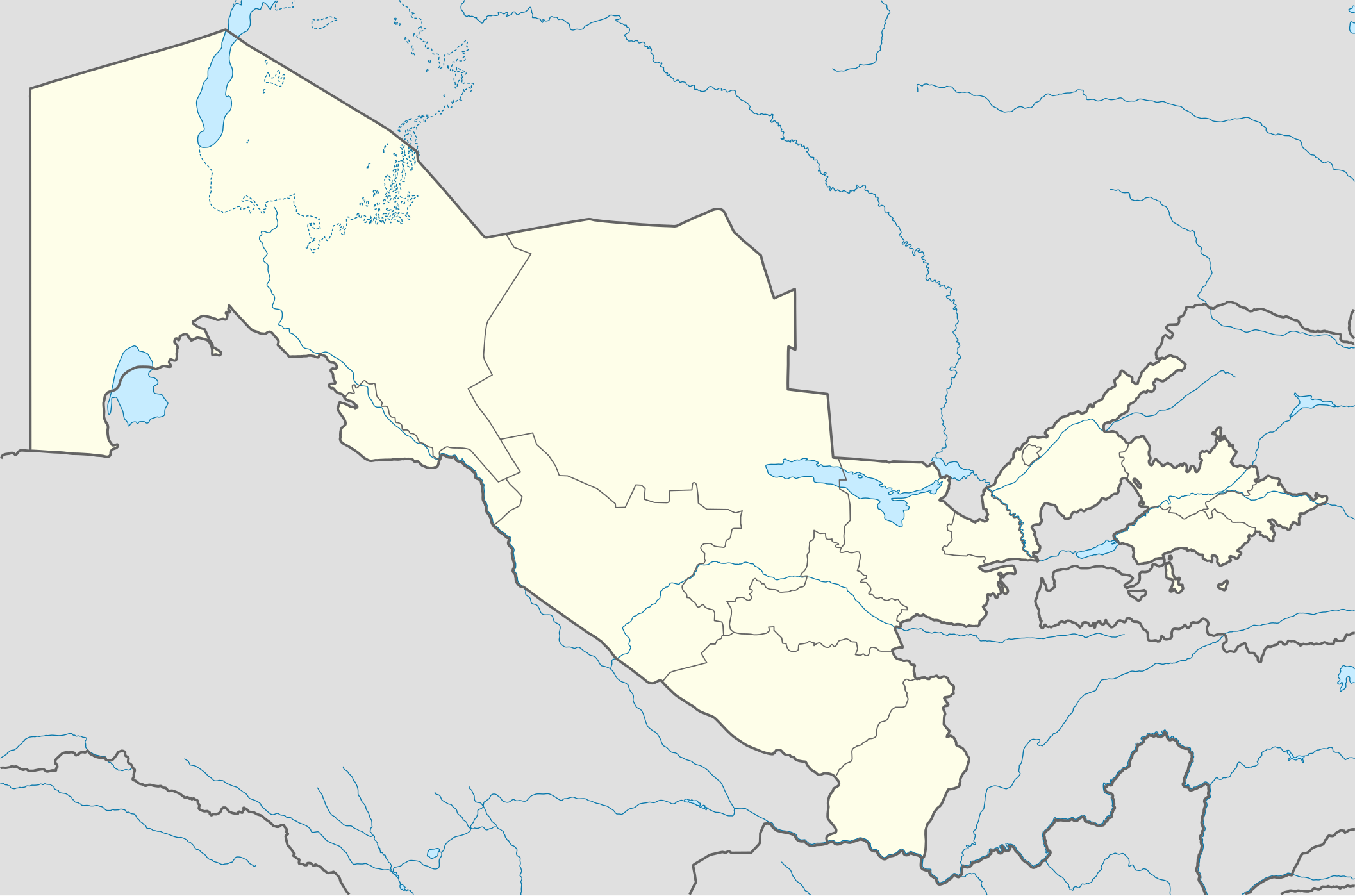
ಚಿತ್ರ:Uzbekistan location map.svg

ಮೂಲ ಕಡತ (SVG ಫೈಲು, ಸುಮಾರಾಗಿ ೨,೧೧೪ × ೧,೩೯೭ ಚಿತ್ರಬಿಂದುಗಳು, ಫೈಲಿನ ಗಾತ್ರ: ೩೦೬ KB)
ಈ ಫೈಲು ವಿಕಿಮೀಡಿಯ ಕಾಮನ್ಸ್ನಲ್ಲಿ ಇರುವುದು. ಅಲ್ಲಿನ ವಿವರಣೆ ಪುಟವನ್ನೇ ಕೆಳಗೆ ತೋರಿಸಲಾಗಿದೆ. ಕಾಮನ್ಸ್ ಕೃತಿಸ್ವಾಮ್ಯತೆಯಿಂದ ಮುಕ್ತ ಫೈಲುಗಳ ಒಂದು ಆಗರ. ಅಲ್ಲಿ ನೀವೂ ಸಹಕರಿಸಬಹುದು. |
ಸಾರಾಂಶ
| ವಿವರ |
Deutsch: Positionskarte von Usbekistan
Quadratische Plattkarte, N-S-Streckung 130 %. Geographische Begrenzung der Karte:
English: Location map of Uzbekistan
Equirectangular projection, N/S stretching 130 %. Geographic limits of the map:
|
|
| ದಿನಾಂಕ | ||
| ಆಕರ |
ಸ್ವಂತ ಕೆಲಸ, using
|
|
| ಕರ್ತೃ | NordNordWest | |
| ಅನುಮತಿ (ಈ ಕಡತವನ್ನು ಮರುಬಳಕೆ ಮಾಡಲಾಗುತ್ತಿದೆ) |
This file is licensed under the Creative Commons Attribution-Share Alike 3.0 Germany license.
 This file is licensed under the Creative Commons Attribution-Share Alike 3.0 Germany license.
|


|
This map has been made or improved in the German Kartenwerkstatt (Map Lab). You can propose maps to improve as well.
|
ಕಡತದ ಇತಿಹಾಸ
ದಿನ/ಕಾಲ ಒತ್ತಿದರೆ ಆ ಸಮಯದಲ್ಲಿ ಈ ಕಡತದ ವಸ್ತುಸ್ಥಿತಿ ತೋರುತ್ತದೆ.
| ದಿನ/ಕಾಲ | ಕಿರುನೋಟ | ಆಯಾಮಗಳು | ಬಳಕೆದಾರ | ಟಿಪ್ಪಣಿ | |
|---|---|---|---|---|---|
| ಪ್ರಸಕ್ತ | ೦೦:೧೯, ೨ ಆಗಸ್ಟ್ ೨೦೧೦ | | ೨,೧೧೪ × ೧,೩೯೭ (೩೦೬ KB) | NordNordWest | upd |
| ೦೦:೪೪, ೨೮ ನವೆಂಬರ್ ೨೦೦೯ |  | ೨,೧೧೪ × ೧,೩೯೭ (೪೧೯ KB) | NordNordWest | =={{int:filedesc}}== {{Information |Description= {{de|Positionskarte von Usbekistan}} Quadratische Plattkarte, N-S-Streckung 130 %. Geographische Begrenzung der Karte: * N: 45.9° N * S: 36.8° N * W: 55.6° O * O: 73.5° O {{en|Locatio |
ಕಡತ ಬಳಕೆ
ಈ ಕೆಳಗಿನ ಪುಟವು ಈ ಚಿತ್ರಕ್ಕೆ ಸಂಪರ್ಕ ಹೊಂದಿದೆ:
ಜಾಗತಿಕ ಕಡತ ಉಪಯೋಗ
ಈ ಕಡತವನ್ನು ಕೆಳಗಿನ ಬೇರೆ ವಿಕಿಗಳೂ ಉಪಯೋಗಿಸುತ್ತಿವೆ:
- als.wikipedia.org ಮೇಲೆ ಬಳಕೆ
- an.wikipedia.org ಮೇಲೆ ಬಳಕೆ
- ar.wikipedia.org ಮೇಲೆ ಬಳಕೆ
- azb.wikipedia.org ಮೇಲೆ ಬಳಕೆ
- az.wikipedia.org ಮೇಲೆ ಬಳಕೆ
- Daşkənd
- Səmərqənd
- Buxara
- Fərqanə
- Nukus
- Bibixanım məscidi
- Şablon:Yer xəritəsi Özbəkistan
- Əfrasiyab (qədim şəhər)
- Xivə
- Kokand
- Əndican
- Termez
- Paykənd
- Mərğilan
- Registan meydanı (Səmərqənd)
- Axsikənd
- Baysun
- Əngren
- Paltau çayı
- Çirçik çayı
- Ağbulaq (Çatkal)
- Qaraarça çayı
- Qızılsu çayı (Çirçik)
- Pskem
- Cizak (şəhər)
- Daşkənd Beynəlxalq Hava Limanı
- Nəməngan
- Xanabad (Özbəkistan)
- Mübarək (şəhər)
- Yanqıyol
- Kağan (Özbəkistan)
- Gicduvan
- Vabkənd
ಈ ಫೈಲ್ನ ಹೆಚ್ಚು ಜಾಗತಿಕ ಬಳಕೆಯನ್ನು ವೀಕ್ಷಿಸಿ.