
ಚಿತ್ರ:USA West Virginia location map.svg

Size of this PNG preview of this SVG file: ೬೪೪ × ೫೯೯ ಪಿಕ್ಸೆಲ್ಗಳು. ಇತರ ರೆಸಲ್ಯೂಶನ್ಗಳು: ೨೫೮ × ೨೪೦ ಪಿಕ್ಸೆಲ್ಗಳು | ೫೧೬ × ೪೮೦ ಪಿಕ್ಸೆಲ್ಗಳು | ೮೨೫ × ೭೬೮ ಪಿಕ್ಸೆಲ್ಗಳು | ೧,೧೦೦ × ೧,೦೨೪ ಪಿಕ್ಸೆಲ್ಗಳು | ೨,೨೦೦ × ೨,೦೪೮ ಪಿಕ್ಸೆಲ್ಗಳು | ೧,೨೦೧ × ೧,೧೧೮ ಪಿಕ್ಸೆಲ್ಗಳು.
ಮೂಲ ಕಡತ (SVG ಫೈಲು, ಸುಮಾರಾಗಿ ೧,೨೦೧ × ೧,೧೧೮ ಚಿತ್ರಬಿಂದುಗಳು, ಫೈಲಿನ ಗಾತ್ರ: ೫೨೩ KB)
ಈ ಫೈಲು ವಿಕಿಮೀಡಿಯ ಕಾಮನ್ಸ್ನಲ್ಲಿ ಇರುವುದು. ಅಲ್ಲಿನ ವಿವರಣೆ ಪುಟವನ್ನೇ ಕೆಳಗೆ ತೋರಿಸಲಾಗಿದೆ. ಕಾಮನ್ಸ್ ಕೃತಿಸ್ವಾಮ್ಯತೆಯಿಂದ ಮುಕ್ತ ಫೈಲುಗಳ ಒಂದು ಆಗರ. ಅಲ್ಲಿ ನೀವೂ ಸಹಕರಿಸಬಹುದು. |
ಸಾರಾಂಶ
| ವಿವರ |
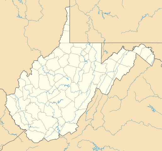
Deutsch: Positionskarte von West Virginia, USA
Quadratische Plattkarte, N-S-Streckung 130.0 %. Geographische Begrenzung der Karte:
English: Location map of West Virginia, USA
Equirectangular projection, N/S stretching 130.0 %. Geographic limits of the map:
|
||
| ದಿನಾಂಕ | |||
| ಆಕರ | ಸ್ವಂತ ಕೆಲಸ | ||
| ಕರ್ತೃ | Alexrk2 | ||
| ಇತರೆ ಆವೃತ್ತಿಗಳು | Derivative works of this file: Wawa footprint 2012-07.png | ||
| SVG genesis |
|

Derivative works of this file:
ಪರವಾನಗಿ
I, the copyright holder of this work, hereby publish it under the following licenses:

|
GNU ಉಚಿತ ಡಾಕ್ಯುಮೆಂಟೇಶನ್ ಪರವಾನಗಿ, ಆವೃತ್ತಿಯ ನಿಯಮಗಳ ಅಡಿಯಲ್ಲಿ ಈ ಡಾಕ್ಯುಮೆಂಟ್ ಅನ್ನು ನಕಲಿಸಲು, ವಿತರಿಸಲು ಮತ್ತು/ಅಥವಾ ಮಾರ್ಪಡಿಸಲು ಅನುಮತಿಯನ್ನು ನೀಡಲಾಗಿದೆ. 1.2 ಅಥವಾ ಯಾವುದೇ ನಂತರದ ಆವೃತ್ತಿಯನ್ನು ಉಚಿತ ಸಾಫ್ಟ್ವೇರ್ ಫೌಂಡೇಶನ್ ಪ್ರಕಟಿಸಿದೆ; ಯಾವುದೇ ಅಸ್ಥಿರ ವಿಭಾಗಗಳಿಲ್ಲದೆ, ಮುಖ ಪಠ್ಯಗಳಿಲ್ಲ ಮತ್ತು ಹಿಂದಿನ ಕವರ್ ಪಠ್ಯಗಳಿಲ್ಲ. ಪರವಾನಗಿಯ ಪ್ರತಿಯನ್ನು GNU ಉಚಿತ ಡಾಕ್ಯುಮೆಂಟೇಶನ್ ಪರವಾನಗಿ ಎಂಬ ವಿಭಾಗದಲ್ಲಿ ಸೇರಿಸಲಾಗಿದೆ. |
This file is licensed under the Creative Commons Attribution 3.0 Unported license.
- ನೀವು ಮುಕ್ತ:
- ಹಂಚಿಕೆಗೆ – ಕೆಲಸವನ್ನು ನಕಲು ಮಾಡಲು, ವಿತರಣೆ ಮತ್ತು ಸಾಗಿಸಲು
- ರೀಮಿಕ್ಸ್ ಮಾಡಲು – ಕೆಲಸವನ್ನು ಬಳಸಿಕೊಳ್ಳಲು
- ಈ ಕೆಳಗಿನ ಷರತ್ತುಗಳಲ್ಲಿ:
- ವೈಶಿಷ್ಟ್ಯ – ನೀವು ಸೂಕ್ತವಾದ ಕ್ರೆಡಿಟ್ ನೀಡಬೇಕು, ಪರವಾನಗಿಗೆ ಲಿಂಕ್ ಅನ್ನು ಒದಗಿಸಬೇಕು ಮತ್ತು ಯಾವುದೇ ಬದಲಾವಣೆಗಳನ್ನು ಮಾಡಿದ್ದರೆ ಸೂಚಿಸಬೇಕು. ನೀವು ಯಾವುದೇ ಸಮಂಜಸವಾದ ರೀತಿಯಲ್ಲಿ ಮಾಡಬಹುದು, ಆದರೆ ಪರವಾನಗಿದಾರರು ನಿಮ್ಮನ್ನು ಅಥವಾ ನಿಮ್ಮ ಯಾವುದೇ ಬಳಕೆಯನ್ನು ಅನುಮೋದಿಸಿದಂತೆ ರೀತಿಯಲ್ಲಿ ಉಪಯೋಗಿಸಬಾರದು.
ನಿಮ್ಮಿಚ್ಛೆಯ ಪರವಾನಗಿಯನ್ನು ನೀವು ಆರಿಸಿಕೊಳ್ಳಬಹುದು.
ಕಡತದ ಇತಿಹಾಸ
ದಿನ/ಕಾಲ ಒತ್ತಿದರೆ ಆ ಸಮಯದಲ್ಲಿ ಈ ಕಡತದ ವಸ್ತುಸ್ಥಿತಿ ತೋರುತ್ತದೆ.
| ದಿನ/ಕಾಲ | ಕಿರುನೋಟ | ಆಯಾಮಗಳು | ಬಳಕೆದಾರ | ಟಿಪ್ಪಣಿ | |
|---|---|---|---|---|---|
| ಪ್ರಸಕ್ತ | ೨೧:೦೧, ೩ ಜುಲೈ ೨೦೦೯ | | ೧,೨೦೧ × ೧,೧೧೮ (೫೨೩ KB) | Alexrk2 | == Beschreibung == {{Information |Description= {{de|Positionskarte von West Virginia, USA}} Quadratische Plattkarte, N-S-Streckung 130.0 %. Geographische Begrenzung der Karte: * N: 40.8° N * S: 37.0° N * W: 82.8° W * O |
ಕಡತ ಬಳಕೆ
ಈ ಕೆಳಗಿನ ಪುಟವು ಈ ಚಿತ್ರಕ್ಕೆ ಸಂಪರ್ಕ ಹೊಂದಿದೆ:
ಜಾಗತಿಕ ಕಡತ ಉಪಯೋಗ
ಈ ಕಡತವನ್ನು ಕೆಳಗಿನ ಬೇರೆ ವಿಕಿಗಳೂ ಉಪಯೋಗಿಸುತ್ತಿವೆ:
- an.wikipedia.org ಮೇಲೆ ಬಳಕೆ
- ar.wikipedia.org ಮೇಲೆ ಬಳಕೆ
- azb.wikipedia.org ಮೇಲೆ ಬಳಕೆ
- دانلو، باتی ویرجینیا
- پوینتس، باتی ویرجینیا
- تالمنزویل، باتی ویرجینیا
- جراردزتاون، باتی ویرجینیا
- لندقراف، باتی ویرجینیا
- کیربی، باتی ویرجینیا
- کوالوود، باتی ویرجینیا
- آقوستا، وست ویرجینیا
- های ویو، باتی ویرجینیا
- قلنقری، باتی ویرجینیا
- اسلینزویل، باتی ویرجینیا
- شنکس، باتی ویرجینیا
- دلری، باتی ویرجینیا
- پرجیتسویل، باتی ویرجینیا
- یلو اسپرینق، باتی ویرجینیا
- هوکس میلز، باتی ویرجینیا
- ریپان، باتی ویرجینیا
- نورت ریور میلز، باتی ویرجینیا
- اسلب فورک، وست ویرجینا
- راک کیو، باتی ویرجینیا
- فورکس آو کاکاپون، باتی ویرجینیا
- نایبرت، باتی ویرجینیا
- لیتل کاکیپون، باتی ویرجینیا
- لولز، باتی ویرجینیا
- ایوانز، باتی ویرجینیا
- بیکر، باتی ویرجینیا
- کپون اسپرینقز، باتی ویرجینیا
- ماونت استورم، باتی ویرجینیا
- سامیت پوینت، باتی ویرجینیا
- اتول، باتی ویرجینیا
- اجوود، باتی ویرجینیا
- ادنا، باتی ویرجینیا
- ارباکان، باتی ویرجینیا
- ارین، باتی ویرجینیا
- ازبری، باتی ویرجینیا
- اسرائیل، باتی ویرجینیا
- اسکو، باتی ویرجینیا
- اشتون، باتی ویرجینیا
- اشلند، باتی ویرجینیا
- اطلس، باتی ویرجینیا
- افتن، باتی ویرجینیا
- اکسچنج، باتی ویرجینیا
- اکمن، باتی ویرجینیا
ಈ ಫೈಲ್ನ ಹೆಚ್ಚು ಜಾಗತಿಕ ಬಳಕೆಯನ್ನು ವೀಕ್ಷಿಸಿ.