
ಚಿತ್ರ:Turks and Caicos Islands location map.svg

Size of this PNG preview of this SVG file: ೮೦೦ × ೫೧೬ ಪಿಕ್ಸೆಲ್ಗಳು. ಇತರ ರೆಸಲ್ಯೂಶನ್ಗಳು: ೩೨೦ × ೨೦೬ ಪಿಕ್ಸೆಲ್ಗಳು | ೬೪೦ × ೪೧೩ ಪಿಕ್ಸೆಲ್ಗಳು | ೧,೦೨೪ × ೬೬೦ ಪಿಕ್ಸೆಲ್ಗಳು | ೧,೨೮೦ × ೮೨೫ ಪಿಕ್ಸೆಲ್ಗಳು | ೨,೫೬೦ × ೧,೬೫೧ ಪಿಕ್ಸೆಲ್ಗಳು | ೧,೧೨೬ × ೭೨೬ ಪಿಕ್ಸೆಲ್ಗಳು.
ಮೂಲ ಕಡತ (SVG ಫೈಲು, ಸುಮಾರಾಗಿ ೧,೧೨೬ × ೭೨೬ ಚಿತ್ರಬಿಂದುಗಳು, ಫೈಲಿನ ಗಾತ್ರ: ೨೭೧ KB)
ಈ ಫೈಲು ವಿಕಿಮೀಡಿಯ ಕಾಮನ್ಸ್ನಲ್ಲಿ ಇರುವುದು. ಅಲ್ಲಿನ ವಿವರಣೆ ಪುಟವನ್ನೇ ಕೆಳಗೆ ತೋರಿಸಲಾಗಿದೆ. ಕಾಮನ್ಸ್ ಕೃತಿಸ್ವಾಮ್ಯತೆಯಿಂದ ಮುಕ್ತ ಫೈಲುಗಳ ಒಂದು ಆಗರ. ಅಲ್ಲಿ ನೀವೂ ಸಹಕರಿಸಬಹುದು. |
| ವಿವರ |
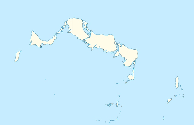
Deutsch: Positionskarte der Turks- und Caicosinseln
Quadratische Plattkarte, N-S-Streckung. Geographische Begrenzung der Karte:
English: Location map of the Turks and Caicos Islands
Equirectangular projection, N/S stretching. Geographic limits of the map:
|
| ದಿನಾಂಕ | |
| ಆಕರ | own work, using the General Mapping Tools |
| ಕರ್ತೃ | Carport |
| ಅನುಮತಿ (ಈ ಕಡತವನ್ನು ಮರುಬಳಕೆ ಮಾಡಲಾಗುತ್ತಿದೆ) |
ಈ ಕಡತ ಕ್ರಿಯೇಟಿವ್ ಕಾಮನ್ಸ್ Attribution
-Share Alike 3.0 Unported ಪರವಾನಗಿ ಹೊಂದಿದೆ.
|

|
This map has been made or improved in the German Kartenwerkstatt (Map Lab). You can propose maps to improve as well.
|
ಕಡತದ ಇತಿಹಾಸ
ದಿನ/ಕಾಲ ಒತ್ತಿದರೆ ಆ ಸಮಯದಲ್ಲಿ ಈ ಕಡತದ ವಸ್ತುಸ್ಥಿತಿ ತೋರುತ್ತದೆ.
| ದಿನ/ಕಾಲ | ಕಿರುನೋಟ | ಆಯಾಮಗಳು | ಬಳಕೆದಾರ | ಟಿಪ್ಪಣಿ | |
|---|---|---|---|---|---|
| ಪ್ರಸಕ್ತ | ೧೫:೦೮, ೯ ಏಪ್ರಿಲ್ ೨೦೧೦ | | ೧,೧೨೬ × ೭೨೬ (೨೭೧ KB) | Carport | borders corrected |
| ೧೫:೦೦, ೯ ಏಪ್ರಿಲ್ ೨೦೧೦ |  | ೧,೧೨೬ × ೭೨೬ (೨೭೧ KB) | Carport | {{Information |Description= {{de|Positionskarte der {{w|Turks- und Caicosinseln|3=de}} }} Quadratische Plattkarte, N-S-Streckung. Geographische Begrenzung der Karte: * N: 22.10° N * S: 21.14° N * W: 72.60° W * O: 71.00° W {{en|Location map of the {{w| |
ಕಡತ ಬಳಕೆ
ಈ ಕೆಳಗಿನ ಪುಟವು ಈ ಚಿತ್ರಕ್ಕೆ ಸಂಪರ್ಕ ಹೊಂದಿದೆ:
ಜಾಗತಿಕ ಕಡತ ಉಪಯೋಗ
ಈ ಕಡತವನ್ನು ಕೆಳಗಿನ ಬೇರೆ ವಿಕಿಗಳೂ ಉಪಯೋಗಿಸುತ್ತಿವೆ:
- af.wikipedia.org ಮೇಲೆ ಬಳಕೆ
- an.wikipedia.org ಮೇಲೆ ಬಳಕೆ
- ar.wikipedia.org ಮೇಲೆ ಬಳಕೆ
- ast.wikipedia.org ಮೇಲೆ ಬಳಕೆ
- ba.wikipedia.org ಮೇಲೆ ಬಳಕೆ
- be-tarask.wikipedia.org ಮೇಲೆ ಬಳಕೆ
- be.wikipedia.org ಮೇಲೆ ಬಳಕೆ
- bg.wikipedia.org ಮೇಲೆ ಬಳಕೆ
- ceb.wikipedia.org ಮೇಲೆ ಬಳಕೆ
- Plantilya:Location map United Kingdom Turks and Caicos Islands
- Long Bay
- Bird Island
- High Rock
- Grassy Creek
- South Rock
- South Bluff
- Blue Hills
- White Cay
- Water Cay
- Southwest Point
- Salt Cay
- Caye de Sel
- Pine Cay
- Hog Cay
- Pelican Cay
- Pear Cay
- Mangrove Cay
- Long Cay
- Iguana Cay
- French Cay
- Fish Cays
- Cotton Cay
- Conch Cay
- Cockburn Town
- Chalk Sound
- Breezy Point
- The Bight
- Ambergris Cays
- Toney Rock
- East Cay
- Seal Cays
- Little Water Cay
- Sand Cay
- East Bay
ಈ ಫೈಲ್ನ ಹೆಚ್ಚು ಜಾಗತಿಕ ಬಳಕೆಯನ್ನು ವೀಕ್ಷಿಸಿ.