
ಚಿತ್ರ:Tierra del Fuego location map.svg

ಮೂಲ ಕಡತ (SVG ಫೈಲು, ಸುಮಾರಾಗಿ ೧,೫೩೫ × ೧,೫೫೦ ಚಿತ್ರಬಿಂದುಗಳು, ಫೈಲಿನ ಗಾತ್ರ: ೮೨೪ KB)
ಈ ಫೈಲು ವಿಕಿಮೀಡಿಯ ಕಾಮನ್ಸ್ನಲ್ಲಿ ಇರುವುದು. ಅಲ್ಲಿನ ವಿವರಣೆ ಪುಟವನ್ನೇ ಕೆಳಗೆ ತೋರಿಸಲಾಗಿದೆ. ಕಾಮನ್ಸ್ ಕೃತಿಸ್ವಾಮ್ಯತೆಯಿಂದ ಮುಕ್ತ ಫೈಲುಗಳ ಒಂದು ಆಗರ. ಅಲ್ಲಿ ನೀವೂ ಸಹಕರಿಸಬಹುದು. |
ಸಾರಾಂಶ
| ವಿವರ |
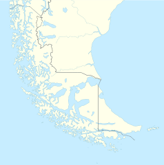
Deutsch: Positionskarte von Feuerland und Umgebung
Quadratische Plattkarte, N-S-Streckung 160 %. Geographische Begrenzung der Karte:
English: Location map of Tierra del Fuego and surroundings
Equirectangular projection, N/S stretching 160 %. Geographic limits of the map:
Español: Ubicación de Tierra del Fuego y alrededores
Proyección equirectangular, N/S 160% de estiramiento. Límites geográficos del mapa:
|
|
| ದಿನಾಂಕ | ||
| ಆಕರ |
ಸ್ವಂತ ಕೆಲಸ, using
|
|
| ಕರ್ತೃ | NordNordWest | |
| ಅನುಮತಿ (ಈ ಕಡತವನ್ನು ಮರುಬಳಕೆ ಮಾಡಲಾಗುತ್ತಿದೆ) |
This file is licensed under the Creative Commons Attribution-Share Alike 3.0 Germany license.
 This file is licensed under the Creative Commons Attribution-Share Alike 3.0 Germany license.
|
|
| ಇತರೆ ಆವೃತ್ತಿಗಳು |
Derivative works of this file: |

.svg)

|
This map has been made or improved in the German Kartenwerkstatt (Map Lab). You can propose maps to improve as well.
|
ಕಡತದ ಇತಿಹಾಸ
ದಿನ/ಕಾಲ ಒತ್ತಿದರೆ ಆ ಸಮಯದಲ್ಲಿ ಈ ಕಡತದ ವಸ್ತುಸ್ಥಿತಿ ತೋರುತ್ತದೆ.
| ದಿನ/ಕಾಲ | ಕಿರುನೋಟ | ಆಯಾಮಗಳು | ಬಳಕೆದಾರ | ಟಿಪ್ಪಣಿ | |
|---|---|---|---|---|---|
| ಪ್ರಸಕ್ತ | ೨೧:೫೦, ೫ ಮಾರ್ಚ್ ೨೦೨೪ | | ೧,೫೩೫ × ೧,೫೫೦ (೮೨೪ KB) | Janitoalevic | More specific Beagle Channel |
| ೦೬:೫೩, ೨೯ ಡಿಸೆಂಬರ್ ೨೦೨೨ |  | ೧,೫೩೫ × ೧,೫೫೦ (೫೮೮ KB) | Janitoalevic | Improved borders | |
| ೦೧:೧೧, ೪ ಮೇ ೨೦೨೦ |  | ೧,೫೩೫ × ೧,೫೫೦ (೫೬೬ KB) | Janitoalevic | Improved Isla de los Estados | |
| ೦೦:೧೭, ೪ ಮೇ ೨೦೨೦ |  | ೧,೫೩೫ × ೧,೫೫೦ (೫೫೮ KB) | Janitoalevic | Improved | |
| ೦೪:೫೩, ೩೦ ಆಗಸ್ಟ್ ೨೦೧೭ |  | ೧,೫೩೫ × ೧,೫೫೦ (೪೪೧ KB) | Janitoalevic | Fixed size | |
| ೧೬:೫೩, ೨೯ ಆಗಸ್ಟ್ ೨೦೧೭ |  | ೧,೫೩೫ × ೧,೫೫೦ (೫೧೦ KB) | NordNordWest | Reverted to version as of 20:59, 15 March 2016 (UTC); change of size is catastrophic to some templates | |
| ೦೩:೪೮, ೨೯ ಆಗಸ್ಟ್ ೨೦೧೭ |  | ೧,೬೩೮ × ೧,೬೫೩ (೪೪೨ KB) | Janitoalevic | More precise borders and lakes | |
| ೦೨:೨೯, ೧೬ ಮಾರ್ಚ್ ೨೦೧೬ |  | ೧,೫೩೫ × ೧,೫೫೦ (೫೧೦ KB) | Janitoalevic | Fixed limits following Google Earth/maps limits | |
| ೦೩:೪೨, ೩ ಮಾರ್ಚ್ ೨೦೧೬ |  | ೧,೫೩೫ × ೧,೫೫೦ (೫೧೦ KB) | Janitoalevic | Updated | |
| ೦೨:೦೪, ೧೨ ಸೆಪ್ಟೆಂಬರ್ ೨೦೧೫ |  | ೧,೫೩೫ × ೧,೫೫೦ (೫೦೮ KB) | Janitoalevic | Added Southern Patagonian Ice Field (Campo de hielo Patagónico Sur) undefined limits part, since 1998 For more information read: https://en.wikipedia.org/wiki/Southern_Patagonian_Ice_Field#Borderline Now with full resolution. |
ಕಡತ ಬಳಕೆ
ಈ ಕೆಳಗಿನ ಪುಟವು ಈ ಚಿತ್ರಕ್ಕೆ ಸಂಪರ್ಕ ಹೊಂದಿದೆ:
ಜಾಗತಿಕ ಕಡತ ಉಪಯೋಗ
ಈ ಕಡತವನ್ನು ಕೆಳಗಿನ ಬೇರೆ ವಿಕಿಗಳೂ ಉಪಯೋಗಿಸುತ್ತಿವೆ:
- als.wikipedia.org ಮೇಲೆ ಬಳಕೆ
- ar.wikipedia.org ಮೇಲೆ ಬಳಕೆ
- az.wikipedia.org ಮೇಲೆ ಬಳಕೆ
- ba.wikipedia.org ಮೇಲೆ ಬಳಕೆ
- bn.wikipedia.org ಮೇಲೆ ಬಳಕೆ
- ceb.wikipedia.org ಮೇಲೆ ಬಳಕೆ
- cs.wikipedia.org ಮೇಲೆ ಬಳಕೆ
- da.wikipedia.org ಮೇಲೆ ಬಳಕೆ
- de.wikipedia.org ಮೇಲೆ ಬಳಕೆ
- el.wikipedia.org ಮೇಲೆ ಬಳಕೆ
- en.wikipedia.org ಮೇಲೆ ಬಳಕೆ
- Tierra del Fuego
- Ushuaia – Malvinas Argentinas International Airport
- Isla Grande de Tierra del Fuego
- Puerto Williams
- Río Grande, Tierra del Fuego
- Diego Ramírez Islands
- Riesco Island
- Hoste Island
- Viedma (volcano)
- Cerro Torre
- Fitz Roy
- Viedma Lake
- Gallegos River
- Mount Darwin (Andes)
- Puerto Toro
- Dawson Island
- Ildefonso Islands
- Hermite Islands
- Southern Patagonian Ice Field
- Navarino Island
- Cordillera Darwin
- Cordillera Sarmiento
- Londonderry Island
- Hornos Island
- Grey Lake
- Desolación Island
- Clarence Island, Chile
- Gordon Island
- Juan Guillermos Island
ಈ ಫೈಲ್ನ ಹೆಚ್ಚು ಜಾಗತಿಕ ಬಳಕೆಯನ್ನು ವೀಕ್ಷಿಸಿ.