
ಚಿತ್ರ:South Ossetia location map.svg

Size of this PNG preview of this SVG file: ೬೦೦ × ೫೩೧ ಪಿಕ್ಸೆಲ್ಗಳು. ಇತರ ರೆಸಲ್ಯೂಶನ್ಗಳು: ೨೭೧ × ೨೪೦ ಪಿಕ್ಸೆಲ್ಗಳು | ೫೪೨ × ೪೮೦ ಪಿಕ್ಸೆಲ್ಗಳು | ೮೬೮ × ೭೬೮ ಪಿಕ್ಸೆಲ್ಗಳು | ೧,೧೫೭ × ೧,೦೨೪ ಪಿಕ್ಸೆಲ್ಗಳು | ೨,೩೧೪ × ೨,೦೪೮ ಪಿಕ್ಸೆಲ್ಗಳು.
ಮೂಲ ಕಡತ (SVG ಫೈಲು, ಸುಮಾರಾಗಿ ೬೦೦ × ೫೩೧ ಚಿತ್ರಬಿಂದುಗಳು, ಫೈಲಿನ ಗಾತ್ರ: ೧೪೦ KB)
ಈ ಫೈಲು ವಿಕಿಮೀಡಿಯ ಕಾಮನ್ಸ್ನಲ್ಲಿ ಇರುವುದು. ಅಲ್ಲಿನ ವಿವರಣೆ ಪುಟವನ್ನೇ ಕೆಳಗೆ ತೋರಿಸಲಾಗಿದೆ. ಕಾಮನ್ಸ್ ಕೃತಿಸ್ವಾಮ್ಯತೆಯಿಂದ ಮುಕ್ತ ಫೈಲುಗಳ ಒಂದು ಆಗರ. ಅಲ್ಲಿ ನೀವೂ ಸಹಕರಿಸಬಹುದು. |
ಸಾರಾಂಶ
| ವಿವರ |
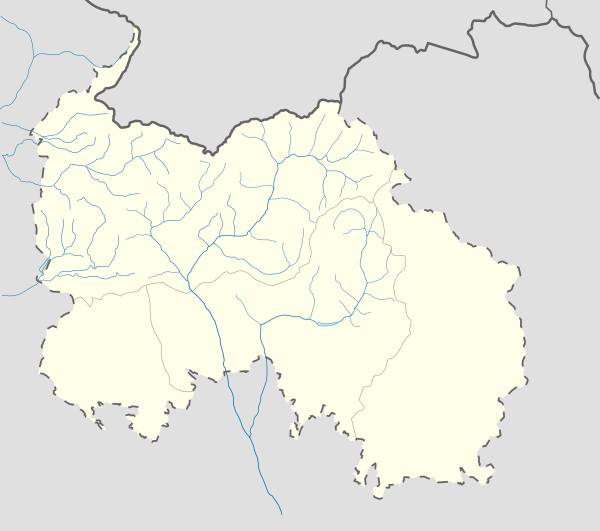
English: Location map of South Ossetia
Geographic limits of the map:
Ирон: Хуссар Ирыстоны позицион картæ
Кæрæтты координæттæ:
|
| ದಿನಾಂಕ | |
| ಆಕರ | ಸ್ವಂತ ಕೆಲಸ |
| ಕರ್ತೃ | Soslanx |
| ಇತರೆ ಆವೃತ್ತಿಗಳು | File:RSOLocatorMap.png |
ಪರವಾನಗಿ
| I, the copyright holder of this work, release this work into the public domain. This applies worldwide. In some countries this may not be legally possible; if so: I grant anyone the right to use this work for any purpose, without any conditions, unless such conditions are required by law. |
ಕಡತದ ಇತಿಹಾಸ
ದಿನ/ಕಾಲ ಒತ್ತಿದರೆ ಆ ಸಮಯದಲ್ಲಿ ಈ ಕಡತದ ವಸ್ತುಸ್ಥಿತಿ ತೋರುತ್ತದೆ.
| ದಿನ/ಕಾಲ | ಕಿರುನೋಟ | ಆಯಾಮಗಳು | ಬಳಕೆದಾರ | ಟಿಪ್ಪಣಿ | |
|---|---|---|---|---|---|
| ಪ್ರಸಕ್ತ | ೧೫:೩೫, ೭ ಡಿಸೆಂಬರ್ ೨೦೧೬ | | ೬೦೦ × ೫೩೧ (೧೪೦ KB) | Giorgi Balakhadze | Rv of sockpuppet |
| ೦೫:೪೦, ೧೫ ಫೆಬ್ರವರಿ ೨೦೧೫ |  | ೬೦೦ × ೫೩೧ (೧೪೦ KB) | Leftcry | Reverted to version as of 15:04, 4 September 2011 That doesn't really "fix" anything | |
| ೨೩:೫೧, ೧೪ ಫೆಬ್ರವರಿ ೨೦೧೫ |  | ೬೦೦ × ೫೩೧ (೧೪೦ KB) | Giorgi Balakhadze | Fixing border | |
| ೨೦:೩೪, ೪ ಸೆಪ್ಟೆಂಬರ್ ೨೦೧೧ |  | ೬೦೦ × ೫೩೧ (೧೪೦ KB) | Bouron | Black sea basin rivers added | |
| ೨೧:೫೦, ೨೭ ಮಾರ್ಚ್ ೨೦೧೧ |  | ೬೦೦ × ೫೩೧ (೧೧೮ KB) | Bouron | hydro reloading: + basin of L.Liakhva rivers width fixed | |
| ೨೨:೪೯, ೨೫ ಮಾರ್ಚ್ ೨೦೧೧ |  | ೬೦೦ × ೫೩೧ (೧೦೪ KB) | Bouron | Hydro reloading: bassin of Bigger Liakhva river added | |
| ೧೬:೧೦, ೧೭ ಫೆಬ್ರವರಿ ೨೦೧೧ |  | ೬೦೦ × ೫೩೧ (೮೩ KB) | Iguacu | dotted-lined borders of SO | |
| ೨೩:೩೬, ೧೬ ಫೆಬ್ರವರಿ ೨೦೧೧ |  | ೬೦೦ × ೫೩೧ (೯೮ KB) | Bouron | border fixed | |
| ೧೮:೨೯, ೧೫ ಫೆಬ್ರವರಿ ೨೦೧೧ |  | ೧,೦೦೬ × ೯೧೦ (೭೩ KB) | Bouron | Reverted to version as of 12:51, 13 June 2010 | |
| ೧೮:೧೦, ೧೫ ಫೆಬ್ರವರಿ ೨೦೧೧ |  | ೫,೭೮೫ × ೫,೨೦೩ (೭೭ KB) | Bouron | Reverted to version as of 12:09, 13 June 2010 |
ಕಡತ ಬಳಕೆ
ಈ ಕೆಳಗಿನ ಪುಟವು ಈ ಚಿತ್ರಕ್ಕೆ ಸಂಪರ್ಕ ಹೊಂದಿದೆ:
ಜಾಗತಿಕ ಕಡತ ಉಪಯೋಗ
ಈ ಕಡತವನ್ನು ಕೆಳಗಿನ ಬೇರೆ ವಿಕಿಗಳೂ ಉಪಯೋಗಿಸುತ್ತಿವೆ:
- af.wikipedia.org ಮೇಲೆ ಬಳಕೆ
- ar.wikipedia.org ಮೇಲೆ ಬಳಕೆ
- az.wikipedia.org ಮೇಲೆ ಬಳಕೆ
- ba.wikipedia.org ಮೇಲೆ ಬಳಕೆ
- be.wikipedia.org ಮೇಲೆ ಬಳಕೆ
- bg.wikipedia.org ಮೇಲೆ ಬಳಕೆ
- bn.wikipedia.org ಮೇಲೆ ಬಳಕೆ
- bs.wikipedia.org ಮೇಲೆ ಬಳಕೆ
- ceb.wikipedia.org ಮೇಲೆ ಬಳಕೆ
- ce.wikipedia.org ಮೇಲೆ ಬಳಕೆ
- ckb.wikipedia.org ಮೇಲೆ ಬಳಕೆ
- cs.wikipedia.org ಮೇಲೆ ಬಳಕೆ
- da.wikipedia.org ಮೇಲೆ ಬಳಕೆ
- de.wikipedia.org ಮೇಲೆ ಬಳಕೆ
- en.wikipedia.org ಮೇಲೆ ಬಳಕೆ
ಈ ಫೈಲ್ನ ಹೆಚ್ಚು ಜಾಗತಿಕ ಬಳಕೆಯನ್ನು ವೀಕ್ಷಿಸಿ.