
ಚಿತ್ರ:Ross and Cromarty UK location map.svg

Size of this PNG preview of this SVG file: ೬೧೦ × ೫೯೯ ಪಿಕ್ಸೆಲ್ಗಳು. ಇತರ ರೆಸಲ್ಯೂಶನ್ಗಳು: ೨೪೪ × ೨೪೦ ಪಿಕ್ಸೆಲ್ಗಳು | ೪೮೯ × ೪೮೦ ಪಿಕ್ಸೆಲ್ಗಳು | ೭೮೨ × ೭೬೮ ಪಿಕ್ಸೆಲ್ಗಳು | ೧,೦೪೨ × ೧,೦೨೪ ಪಿಕ್ಸೆಲ್ಗಳು | ೨,೦೮೫ × ೨,೦೪೮ ಪಿಕ್ಸೆಲ್ಗಳು | ೧,೪೨೫ × ೧,೪೦೦ ಪಿಕ್ಸೆಲ್ಗಳು.
ಮೂಲ ಕಡತ (SVG ಫೈಲು, ಸುಮಾರಾಗಿ ೧,೪೨೫ × ೧,೪೦೦ ಚಿತ್ರಬಿಂದುಗಳು, ಫೈಲಿನ ಗಾತ್ರ: ೩.೦೪ MB)
ಈ ಫೈಲು ವಿಕಿಮೀಡಿಯ ಕಾಮನ್ಸ್ನಲ್ಲಿ ಇರುವುದು. ಅಲ್ಲಿನ ವಿವರಣೆ ಪುಟವನ್ನೇ ಕೆಳಗೆ ತೋರಿಸಲಾಗಿದೆ. ಕಾಮನ್ಸ್ ಕೃತಿಸ್ವಾಮ್ಯತೆಯಿಂದ ಮುಕ್ತ ಫೈಲುಗಳ ಒಂದು ಆಗರ. ಅಲ್ಲಿ ನೀವೂ ಸಹಕರಿಸಬಹುದು. |
| ವಿವರ |
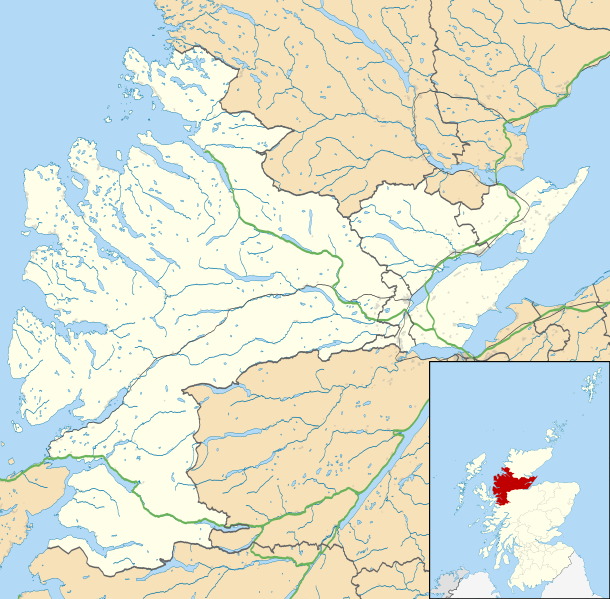
Map of Ross and Cromarty, UK in 2011, with the following information shown:
Equirectangular map projection on WGS 84 datum, with N/S stretched 180% Geographic limits:
|
| ದಿನಾಂಕ | |
| ಆಕರ |
|
| ಕರ್ತೃ | Nilfanion, created using Ordnance Survey data |
| ಅನುಮತಿ (ಈ ಕಡತವನ್ನು ಮರುಬಳಕೆ ಮಾಡಲಾಗುತ್ತಿದೆ) |
ಈ ಕಡತ ಕ್ರಿಯೇಟಿವ್ ಕಾಮನ್ಸ್ Attribution
-Share Alike 3.0 Unported ಪರವಾನಗಿ ಹೊಂದಿದೆ. ವೈಶಿಷ್ಟ್ಯ: Contains Ordnance Survey data © Crown copyright and database right
|
| ಇತರೆ ಆವೃತ್ತಿಗಳು | File:Ross and Cromarty UK blank map.svg - Blank map |
ಕಡತದ ಇತಿಹಾಸ
ದಿನ/ಕಾಲ ಒತ್ತಿದರೆ ಆ ಸಮಯದಲ್ಲಿ ಈ ಕಡತದ ವಸ್ತುಸ್ಥಿತಿ ತೋರುತ್ತದೆ.
| ದಿನ/ಕಾಲ | ಕಿರುನೋಟ | ಆಯಾಮಗಳು | ಬಳಕೆದಾರ | ಟಿಪ್ಪಣಿ | |
|---|---|---|---|---|---|
| ಪ್ರಸಕ್ತ | ೦೫:೦೧, ೫ ಮಾರ್ಚ್ ೨೦೧೧ | | ೧,೪೨೫ × ೧,೪೦೦ (೩.೦೪ MB) | Nilfanion | {{Information |Description=Map of Ross and Cromarty, UK in 2011, with the following information shown: *Ward boundaries *Coastline and lakes *Roads and railways *Urban areas Equirectangular map projection on WGS 84 datum, with N/S |
ಕಡತ ಬಳಕೆ
ಈ ಕೆಳಗಿನ ಪುಟವು ಈ ಚಿತ್ರಕ್ಕೆ ಸಂಪರ್ಕ ಹೊಂದಿದೆ:
ಜಾಗತಿಕ ಕಡತ ಉಪಯೋಗ
ಈ ಕಡತವನ್ನು ಕೆಳಗಿನ ಬೇರೆ ವಿಕಿಗಳೂ ಉಪಯೋಗಿಸುತ್ತಿವೆ:
- ar.wikipedia.org ಮೇಲೆ ಬಳಕೆ
- be.wikipedia.org ಮೇಲೆ ಬಳಕೆ
- br.wikipedia.org ಮೇಲೆ ಬಳಕೆ
- ceb.wikipedia.org ಮೇಲೆ ಬಳಕೆ
- en.wikipedia.org ಮೇಲೆ ಬಳಕೆ
- Achduart
- Achiltibuie
- Cromarty
- Gairloch
- Ullapool
- Dingwall
- Fortrose
- Kyle of Lochalsh
- Lochcarron
- Culbokie
- Portmahomack
- Hill of Fearn
- Strathpeffer
- Loch Kishorn
- Glenelg, Highland
- Saltburn, Ross and Cromarty
- Dornie
- Invergordon
- Applecross
- Hilton of Cadboll
- Achanalt
- Achandunie
- Alness
- Rosemarkie
- Achintraid
- Ardarroch
- Evanton
- Kildary
- Jemimaville
- Shieldaig
- Kinlochewe
- Poolewe
- Scoraig
- Victoria Park, Dingwall
- Coigach
- Conon Bridge
- North Kessock
- Munlochy
- Edderton
- Duirinish, Lochalsh
- Garve
- Muir of Ord
- Corran, Loch Hourn
- Milton, Easter Ross
- HMS Fieldfare
- Maryburgh
ಈ ಫೈಲ್ನ ಹೆಚ್ಚು ಜಾಗತಿಕ ಬಳಕೆಯನ್ನು ವೀಕ್ಷಿಸಿ.