
ಚಿತ್ರ:Relief map of Crimea (disputed status).jpg

ಈ ಮುನ್ನೋಟ ಗಾತ್ರ:೮೦೦ × ೫೪೨ ಪಿಕ್ಸೆಲ್ಗಳು. ಇತರ ರೆಸಲ್ಯೂಶನ್ಗಳು: ೩೨೦ × ೨೧೭ ಪಿಕ್ಸೆಲ್ಗಳು | ೬೪೦ × ೪೩೪ ಪಿಕ್ಸೆಲ್ಗಳು | ೧,೦೨೪ × ೬೯೪ ಪಿಕ್ಸೆಲ್ಗಳು | ೧,೨೦೦ × ೮೧೩ ಪಿಕ್ಸೆಲ್ಗಳು.
ಮೂಲ ಕಡತ (೧,೨೦೦ × ೮೧೩ ಚಿತ್ರಬಿಂದು, ಫೈಲಿನ ಗಾತ್ರ: ೪೨೪ KB, MIME ಪ್ರಕಾರ: image/jpeg)
ಈ ಫೈಲು ವಿಕಿಮೀಡಿಯ ಕಾಮನ್ಸ್ನಲ್ಲಿ ಇರುವುದು. ಅಲ್ಲಿನ ವಿವರಣೆ ಪುಟವನ್ನೇ ಕೆಳಗೆ ತೋರಿಸಲಾಗಿದೆ. ಕಾಮನ್ಸ್ ಕೃತಿಸ್ವಾಮ್ಯತೆಯಿಂದ ಮುಕ್ತ ಫೈಲುಗಳ ಒಂದು ಆಗರ. ಅಲ್ಲಿ ನೀವೂ ಸಹಕರಿಸಬಹುದು. |
.jpg)
ಸಾರಾಂಶ
| ವಿವರ |
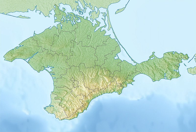
Русский: Физическая карта Крыма
Равноугольная проекция, стандартная параллель — 45°15′с.ш. Параметры шаблона (координаты краёв): English: Physical map of the Crimea
Conformal projection, standard parallels — 45°15's.W. Template parameters (coordinates of the edges):
|
| ದಿನಾಂಕ | |
| ಆಕರ | Relief map of Crimea.jpg |
| ಕರ್ತೃ | original map (see authors of Relief map of Crimea.jpg), derivative work: Dinamik |
ಪರವಾನಗಿ
I, the copyright holder of this work, hereby publish it under the following license:
| I, the copyright holder of this work, release this work into the public domain. This applies worldwide. In some countries this may not be legally possible; if so: I grant anyone the right to use this work for any purpose, without any conditions, unless such conditions are required by law. |
ಕಡತದ ಇತಿಹಾಸ
ದಿನ/ಕಾಲ ಒತ್ತಿದರೆ ಆ ಸಮಯದಲ್ಲಿ ಈ ಕಡತದ ವಸ್ತುಸ್ಥಿತಿ ತೋರುತ್ತದೆ.
| ದಿನ/ಕಾಲ | ಕಿರುನೋಟ | ಆಯಾಮಗಳು | ಬಳಕೆದಾರ | ಟಿಪ್ಪಣಿ | |
|---|---|---|---|---|---|
| ಪ್ರಸಕ್ತ | ೦೩:೧೩, ೧೯ ಮೇ ೨೦೧೮ | | ೧,೨೦೦ × ೮೧೩ (೪೨೪ KB) | Janitoalevic | Better quality |
| ೧೭:೧೨, ೧೨ ಮೇ ೨೦೧೪ |  | ೧,೨೦೦ × ೮೧೩ (೨೩೪ KB) | Dinamik | == {{int:filedesc}} == {{Information |Description = {{ru|1=Физическая карта Крыма<br>Равноугольная проекция, стандартная параллель — 45°15′с.ш.<br>Параметры шаблона (к... |
ಕಡತ ಬಳಕೆ
ಈ ಕೆಳಗಿನ ಪುಟವು ಈ ಚಿತ್ರಕ್ಕೆ ಸಂಪರ್ಕ ಹೊಂದಿದೆ:
ಜಾಗತಿಕ ಕಡತ ಉಪಯೋಗ
ಈ ಕಡತವನ್ನು ಕೆಳಗಿನ ಬೇರೆ ವಿಕಿಗಳೂ ಉಪಯೋಗಿಸುತ್ತಿವೆ:
- ast.wikipedia.org ಮೇಲೆ ಬಳಕೆ
- azb.wikipedia.org ಮೇಲೆ ಬಳಕೆ
- az.wikipedia.org ಮೇಲೆ ಬಳಕೆ
- ba.wikipedia.org ಮೇಲೆ ಬಳಕೆ
- bn.wikipedia.org ಮೇಲೆ ಬಳಕೆ
- bs.wikipedia.org ಮೇಲೆ ಬಳಕೆ
- ca.wikipedia.org ಮೇಲೆ ಬಳಕೆ
- ceb.wikipedia.org ಮೇಲೆ ಬಳಕೆ
- da.wikipedia.org ಮೇಲೆ ಬಳಕೆ
- el.wikipedia.org ಮೇಲೆ ಬಳಕೆ
- en.wikipedia.org ಮೇಲೆ ಬಳಕೆ
- Crimea
- Kerch Strait
- Pantikapaion
- Russo-Turkish War (1735–1739)
- Perekop
- Arabat Spit
- Sudak
- Yevpatoria
- Chufut-Kale
- Mangup
- Scythian Neapolis
- Inkerman
- Alushta
- Staryi Krym
- Krasnoperekopsk
- Syvash
- Simferopol International Airport
- Bakhchysarai Cave Monastery
- Kerch Peninsula
- Saky
- Partenit
- Nymphaion (Crimea)
- Module:Location map/data/Crimea/doc
- Kara Dag Mountain
- 1927 Crimean earthquakes
- Ai-Petri
- Uchan-su (waterfall)
- Tuzla Spit
- Chushka Spit
- Karkinit Bay
- Sevastopol International Airport
- Yevpatoria RT-70 radio telescope
ಈ ಫೈಲ್ನ ಹೆಚ್ಚು ಜಾಗತಿಕ ಬಳಕೆಯನ್ನು ವೀಕ್ಷಿಸಿ.
.jpg)
.jpg)