
ಚಿತ್ರ:Raionul Cantemir location map.jpg

ಈ ಮುನ್ನೋಟ ಗಾತ್ರ:೪೬೮ × ೫೯೯ ಪಿಕ್ಸೆಲ್ಗಳು. ಇತರ ರೆಸಲ್ಯೂಶನ್ಗಳು: ೧೮೭ × ೨೪೦ ಪಿಕ್ಸೆಲ್ಗಳು | ೩೭೫ × ೪೮೦ ಪಿಕ್ಸೆಲ್ಗಳು | ೫೯೯ × ೭೬೮ ಪಿಕ್ಸೆಲ್ಗಳು | ೧,೧೨೫ × ೧,೪೪೧ ಪಿಕ್ಸೆಲ್ಗಳು.
ಮೂಲ ಕಡತ (೧,೧೨೫ × ೧,೪೪೧ ಚಿತ್ರಬಿಂದು, ಫೈಲಿನ ಗಾತ್ರ: ೪೯೩ KB, MIME ಪ್ರಕಾರ: image/jpeg)
ಈ ಫೈಲು ವಿಕಿಮೀಡಿಯ ಕಾಮನ್ಸ್ನಲ್ಲಿ ಇರುವುದು. ಅಲ್ಲಿನ ವಿವರಣೆ ಪುಟವನ್ನೇ ಕೆಳಗೆ ತೋರಿಸಲಾಗಿದೆ. ಕಾಮನ್ಸ್ ಕೃತಿಸ್ವಾಮ್ಯತೆಯಿಂದ ಮುಕ್ತ ಫೈಲುಗಳ ಒಂದು ಆಗರ. ಅಲ್ಲಿ ನೀವೂ ಸಹಕರಿಸಬಹುದು. |
ಸಾರಾಂಶ
| ವಿವರ |
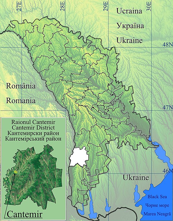
Română: Harta de localizare raionul Cantemir, Moldova.
|
| ದಿನಾಂಕ | |
| ಆಕರ | Topographic data SRTM from NASA and World Imagery & 3DEM & Inkscape |
| ಕರ್ತೃ | Asybaris01 |
ಪರವಾನಗಿ
| This file is in the public domain in the United States because it was solely created by NASA. NASA copyright policy states that "NASA material is not protected by copyright unless noted". (See Template:PD-USGov, NASA copyright policy page or JPL Image Use Policy.) | ||
 |
Warnings:
|
ಕಡತದ ಇತಿಹಾಸ
ದಿನ/ಕಾಲ ಒತ್ತಿದರೆ ಆ ಸಮಯದಲ್ಲಿ ಈ ಕಡತದ ವಸ್ತುಸ್ಥಿತಿ ತೋರುತ್ತದೆ.
| ದಿನ/ಕಾಲ | ಕಿರುನೋಟ | ಆಯಾಮಗಳು | ಬಳಕೆದಾರ | ಟಿಪ್ಪಣಿ | |
|---|---|---|---|---|---|
| ಪ್ರಸಕ್ತ | ೧೨:೨೪, ೧೨ ಫೆಬ್ರವರಿ ೨೦೧೨ | | ೧,೧೨೫ × ೧,೪೪೧ (೪೯೩ KB) | Asybaris01 | new concept |
| ೦೧:೦೦, ೮ ಫೆಬ್ರವರಿ ೨೦೧೨ |  | ೧,೩೪೯ × ೧,೭೩೧ (೫೫೫ KB) | Asybaris01 | {{Information |Description ={{ro|1=Harta de localizare raionul Cantemir, Moldova.}} |Source =Topographic data SRTM from NASA and World Imagery & 3DEM & Inkscape |Author =Asybaris01 |Date =feb 2012 |Permissi |
ಕಡತ ಬಳಕೆ
ಈ ಕೆಳಗಿನ ಪುಟವು ಈ ಚಿತ್ರಕ್ಕೆ ಸಂಪರ್ಕ ಹೊಂದಿದೆ:
ಜಾಗತಿಕ ಕಡತ ಉಪಯೋಗ
ಈ ಕಡತವನ್ನು ಕೆಳಗಿನ ಬೇರೆ ವಿಕಿಗಳೂ ಉಪಯೋಗಿಸುತ್ತಿವೆ:
- ar.wikipedia.org ಮೇಲೆ ಬಳಕೆ
- ceb.wikipedia.org ಮೇಲೆ ಬಳಕೆ
- da.wikipedia.org ಮೇಲೆ ಬಳಕೆ
- en.wikipedia.org ಮೇಲೆ ಬಳಕೆ
- Cantemir, Moldova
- Cania
- Tartaul
- Capaclia
- Cîrpești
- Cociulia
- Coștangalia
- Haragîș
- Stoianovca
- Șamalia
- Vișniovca
- Lărguța
- Porumbești, Cantemir
- Antonești, Cantemir
- Chioselia
- Cîietu
- Cîșla, Cantemir
- Sadîc
- Toceni
- Gotești
- Baimaclia, Cantemir
- Ciobalaccia
- Lingura
- Pleșeni
- Țiganca
- Enichioi
- Plopi, Cantemir
- Module:Location map/data/Moldova Cantemir/doc
- Module:Location map/data/Moldova Cantemir
- fa.wikipedia.org ಮೇಲೆ ಬಳಕೆ
- ro.wikipedia.org ಮೇಲೆ ಬಳಕೆ
- Cantemir, Moldova
- Vișniovca, Cantemir
- Lărguța, Cantemir
- Baimaclia, Cantemir
- Cania, Cantemir
- Capaclia, Cantemir
- Chioselia, Cantemir
- Ciobalaccia, Cantemir
- Cîrpești, Cantemir
- Cociulia, Cantemir
- Gotești, Cantemir
- Pleșeni, Cantemir
- Plopi, Cantemir
- Sadîc, Cantemir
- Tartaul, Cantemir
- Țiganca, Cantemir
- Cîietu, Cantemir
ಈ ಫೈಲ್ನ ಹೆಚ್ಚು ಜಾಗತಿಕ ಬಳಕೆಯನ್ನು ವೀಕ್ಷಿಸಿ.