
ಚಿತ್ರ:Norfolk UK relief location map.jpg

ಈ ಮುನ್ನೋಟ ಗಾತ್ರ:೮೦೦ × ೪೯೭ ಪಿಕ್ಸೆಲ್ಗಳು. ಇತರ ರೆಸಲ್ಯೂಶನ್ಗಳು: ೩೨೦ × ೧೯೯ ಪಿಕ್ಸೆಲ್ಗಳು | ೬೪೦ × ೩೯೮ ಪಿಕ್ಸೆಲ್ಗಳು | ೧,೦೨೪ × ೬೩೬ ಪಿಕ್ಸೆಲ್ಗಳು | ೧,೨೮೦ × ೭೯೫ ಪಿಕ್ಸೆಲ್ಗಳು | ೧,೯೯೯ × ೧,೨೪೨ ಪಿಕ್ಸೆಲ್ಗಳು.
ಮೂಲ ಕಡತ (೧,೯೯೯ × ೧,೨೪೨ ಚಿತ್ರಬಿಂದು, ಫೈಲಿನ ಗಾತ್ರ: ೨೨೯ KB, MIME ಪ್ರಕಾರ: image/jpeg)
ಈ ಫೈಲು ವಿಕಿಮೀಡಿಯ ಕಾಮನ್ಸ್ನಲ್ಲಿ ಇರುವುದು. ಅಲ್ಲಿನ ವಿವರಣೆ ಪುಟವನ್ನೇ ಕೆಳಗೆ ತೋರಿಸಲಾಗಿದೆ. ಕಾಮನ್ಸ್ ಕೃತಿಸ್ವಾಮ್ಯತೆಯಿಂದ ಮುಕ್ತ ಫೈಲುಗಳ ಒಂದು ಆಗರ. ಅಲ್ಲಿ ನೀವೂ ಸಹಕರಿಸಬಹುದು. |
| ವಿವರ |
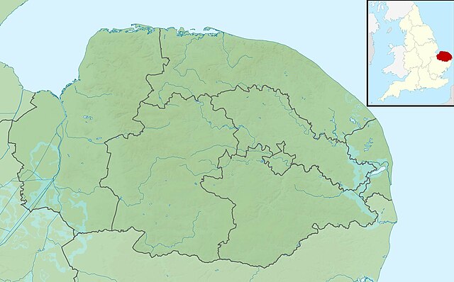
Relief map of Norfolk, UK. Equirectangular map projection on WGS 84 datum, with N/S stretched 160% Geographic limits:
|
| ದಿನಾಂಕ | |
| ಆಕರ |
|
| ಕರ್ತೃ | Nilfanion, created using Ordnance Survey data |
| ಅನುಮತಿ (ಈ ಕಡತವನ್ನು ಮರುಬಳಕೆ ಮಾಡಲಾಗುತ್ತಿದೆ) |
ಈ ಕಡತ ಕ್ರಿಯೇಟಿವ್ ಕಾಮನ್ಸ್ Attribution
-Share Alike 3.0 Unported ಪರವಾನಗಿ ಹೊಂದಿದೆ. ವೈಶಿಷ್ಟ್ಯ: Contains Ordnance Survey data © Crown copyright and database right
|
| ಇತರೆ ಆವೃತ್ತಿಗಳು | File:Norfolk UK district map (blank).svg - Blank map |
.svg)
ಕಡತದ ಇತಿಹಾಸ
ದಿನ/ಕಾಲ ಒತ್ತಿದರೆ ಆ ಸಮಯದಲ್ಲಿ ಈ ಕಡತದ ವಸ್ತುಸ್ಥಿತಿ ತೋರುತ್ತದೆ.
| ದಿನ/ಕಾಲ | ಕಿರುನೋಟ | ಆಯಾಮಗಳು | ಬಳಕೆದಾರ | ಟಿಪ್ಪಣಿ | |
|---|---|---|---|---|---|
| ಪ್ರಸಕ್ತ | ೦೭:೧೬, ೨೯ ನವೆಂಬರ್ ೨೦೧೧ | | ೧,೯೯೯ × ೧,೨೪೨ (೨೨೯ KB) | Nilfanion | {{Information |Description=Relief map of Norfolk, UK. Equirectangular map projection on WGS 84 datum, with N/S stretched 160% Geographic limits: *West: 0.12E *East: 2.00E *North: 53.05N *South: 52.32N |Source=[[w:Ordnance Survey|Ordnance S |
ಕಡತ ಬಳಕೆ
ಈ ಕೆಳಗಿನ ಪುಟವು ಈ ಚಿತ್ರಕ್ಕೆ ಸಂಪರ್ಕ ಹೊಂದಿದೆ:
ಜಾಗತಿಕ ಕಡತ ಉಪಯೋಗ
ಈ ಕಡತವನ್ನು ಕೆಳಗಿನ ಬೇರೆ ವಿಕಿಗಳೂ ಉಪಯೋಗಿಸುತ್ತಿವೆ:
- ar.wikipedia.org ಮೇಲೆ ಬಳಕೆ
- bg.wikipedia.org ಮೇಲೆ ಬಳಕೆ
- ceb.wikipedia.org ಮೇಲೆ ಬಳಕೆ
- cs.wikipedia.org ಮೇಲೆ ಬಳಕೆ
- en.wikipedia.org ಮೇಲೆ ಬಳಕೆ
- Malthouse Broad
- Hoveton Great Broad
- Crome's Broad
- Salhouse Broad
- Holkham National Nature Reserve
- River Ant
- River Yare
- River Thurne
- River Chet
- River Wensum
- Titchwell Marsh
- Sandringham House
- River Burn, Norfolk
- Filby Broad
- Beacon Hill, Norfolk
- River Stiffkey
- River Tas
- Blakeney Point
- Horsey Mere
- River Glaven
- Heacham River
- Gaywood River
- River Tiffey
- River Thet
- Buxton Watermill
- River Tud
- River Cong (Norfolk)
- River Mun
- River Hun
- River Ingol
- Beeston Beck (Norfolk)
- River Tat
- River Ainse (or Eyn)
- Scarrow Beck
- River Hor
- Gur Beck
- Hagon Beck
- Panford Beck
- Penny Spot Beck
ಈ ಫೈಲ್ನ ಹೆಚ್ಚು ಜಾಗತಿಕ ಬಳಕೆಯನ್ನು ವೀಕ್ಷಿಸಿ.