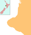
ಚಿತ್ರ:NZ-Taranaki plain map.png
ಗೋಚರ
NZ-Taranaki_plain_map.png (೩೭೮ × ೪೨೩ ಚಿತ್ರಬಿಂದು, ಫೈಲಿನ ಗಾತ್ರ: ೧೦ KB, MIME ಪ್ರಕಾರ: image/png)
ಕಡತದ ಇತಿಹಾಸ
ದಿನ/ಕಾಲ ಒತ್ತಿದರೆ ಆ ಸಮಯದಲ್ಲಿ ಈ ಕಡತದ ವಸ್ತುಸ್ಥಿತಿ ತೋರುತ್ತದೆ.
| ದಿನ/ಕಾಲ | ಕಿರುನೋಟ | ಆಯಾಮಗಳು | ಬಳಕೆದಾರ | ಟಿಪ್ಪಣಿ | |
|---|---|---|---|---|---|
| ಪ್ರಸಕ್ತ | ೧೨:೩೪, ೨ ಜೂನ್ ೨೦೦೮ |  | ೩೭೮ × ೪೨೩ (೧೦ KB) | Grutness | == Summary == {{Information |Description=Locator map for Taranaki, New Zealand |Source=combination of Image:NZ-NI plain map.png and Image:Position of Taranaki.png |Date=3 June 2008 |Author=Grutness |Permission=public domain |other_versions= }} [ |
ಕಡತ ಬಳಕೆ
ಈ ಕೆಳಗಿನ ಪುಟವು ಈ ಚಿತ್ರಕ್ಕೆ ಸಂಪರ್ಕ ಹೊಂದಿದೆ:
ಜಾಗತಿಕ ಕಡತ ಉಪಯೋಗ
ಈ ಕಡತವನ್ನು ಕೆಳಗಿನ ಬೇರೆ ವಿಕಿಗಳೂ ಉಪಯೋಗಿಸುತ್ತಿವೆ:
- ar.wikipedia.org ಮೇಲೆ ಬಳಕೆ
- ceb.wikipedia.org ಮೇಲೆ ಬಳಕೆ
- en.wikipedia.org ಮೇಲೆ ಬಳಕೆ
- New Plymouth
- Second Taranaki War
- Tītokowaru's War
- Parihaka
- New Plymouth Airport
- Whenuakura
- Ngaere
- Tututawa
- List of schools in Taranaki
- Tahora, Manawatū-Whanganui
- Pungarehu
- Mokoia
- Hurleyville
- Alton, New Zealand
- Strathmore, New Zealand
- Cardiff, New Zealand
- Huiroa
- Te Popo
- Huiakama
- Warea, New Zealand
- Oaonui
- Motunui
- Tongapōrutu
- Purangi
- Lake Dive
- Module:Location map/data/New Zealand Taranaki/doc
- Marco, New Zealand
- Kakaramea
- Matapu
- Ahititi
- Huirangi
- Kaimata
- Mimi, New Zealand
- Manutahi
- Lake Rotokare
- Hurworth, New Zealand
- Module:Location map/data/New Zealand Taranaki
- Module:Location map/data/Taranaki
- Tariki, New Zealand
- fa.wikipedia.org ಮೇಲೆ ಬಳಕೆ
- fr.wikipedia.org ಮೇಲೆ ಬಳಕೆ
- ko.wikipedia.org ಮೇಲೆ ಬಳಕೆ
- mi.wikipedia.org ಮೇಲೆ ಬಳಕೆ
ಈ ಫೈಲ್ನ ಹೆಚ್ಚು ಜಾಗತಿಕ ಬಳಕೆಯನ್ನು ವೀಕ್ಷಿಸಿ.

