
ಚಿತ್ರ:NZ-Northland plain map2.png
ಇದಕ್ಕಿಂತ ಹೆಚ್ಚಿನ ವಿವರವಾದ ನೋಟ ಇಲ್ಲ.
NZ-Northland_plain_map2.png (೩೭೮ × ೪೨೩ ಚಿತ್ರಬಿಂದು, ಫೈಲಿನ ಗಾತ್ರ: ೧೨ KB, MIME ಪ್ರಕಾರ: image/png)
ಈ ಫೈಲು ವಿಕಿಮೀಡಿಯ ಕಾಮನ್ಸ್ನಲ್ಲಿ ಇರುವುದು. ಅಲ್ಲಿನ ವಿವರಣೆ ಪುಟವನ್ನೇ ಕೆಳಗೆ ತೋರಿಸಲಾಗಿದೆ. ಕಾಮನ್ಸ್ ಕೃತಿಸ್ವಾಮ್ಯತೆಯಿಂದ ಮುಕ್ತ ಫೈಲುಗಳ ಒಂದು ಆಗರ. ಅಲ್ಲಿ ನೀವೂ ಸಹಕರಿಸಬಹುದು. |

|
This locator map image could be re-created using vector graphics as an SVG file. This has several advantages; see Commons:Media for cleanup for more information. If an SVG form of this image is available, please upload it and afterwards replace this template with
{{vector version available|new image name}}.
It is recommended to name the SVG file “NZ-Northland plain map2.svg”—then the template Vector version available (or Vva) does not need the new image name parameter. |
ಸಾರಾಂಶ
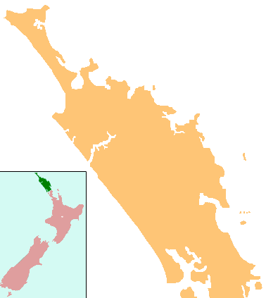
| ವಿವರ | Locator map for Northland, New Zealand |
| ದಿನಾಂಕ | |
| ಆಕರ | combination of Image:NZ-NI plain map.png and Image:Position of Northland.png |
| ಕರ್ತೃ | Grutness, based on work by User:Gadfium |
| ಅನುಮತಿ (ಈ ಕಡತವನ್ನು ಮರುಬಳಕೆ ಮಾಡಲಾಗುತ್ತಿದೆ) |
public domain. Copied from en:Image:NZ-Northland plain map2.png |
| ಇತರೆ ಆವೃತ್ತಿಗಳು | Earlier version is at Image:NZ-Northland_plain_map.png |
ಪರವಾನಗಿ
| This work has been released into the public domain by its author, Grutness. This applies worldwide. In some countries this may not be legally possible; if so: |
ಕಡತದ ಇತಿಹಾಸ
ದಿನ/ಕಾಲ ಒತ್ತಿದರೆ ಆ ಸಮಯದಲ್ಲಿ ಈ ಕಡತದ ವಸ್ತುಸ್ಥಿತಿ ತೋರುತ್ತದೆ.
| ದಿನ/ಕಾಲ | ಕಿರುನೋಟ | ಆಯಾಮಗಳು | ಬಳಕೆದಾರ | ಟಿಪ್ಪಣಿ | |
|---|---|---|---|---|---|
| ಪ್ರಸಕ್ತ | ೦೪:೩೮, ೧೭ ಏಪ್ರಿಲ್ ೨೦೦೮ | | ೩೭೮ × ೪೨೩ (೧೨ KB) | Gadfium | {{Information |Description=Locator map for Northland, New Zealand |Source=combination of Image:NZ-NI plain map.png and Image:Position of Northland.png |Date=17 March 2008 |Author=Grutness, based on work by User:Gadfium |Permission=public dom |
ಕಡತ ಬಳಕೆ
ಈ ಕೆಳಗಿನ ಪುಟವು ಈ ಚಿತ್ರಕ್ಕೆ ಸಂಪರ್ಕ ಹೊಂದಿದೆ:
ಜಾಗತಿಕ ಕಡತ ಉಪಯೋಗ
ಈ ಕಡತವನ್ನು ಕೆಳಗಿನ ಬೇರೆ ವಿಕಿಗಳೂ ಉಪಯೋಗಿಸುತ್ತಿವೆ:
- ar.wikipedia.org ಮೇಲೆ ಬಳಕೆ
- ceb.wikipedia.org ಮೇಲೆ ಬಳಕೆ
- en.wikipedia.org ಮೇಲೆ ಬಳಕೆ
- Whangārei
- Lake Ōmāpere
- Whangarei Airport
- Kaitaia Airport
- Rangiahua
- Kerikeri Airport
- List of schools in the Northland Region
- Taurikura
- Mount Manaia
- Mangamuka
- Matihetihe
- Omanaia
- Oromahoe
- Whirinaki, Northland
- Whangape Harbour
- Whangaroa Harbour
- Umawera
- Aranga, New Zealand
- Arapohue
- Kaihu
- Pouto Peninsula
- Module:Location map/data/New Zealand Northland/doc
- Kokopu, New Zealand
- Titoki, New Zealand
- Pakotai
- Poroti
- Purua
- Tauraroa
- Waiotira
- Whananaki
- Otiria
- Ōruawharo River
- Topuni River
- Bulrush Lake (Northland)
- Half Mile Lagoon
- Lake Half
- Lake Humuhumu
- Lake Kahuparere
- Lake Kaiwai
- Lake Kanono
- Lake Kapoai
- Lake Karaka
- Lake Karoro / Mathews
- Lake Kihona
- Lake Manuwai
- Lake Mokeno
ಈ ಫೈಲ್ನ ಹೆಚ್ಚು ಜಾಗತಿಕ ಬಳಕೆಯನ್ನು ವೀಕ್ಷಿಸಿ.