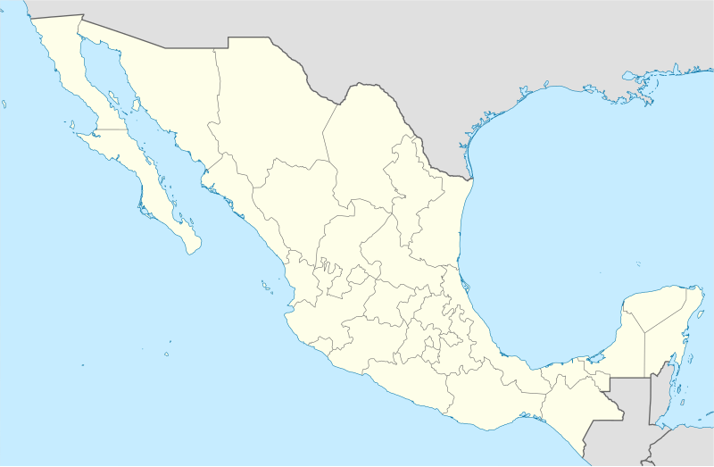
ಚಿತ್ರ:Mexico States blank map.svg
ಗೋಚರ

Size of this PNG preview of this SVG file: ೮೦೦ × ೫೨೩ ಪಿಕ್ಸೆಲ್ಗಳು. ಇತರ ರೆಸಲ್ಯೂಶನ್ಗಳು: ೩೨೦ × ೨೦೯ ಪಿಕ್ಸೆಲ್ಗಳು | ೬೪೦ × ೪೧೮ ಪಿಕ್ಸೆಲ್ಗಳು | ೧,೦೨೪ × ೬೬೯ ಪಿಕ್ಸೆಲ್ಗಳು | ೧,೨೮೦ × ೮೩೭ ಪಿಕ್ಸೆಲ್ಗಳು | ೨,೫೬೦ × ೧,೬೭೩ ಪಿಕ್ಸೆಲ್ಗಳು | ೨,೦೨೯ × ೧,೩೨೬ ಪಿಕ್ಸೆಲ್ಗಳು.
ಮೂಲ ಕಡತ (SVG ಫೈಲು, ಸುಮಾರಾಗಿ ೨,೦೨೯ × ೧,೩೨೬ ಚಿತ್ರಬಿಂದುಗಳು, ಫೈಲಿನ ಗಾತ್ರ: ೪೭೩ KB)
ಕಡತದ ಇತಿಹಾಸ
ದಿನ/ಕಾಲ ಒತ್ತಿದರೆ ಆ ಸಮಯದಲ್ಲಿ ಈ ಕಡತದ ವಸ್ತುಸ್ಥಿತಿ ತೋರುತ್ತದೆ.
| ದಿನ/ಕಾಲ | ಕಿರುನೋಟ | ಆಯಾಮಗಳು | ಬಳಕೆದಾರ | ಟಿಪ್ಪಣಿ | |
|---|---|---|---|---|---|
| ಪ್ರಸಕ್ತ | ೨೧:೧೧, ೧೩ ಆಗಸ್ಟ್ ೨೦೧೦ |  | ೨,೦೨೯ × ೧,೩೨೬ (೪೭೩ KB) | Kmusser | Try that again |
| ೨೧:೧೧, ೧೩ ಆಗಸ್ಟ್ ೨೦೧೦ |  | ೯೭೫ × ೬೫೪ (೩೬೧ KB) | Kmusser | change projection to match that used at File:Mexico location map.svg so should be more accurate for pushpins, also reverted Yucatan boundary change to match Mexican government maps. | |
| ೧೭:೨೮, ೨೫ ಮೇ ೨೦೦೯ |  | ೯೭೫ × ೬೫೪ (೩೬೧ KB) | Sémhur | Modify border south between Quintana Roo and Campeche | |
| ೧೪:೦೧, ೨೪ ಮೇ ೨೦೦೯ |  | ೯೭೫ × ೬೫೪ (೩೬೧ KB) | Sémhur | Adding Yucatan states | |
| ೧೮:೨೭, ೨೪ ಸೆಪ್ಟೆಂಬರ್ ೨೦೦೮ |  | ೯೭೫ × ೬೫೪ (೩೩೦ KB) | Sémhur | new try | |
| ೧೮:೧೦, ೨೪ ಸೆಪ್ಟೆಂಬರ್ ೨೦೦೮ |  | ೯೭೫ × ೬೫೪ (೩೨೮ KB) | Sémhur | Thiner strokes | |
| ೧೮:೦೭, ೨೪ ಸೆಪ್ಟೆಂಬರ್ ೨೦೦೮ |  | ೯೭೫ × ೬೫೪ (೩೨೮ KB) | Sémhur | {{Information |Description= {{en|Map of Mexico, with states borders.}} {{es|Mapa de Mexico, con los límites de los estados.}} {{fr|Carte du Mexique, avec les limites des états.}} |Source=Travail personnel / Own work. Source : * [[:Image:Mexico blank.sv |
ಕಡತ ಬಳಕೆ
ಈ ಕೆಳಗಿನ ಪುಟವು ಈ ಚಿತ್ರಕ್ಕೆ ಸಂಪರ್ಕ ಹೊಂದಿದೆ:
ಜಾಗತಿಕ ಕಡತ ಉಪಯೋಗ
ಈ ಕಡತವನ್ನು ಕೆಳಗಿನ ಬೇರೆ ವಿಕಿಗಳೂ ಉಪಯೋಗಿಸುತ್ತಿವೆ:
- af.wikipedia.org ಮೇಲೆ ಬಳಕೆ
- am.wikipedia.org ಮೇಲೆ ಬಳಕೆ
- ar.wikipedia.org ಮೇಲೆ ಬಳಕೆ
- ast.wikipedia.org ಮೇಲೆ ಬಳಕೆ
- azb.wikipedia.org ಮೇಲೆ ಬಳಕೆ
- ban.wikipedia.org ಮೇಲೆ ಬಳಕೆ
- bcl.wikipedia.org ಮೇಲೆ ಬಳಕೆ
- bn.wikipedia.org ಮೇಲೆ ಬಳಕೆ
- টেমপ্লেট:অবস্থান মানচিত্র মেক্সিকো
- ১৯৮৬ ফিফা বিশ্বকাপ
- মেক্সিকোর বিশ্ব ঐতিহ্যবাহী স্থানসমূহের তালিকা
- মডিউল:অবস্থান মানচিত্র/উপাত্ত/মেক্সিকো
- মডিউল:অবস্থান মানচিত্র/উপাত্ত/মেক্সিকো/নথি
- মোন্তেররেই
- ২০২২ কনকাকাফ ডব্লিউ চ্যাম্পিয়নশিপ
- গুয়াদালাহারা
- লা রেফোর্মা পৌরসভা
- লিগা এমএক্স
- মোন্তেররেই মেট্রোপলিটন এলাকা
- bs.wikipedia.org ಮೇಲೆ ಬಳಕೆ
- ca.wikipedia.org ಮೇಲೆ ಬಳಕೆ
ಈ ಫೈಲ್ನ ಹೆಚ್ಚು ಜಾಗತಿಕ ಬಳಕೆಯನ್ನು ವೀಕ್ಷಿಸಿ.
