
ಚಿತ್ರ:Map of Vigo County Indiana Townships.svg

Size of this PNG preview of this SVG file: ೫೧೨ × ೫೧೨ ಪಿಕ್ಸೆಲ್ಗಳು. ಇತರ ರೆಸಲ್ಯೂಶನ್ಗಳು: ೨೪೦ × ೨೪೦ ಪಿಕ್ಸೆಲ್ಗಳು | ೪೮೦ × ೪೮೦ ಪಿಕ್ಸೆಲ್ಗಳು | ೭೬೮ × ೭೬೮ ಪಿಕ್ಸೆಲ್ಗಳು | ೧,೦೨೪ × ೧,೦೨೪ ಪಿಕ್ಸೆಲ್ಗಳು | ೨,೦೪೮ × ೨,೦೪೮ ಪಿಕ್ಸೆಲ್ಗಳು.
ಮೂಲ ಕಡತ (SVG ಫೈಲು, ಸುಮಾರಾಗಿ ೫೧೨ × ೫೧೨ ಚಿತ್ರಬಿಂದುಗಳು, ಫೈಲಿನ ಗಾತ್ರ: ೬೬ KB)
ಈ ಫೈಲು ವಿಕಿಮೀಡಿಯ ಕಾಮನ್ಸ್ನಲ್ಲಿ ಇರುವುದು. ಅಲ್ಲಿನ ವಿವರಣೆ ಪುಟವನ್ನೇ ಕೆಳಗೆ ತೋರಿಸಲಾಗಿದೆ. ಕಾಮನ್ಸ್ ಕೃತಿಸ್ವಾಮ್ಯತೆಯಿಂದ ಮುಕ್ತ ಫೈಲುಗಳ ಒಂದು ಆಗರ. ಅಲ್ಲಿ ನೀವೂ ಸಹಕರಿಸಬಹುದು. |
| ವಿವರ |
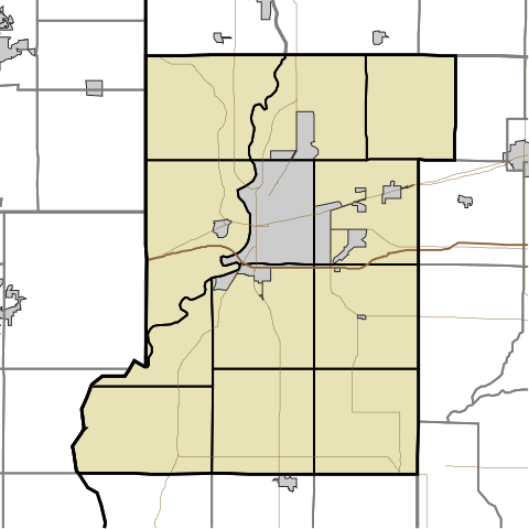
English: This is a map of Vigo County, Indiana, USA divided into townships. |
| ದಿನಾಂಕ | (UTC) |
| ಆಕರ | |
| ಕರ್ತೃ |
|
I, the copyright holder of this work, hereby publish it under the following license:
| I, the copyright holder of this work, release this work into the public domain. This applies worldwide. In some countries this may not be legally possible; if so: I grant anyone the right to use this work for any purpose, without any conditions, unless such conditions are required by law. |
Original upload log
This image is a derivative work of the following images:
- File:Map_highlighting_Prairieton_Township,_Vigo_County,_Indiana.svg licensed with PD-self
- 2007-11-24T19:33:43Z File Upload Bot (Omnedon) 512x512 (37868 Bytes) == Summary == {{Information |Description={{en|This is a map of Vigo County, Indiana, USA which highlights the location of Prairieton Township.}} |Source=My own work, using freely-available TIGER data and custom-written MapSc
Uploaded with derivativeFX
ಕಡತದ ಇತಿಹಾಸ
ದಿನ/ಕಾಲ ಒತ್ತಿದರೆ ಆ ಸಮಯದಲ್ಲಿ ಈ ಕಡತದ ವಸ್ತುಸ್ಥಿತಿ ತೋರುತ್ತದೆ.
| ದಿನ/ಕಾಲ | ಕಿರುನೋಟ | ಆಯಾಮಗಳು | ಬಳಕೆದಾರ | ಟಿಪ್ಪಣಿ | |
|---|---|---|---|---|---|
| ಪ್ರಸಕ್ತ | ೧೯:೨೦, ೧೪ ಮೇ ೨೦೧೦ | | ೫೧೨ × ೫೧೨ (೬೬ KB) | Sweet kate | {{Information |Description={{en|This is a map of Vigo County, Indiana, USA divided into townships.}} |Source=*File:Map_highlighting_Prairieton_Township,_Vigo_County,_Indiana.svg |Date=2010-05-14 13:48 (UTC) |Author=*[[:File:Map_highlighting_Prairiet |
ಕಡತ ಬಳಕೆ
ಈ ಕೆಳಗಿನ ಪುಟವು ಈ ಚಿತ್ರಕ್ಕೆ ಸಂಪರ್ಕ ಹೊಂದಿದೆ:
ಜಾಗತಿಕ ಕಡತ ಉಪಯೋಗ
ಈ ಕಡತವನ್ನು ಕೆಳಗಿನ ಬೇರೆ ವಿಕಿಗಳೂ ಉಪಯೋಗಿಸುತ್ತಿವೆ:
- ar.wikipedia.org ಮೇಲೆ ಬಳಕೆ
- azb.wikipedia.org ಮೇಲೆ ಬಳಕೆ
- ceb.wikipedia.org ಮೇಲೆ ಬಳಕೆ
- en.wikipedia.org ಮೇಲೆ ಬಳಕೆ
- Prairieton, Indiana
- Allendale, Indiana
- Libertyville, Indiana
- Sandford, Indiana
- Burnett, Indiana
- Lewis, Indiana
- Pimento, Indiana
- Eugene V. Debs Home
- Prairie Creek, Indiana
- Shirkieville, Indiana
- Emeline Fairbanks Memorial Library
- Terminal Arcade
- Paul Dresser Birthplace
- Vigo, Indiana
- Woodrow Wilson Middle School (Terre Haute, Indiana)
- Church of the Immaculate Conception (Saint Mary-of-the-Woods, Indiana)
- Blessed Sacrament Chapel (Saint Mary-of-the-Woods, Indiana)
- Module:Location map/data/USA Indiana Vigo County/doc
- Vigo County Courthouse
- Allen Chapel African Methodist Episcopal Church (Terre Haute, Indiana)
- Terre Haute Post Office and Federal Building
- Bethany Congregational Church (West Terre Haute, Indiana)
- Hippodrome Theatre (Terre Haute, Indiana)
- Linton Township High School and Community Building
- Ohio Boulevard–Deming Park Historic District
- Sky King Airport
- Condit House
- First National Bank (Terre Haute, Indiana)
- Blackhawk, Indiana
- Whitcomb Heights, Indiana
- Atherton, Indiana
- Barnhart Town, Indiana
- Cherryvale, Indiana
- Coal Bluff, Indiana
- Cobb, Indiana
- Dewey, Indiana
ಈ ಫೈಲ್ನ ಹೆಚ್ಚು ಜಾಗತಿಕ ಬಳಕೆಯನ್ನು ವೀಕ್ಷಿಸಿ.