
ಚಿತ್ರ:Map of Iowa highlighting Lee County.svg

Size of this PNG preview of this SVG file: ೮೦೦ × ೫೨೪ ಪಿಕ್ಸೆಲ್ಗಳು. ಇತರ ರೆಸಲ್ಯೂಶನ್ಗಳು: ೩೨೦ × ೨೧೦ ಪಿಕ್ಸೆಲ್ಗಳು | ೬೪೦ × ೪೧೯ ಪಿಕ್ಸೆಲ್ಗಳು | ೧,೦೨೪ × ೬೭೧ ಪಿಕ್ಸೆಲ್ಗಳು | ೧,೨೮೦ × ೮೩೮ ಪಿಕ್ಸೆಲ್ಗಳು | ೨,೫೬೦ × ೧,೬೭೭ ಪಿಕ್ಸೆಲ್ಗಳು | ೫,೩೫೦ × ೩,೫೦೪ ಪಿಕ್ಸೆಲ್ಗಳು.
ಮೂಲ ಕಡತ (SVG ಫೈಲು, ಸುಮಾರಾಗಿ ೫,೩೫೦ × ೩,೫೦೪ ಚಿತ್ರಬಿಂದುಗಳು, ಫೈಲಿನ ಗಾತ್ರ: ೪೩ KB)
ಈ ಫೈಲು ವಿಕಿಮೀಡಿಯ ಕಾಮನ್ಸ್ನಲ್ಲಿ ಇರುವುದು. ಅಲ್ಲಿನ ವಿವರಣೆ ಪುಟವನ್ನೇ ಕೆಳಗೆ ತೋರಿಸಲಾಗಿದೆ. ಕಾಮನ್ಸ್ ಕೃತಿಸ್ವಾಮ್ಯತೆಯಿಂದ ಮುಕ್ತ ಫೈಲುಗಳ ಒಂದು ಆಗರ. ಅಲ್ಲಿ ನೀವೂ ಸಹಕರಿಸಬಹುದು. |
ಸಾರಾಂಶ
| ವಿವರ |
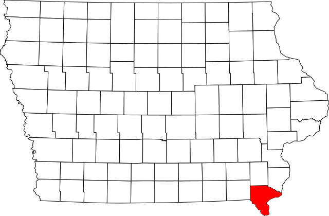
English: This is a locator map showing Lee County in Iowa. For more information, see Commons:United States county locator maps. |
| ದಿನಾಂಕ | |
| ಆಕರ |
ಸ್ವಂತ ಕೆಲಸ: English: The maps use data from nationalatlas.gov, specifically countyp020.tar.gz on the Raw Data Download page. The maps also use state outline data from statesp020.tar.gz. The Florida maps use hydrogm020.tar.gz to display Lake Okeechobee. |
| ಕರ್ತೃ | David Benbennick |
ಪರವಾನಗಿ
| I, the copyright holder of this work, release this work into the public domain. This applies worldwide. In some countries this may not be legally possible; if so: I grant anyone the right to use this work for any purpose, without any conditions, unless such conditions are required by law. |
ಕಡತದ ಇತಿಹಾಸ
ದಿನ/ಕಾಲ ಒತ್ತಿದರೆ ಆ ಸಮಯದಲ್ಲಿ ಈ ಕಡತದ ವಸ್ತುಸ್ಥಿತಿ ತೋರುತ್ತದೆ.
| ದಿನ/ಕಾಲ | ಕಿರುನೋಟ | ಆಯಾಮಗಳು | ಬಳಕೆದಾರ | ಟಿಪ್ಪಣಿ | |
|---|---|---|---|---|---|
| ಪ್ರಸಕ್ತ | ೧೭:೪೫, ೧೨ ಫೆಬ್ರವರಿ ೨೦೦೬ | | ೫,೩೫೦ × ೩,೫೦೪ (೪೩ KB) | David Benbennick | {{subst:User:Dbenbenn/clm|county=Lee County|state=Iowa}} |
ಕಡತ ಬಳಕೆ
ಈ ಫೈಲನ್ನು ಬಳಸುವ ಯಾವ ಪುಟಗಳೂ ಇಲ್ಲ.
ಜಾಗತಿಕ ಕಡತ ಉಪಯೋಗ
ಈ ಕಡತವನ್ನು ಕೆಳಗಿನ ಬೇರೆ ವಿಕಿಗಳೂ ಉಪಯೋಗಿಸುತ್ತಿವೆ:
- ar.wikipedia.org ಮೇಲೆ ಬಳಕೆ
- azb.wikipedia.org ಮೇಲೆ ಬಳಕೆ
- bg.wikipedia.org ಮೇಲೆ ಬಳಕೆ
- bpy.wikipedia.org ಮೇಲೆ ಬಳಕೆ
- cdo.wikipedia.org ಮೇಲೆ ಬಳಕೆ
- ceb.wikipedia.org ಮೇಲೆ ಬಳಕೆ
- ce.wikipedia.org ಮೇಲೆ ಬಳಕೆ
- cy.wikipedia.org ಮೇಲೆ ಬಳಕೆ
- de.wikipedia.org ಮೇಲೆ ಬಳಕೆ
- en.wikipedia.org ಮೇಲೆ ಬಳಕೆ
- List of counties in Iowa
- Lee County, Iowa
- Donnellson, Iowa
- Fort Madison, Iowa
- Franklin, Iowa
- Houghton, Iowa
- Keokuk, Iowa
- Montrose, Iowa
- St. Paul, Iowa
- West Point, Iowa
- Fort Madison Toll Bridge
- Keokuk National Cemetery
- Lock and Dam No. 19
- Template:Lee County, Iowa
- George M. Verity (towboat)
- Atchison, Topeka and Santa Fe Passenger and Freight Complex Historic District
- Denmark, Iowa
- Argyle, Iowa
- Pilot Grove, Iowa
- Wever, Iowa
- National Register of Historic Places listings in Lee County, Iowa
- New Boston, Iowa
- Fort Madison Downtown Commercial Historic District
- Faeth Farmstead and Orchard District
- Charleston, Iowa
- User:Nyttend/County templates/IA/2
ಈ ಫೈಲ್ನ ಹೆಚ್ಚು ಜಾಗತಿಕ ಬಳಕೆಯನ್ನು ವೀಕ್ಷಿಸಿ.