
ಚಿತ್ರ:Location map of Cass County, Indiana.svg

Size of this PNG preview of this SVG file: ೬೦೦ × ೬೦೦ ಪಿಕ್ಸೆಲ್ಗಳು. ಇತರ ರೆಸಲ್ಯೂಶನ್ಗಳು: ೨೪೦ × ೨೪೦ ಪಿಕ್ಸೆಲ್ಗಳು | ೪೮೦ × ೪೮೦ ಪಿಕ್ಸೆಲ್ಗಳು | ೭೬೮ × ೭೬೮ ಪಿಕ್ಸೆಲ್ಗಳು | ೧,೦೨೪ × ೧,೦೨೪ ಪಿಕ್ಸೆಲ್ಗಳು | ೨,೦೪೮ × ೨,೦೪೮ ಪಿಕ್ಸೆಲ್ಗಳು.
ಮೂಲ ಕಡತ (SVG ಫೈಲು, ಸುಮಾರಾಗಿ ೭೬೮ × ೭೬೮ ಚಿತ್ರಬಿಂದುಗಳು, ಫೈಲಿನ ಗಾತ್ರ: ೨೨೧ KB)
ಈ ಫೈಲು ವಿಕಿಮೀಡಿಯ ಕಾಮನ್ಸ್ನಲ್ಲಿ ಇರುವುದು. ಅಲ್ಲಿನ ವಿವರಣೆ ಪುಟವನ್ನೇ ಕೆಳಗೆ ತೋರಿಸಲಾಗಿದೆ. ಕಾಮನ್ಸ್ ಕೃತಿಸ್ವಾಮ್ಯತೆಯಿಂದ ಮುಕ್ತ ಫೈಲುಗಳ ಒಂದು ಆಗರ. ಅಲ್ಲಿ ನೀವೂ ಸಹಕರಿಸಬಹುದು. |
ಸಾರಾಂಶ
| ವಿವರ |
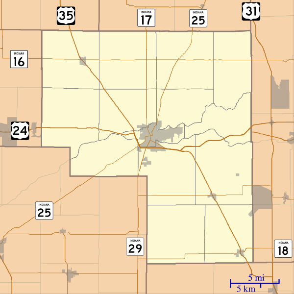
English: This is a map of Cass County, Indiana, USA which includes incorporated settlements, township borders, and major highways. |
| ದಿನಾಂಕ | |
| ಆಕರ | My own work, using custom-written MapScript applications with United States Census Bureau data |
| ಕರ್ತೃ | Omnedon |
ಪರವಾನಗಿ
| I, the copyright holder of this work, release this work into the public domain. This applies worldwide. In some countries this may not be legally possible; if so: I grant anyone the right to use this work for any purpose, without any conditions, unless such conditions are required by law. |
ಕಡತದ ಇತಿಹಾಸ
ದಿನ/ಕಾಲ ಒತ್ತಿದರೆ ಆ ಸಮಯದಲ್ಲಿ ಈ ಕಡತದ ವಸ್ತುಸ್ಥಿತಿ ತೋರುತ್ತದೆ.
| ದಿನ/ಕಾಲ | ಕಿರುನೋಟ | ಆಯಾಮಗಳು | ಬಳಕೆದಾರ | ಟಿಪ್ಪಣಿ | |
|---|---|---|---|---|---|
| ಪ್ರಸಕ್ತ | ೦೮:೪೨, ೧೮ ಸೆಪ್ಟೆಂಬರ್ ೨೦೧೨ | | ೭೬೮ × ೭೬೮ (೨೨೧ KB) | Omnedon | == {{int:filedesc}} == {{Information |Description={{en|This is a map of Cass County, Indiana, USA which includes incorporated settlements, township borders, and major highways.}} |Source=My own work, using custom-written [ht... |
ಕಡತ ಬಳಕೆ
ಈ ಕೆಳಗಿನ ಪುಟವು ಈ ಚಿತ್ರಕ್ಕೆ ಸಂಪರ್ಕ ಹೊಂದಿದೆ:
ಜಾಗತಿಕ ಕಡತ ಉಪಯೋಗ
ಈ ಕಡತವನ್ನು ಕೆಳಗಿನ ಬೇರೆ ವಿಕಿಗಳೂ ಉಪಯೋಗಿಸುತ್ತಿವೆ:
- ar.wikipedia.org ಮೇಲೆ ಬಳಕೆ
- azb.wikipedia.org ಮೇಲೆ ಬಳಕೆ
- ceb.wikipedia.org ಮೇಲೆ ಬಳಕೆ
- en.wikipedia.org ಮೇಲೆ ಬಳಕೆ
- Twelve Mile, Indiana
- Clymers, Indiana
- Metea, Indiana
- Adamsboro, Indiana
- Anoka, Indiana
- Deacon, Indiana
- Dunkirk, Cass County, Indiana
- Georgetown, Cass County, Indiana
- Hoover, Indiana
- Lake Cicott, Indiana
- Lewisburg, Indiana
- Lincoln, Indiana
- Lucerne, Indiana
- Miami Bend, Indiana
- New Waverly, Indiana
- Young America, Indiana
- Cass County Dentzel Carousel
- Module:Location map/data/USA Indiana Cass County/doc
- Pleasant Hill Church (Clinton, Indiana)
- Josephus Atkinson Farm
- Thompson Barnett House
- Jerolaman-Long House
- Kendrick-Baldwin House
- Ferguson House (Logansport, Indiana)
- Willard B. Place House
- John Keip House
- Henry Tousley House
- Pollard-Nelson House
- Point Historic District (Logansport, Indiana)
- Courthouse Historic District (Logansport, Indiana)
- Bankers Row Historic District
- Pipe Creek Falls Resort
- Washington School (Logansport, Indiana)
- Module:Location map/data/USA Indiana Cass County
- fa.wikipedia.org ಮೇಲೆ ಬಳಕೆ
ಈ ಫೈಲ್ನ ಹೆಚ್ಚು ಜಾಗತಿಕ ಬಳಕೆಯನ್ನು ವೀಕ್ಷಿಸಿ.