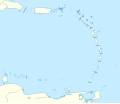
ಚಿತ್ರ:Lesser Antilles location map.svg

Size of this PNG preview of this SVG file: ೬೯೮ × ೫೯೯ ಪಿಕ್ಸೆಲ್ಗಳು. ಇತರ ರೆಸಲ್ಯೂಶನ್ಗಳು: ೨೮೦ × ೨೪೦ ಪಿಕ್ಸೆಲ್ಗಳು | ೫೫೯ × ೪೮೦ ಪಿಕ್ಸೆಲ್ಗಳು | ೮೯೪ × ೭೬೮ ಪಿಕ್ಸೆಲ್ಗಳು | ೧,೧೯೨ × ೧,೦೨೪ ಪಿಕ್ಸೆಲ್ಗಳು | ೨,೩೮೫ × ೨,೦೪೮ ಪಿಕ್ಸೆಲ್ಗಳು | ೧,೩೪೬ × ೧,೧೫೬ ಪಿಕ್ಸೆಲ್ಗಳು.
ಮೂಲ ಕಡತ (SVG ಫೈಲು, ಸುಮಾರಾಗಿ ೧,೩೪೬ × ೧,೧೫೬ ಚಿತ್ರಬಿಂದುಗಳು, ಫೈಲಿನ ಗಾತ್ರ: ೧೮೪ KB)
ಕಡತದ ಇತಿಹಾಸ
ದಿನ/ಕಾಲ ಒತ್ತಿದರೆ ಆ ಸಮಯದಲ್ಲಿ ಈ ಕಡತದ ವಸ್ತುಸ್ಥಿತಿ ತೋರುತ್ತದೆ.
| ದಿನ/ಕಾಲ | ಕಿರುನೋಟ | ಆಯಾಮಗಳು | ಬಳಕೆದಾರ | ಟಿಪ್ಪಣಿ | |
|---|---|---|---|---|---|
| ಪ್ರಸಕ್ತ | ೧೯:೨೯, ೨೪ ಸೆಪ್ಟೆಂಬರ್ ೨೦೧೮ |  | ೧,೩೪೬ × ೧,೧೫೬ (೧೮೪ KB) | NordNordWest | Reverted to version as of 14:01, 13 October 2010 (UTC); please don't change the size of the map, some templates need the correct size |
| ೧೭:೩೦, ೨೪ ಸೆಪ್ಟೆಂಬರ್ ೨೦೧೮ |  | ೫೧೨ × ೪೩೯ (೧೧೪ KB) | Splintax | Nations grouped together and labelled with DOM IDs and inline styles replaced with semantic CSS classes. This reduces the file size and allows the SVG to be animated with JavaScript (eg. to selectively add labels, or change the style of a particular country to highlight it). | |
| ೧೯:೩೧, ೧೩ ಅಕ್ಟೋಬರ್ ೨೦೧೦ |  | ೧,೩೪೬ × ೧,೧೫೬ (೧೮೪ KB) | NordNordWest | upd | |
| ೨೧:೨೬, ೨೯ ಸೆಪ್ಟೆಂಬರ್ ೨೦೦೯ |  | ೧,೩೪೬ × ೧,೧೫೬ (೨೮೧ KB) | NordNordWest | =={{int:filedesc}}== {{Information |Description= {{de|Positionskarte der Kleinen Antillen}} Quadratische Plattkarte, N-S-Streckung 103 %. Geographische Begrenzung der Karte: * N: 19.2° N * S: 9.7° N * W: 70.5° W * O: 59.1° W {{ |
ಕಡತ ಬಳಕೆ
ಈ ಕೆಳಗಿನ ಪುಟವು ಈ ಚಿತ್ರಕ್ಕೆ ಸಂಪರ್ಕ ಹೊಂದಿದೆ:
ಜಾಗತಿಕ ಕಡತ ಉಪಯೋಗ
ಈ ಕಡತವನ್ನು ಕೆಳಗಿನ ಬೇರೆ ವಿಕಿಗಳೂ ಉಪಯೋಗಿಸುತ್ತಿವೆ:
- af.wikipedia.org ಮೇಲೆ ಬಳಕೆ
- als.wikipedia.org ಮೇಲೆ ಬಳಕೆ
- ar.wikipedia.org ಮೇಲೆ ಬಳಕೆ
- az.wikipedia.org ಮೇಲೆ ಬಳಕೆ
- ba.wikipedia.org ಮೇಲೆ ಬಳಕೆ
- be.wikipedia.org ಮೇಲೆ ಬಳಕೆ
- bs.wikipedia.org ಮೇಲೆ ಬಳಕೆ
- ceb.wikipedia.org ಮೇಲೆ ಬಳಕೆ
- ckb.wikipedia.org ಮೇಲೆ ಬಳಕೆ
- cs.wikipedia.org ಮೇಲೆ ಬಳಕೆ
- da.wikipedia.org ಮೇಲೆ ಬಳಕೆ
- de.wikipedia.org ಮೇಲೆ ಬಳಕೆ
- Liste der Nationalparks im Königreich der Niederlande
- Oranjestad (Sint Eustatius)
- Benutzer:Spischot/Sketchpad 3
- Cricket World Cup 2007
- Flamingo International Airport
- Kralendijk
- Vorlage:Positionskarte Aruba
- Wikipedia:Kartenwerkstatt/Positionskarten/Nordamerika
- Juancho E. Yrausquin Airport
- West Indies Cricket Team
- Vorlage:Positionskarte Niederländische Antillen (ABC-Inseln)
- Vorlage:Positionskarte Niederländische Antillen (Inseln über dem Winde)
- Vorlage:Positionskarte Kleine Antillen
- ICC World Twenty20 2010
- ICC Women’s World Twenty20 2010
- Vorlage:Positionskarte Curaçao
- Vorlage:Positionskarte Sint Maarten
ಈ ಫೈಲ್ನ ಹೆಚ್ಚು ಜಾಗತಿಕ ಬಳಕೆಯನ್ನು ವೀಕ್ಷಿಸಿ.

