
ಚಿತ್ರ:Lancashire UK location map.svg

Size of this PNG preview of this SVG file: ೫೧೩ × ೬೦೦ ಪಿಕ್ಸೆಲ್ಗಳು. ಇತರ ರೆಸಲ್ಯೂಶನ್ಗಳು: ೨೦೫ × ೨೪೦ ಪಿಕ್ಸೆಲ್ಗಳು | ೪೧೦ × ೪೮೦ ಪಿಕ್ಸೆಲ್ಗಳು | ೬೫೭ × ೭೬೮ ಪಿಕ್ಸೆಲ್ಗಳು | ೮೭೬ × ೧,೦೨೪ ಪಿಕ್ಸೆಲ್ಗಳು | ೧,೭೫೧ × ೨,೦೪೮ ಪಿಕ್ಸೆಲ್ಗಳು | ೧,೧೧೬ × ೧,೩೦೫ ಪಿಕ್ಸೆಲ್ಗಳು.
ಮೂಲ ಕಡತ (SVG ಫೈಲು, ಸುಮಾರಾಗಿ ೧,೧೧೬ × ೧,೩೦೫ ಚಿತ್ರಬಿಂದುಗಳು, ಫೈಲಿನ ಗಾತ್ರ: ೨.೩ MB)
ಈ ಫೈಲು ವಿಕಿಮೀಡಿಯ ಕಾಮನ್ಸ್ನಲ್ಲಿ ಇರುವುದು. ಅಲ್ಲಿನ ವಿವರಣೆ ಪುಟವನ್ನೇ ಕೆಳಗೆ ತೋರಿಸಲಾಗಿದೆ. ಕಾಮನ್ಸ್ ಕೃತಿಸ್ವಾಮ್ಯತೆಯಿಂದ ಮುಕ್ತ ಫೈಲುಗಳ ಒಂದು ಆಗರ. ಅಲ್ಲಿ ನೀವೂ ಸಹಕರಿಸಬಹುದು. |
| ವಿವರ |
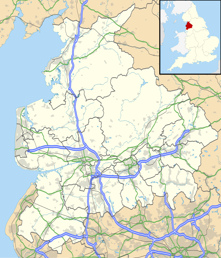
Map of Lancashire, UK with the following information shown:
Equirectangular map projection on WGS 84 datum, with N/S stretched 165% Geographic limits:
|
| ದಿನಾಂಕ | |
| ಆಕರ |
|
| ಕರ್ತೃ | Nilfanion, created using Ordnance Survey data |
| ಅನುಮತಿ (ಈ ಕಡತವನ್ನು ಮರುಬಳಕೆ ಮಾಡಲಾಗುತ್ತಿದೆ) |
ಈ ಕಡತ ಕ್ರಿಯೇಟಿವ್ ಕಾಮನ್ಸ್ Attribution
-Share Alike 3.0 Unported ಪರವಾನಗಿ ಹೊಂದಿದೆ. ವೈಶಿಷ್ಟ್ಯ: Contains Ordnance Survey data © Crown copyright and database right
|
| ಇತರೆ ಆವೃತ್ತಿಗಳು | File:Lancashire UK district map (blank).svg - Blank map |
.svg)
ಕಡತದ ಇತಿಹಾಸ
ದಿನ/ಕಾಲ ಒತ್ತಿದರೆ ಆ ಸಮಯದಲ್ಲಿ ಈ ಕಡತದ ವಸ್ತುಸ್ಥಿತಿ ತೋರುತ್ತದೆ.
| ದಿನ/ಕಾಲ | ಕಿರುನೋಟ | ಆಯಾಮಗಳು | ಬಳಕೆದಾರ | ಟಿಪ್ಪಣಿ | |
|---|---|---|---|---|---|
| ಪ್ರಸಕ್ತ | ೦೦:೨೯, ೨೭ ಸೆಪ್ಟೆಂಬರ್ ೨೦೧೦ | | ೧,೧೧೬ × ೧,೩೦೫ (೨.೩ MB) | Nilfanion | {{Information |Description=Map of Lancashire, UK with the following information shown: *Administrative borders *Coastline, lakes and rivers *Roads and railways *Urban areas Equirectangular map projection on WGS 84 datum, with N/S stretch |
ಕಡತ ಬಳಕೆ
ಈ ಕೆಳಗಿನ ಪುಟವು ಈ ಚಿತ್ರಕ್ಕೆ ಸಂಪರ್ಕ ಹೊಂದಿದೆ:
ಜಾಗತಿಕ ಕಡತ ಉಪಯೋಗ
ಈ ಕಡತವನ್ನು ಕೆಳಗಿನ ಬೇರೆ ವಿಕಿಗಳೂ ಉಪಯೋಗಿಸುತ್ತಿವೆ:
- ar.wikipedia.org ಮೇಲೆ ಬಳಕೆ
- bg.wikipedia.org ಮೇಲೆ ಬಳಕೆ
- ceb.wikipedia.org ಮೇಲೆ ಬಳಕೆ
- en.wikipedia.org ಮೇಲೆ ಬಳಕೆ
- Accrington
- Bacup
- Lancaster, Lancashire
- Preston, Lancashire
- Chorley
- Astley Hall, Chorley
- Blackpool
- Read, Lancashire
- Ormskirk
- Burnley
- Galgate
- Heysham
- Blackburn
- Barnoldswick
- Darwen
- Clitheroe
- Parbold
- Adlington, Lancashire
- Kirkham, Lancashire
- Lytham St Annes
- Longridge
- Poulton-le-Fylde
- Carnforth
- Reedley Hallows
- Up Holland
- Padiham
- Clayton-le-Moors
- Brierfield, Lancashire
- Oswaldtwistle
- Fleetwood
- Whalley, Lancashire
- Cleveleys
- Centre points of the United Kingdom
- Stonyhurst
- Bolton-le-Sands
- Haslingden
- River Wyre
- Lancashire Infantry Museum
- Higham, Lancashire
- Nelson, Lancashire
- Colne
- Wycoller
- Bleasdale
- Scarisbrick
- Knott End-on-Sea
- Great Altcar
- List of places in Lancashire
ಈ ಫೈಲ್ನ ಹೆಚ್ಚು ಜಾಗತಿಕ ಬಳಕೆಯನ್ನು ವೀಕ್ಷಿಸಿ.