
ಚಿತ್ರ:Hong Kong Railway Route Map blank.svg

Size of this PNG preview of this SVG file: ೬೫೫ × ೫೯೯ ಪಿಕ್ಸೆಲ್ಗಳು. ಇತರ ರೆಸಲ್ಯೂಶನ್ಗಳು: ೨೬೨ × ೨೪೦ ಪಿಕ್ಸೆಲ್ಗಳು | ೫೨೫ × ೪೮೦ ಪಿಕ್ಸೆಲ್ಗಳು | ೮೩೯ × ೭೬೮ ಪಿಕ್ಸೆಲ್ಗಳು | ೧,೧೧೯ × ೧,೦೨೪ ಪಿಕ್ಸೆಲ್ಗಳು | ೨,೨೩೮ × ೨,೦೪೮ ಪಿಕ್ಸೆಲ್ಗಳು | ೧,೦೩೮ × ೯೫೦ ಪಿಕ್ಸೆಲ್ಗಳು.
ಮೂಲ ಕಡತ (SVG ಫೈಲು, ಸುಮಾರಾಗಿ ೧,೦೩೮ × ೯೫೦ ಚಿತ್ರಬಿಂದುಗಳು, ಫೈಲಿನ ಗಾತ್ರ: ೨೩ KB)
ಈ ಫೈಲು ವಿಕಿಮೀಡಿಯ ಕಾಮನ್ಸ್ನಲ್ಲಿ ಇರುವುದು. ಅಲ್ಲಿನ ವಿವರಣೆ ಪುಟವನ್ನೇ ಕೆಳಗೆ ತೋರಿಸಲಾಗಿದೆ. ಕಾಮನ್ಸ್ ಕೃತಿಸ್ವಾಮ್ಯತೆಯಿಂದ ಮುಕ್ತ ಫೈಲುಗಳ ಒಂದು ಆಗರ. ಅಲ್ಲಿ ನೀವೂ ಸಹಕರಿಸಬಹುದು. |
ಸಾರಾಂಶ
| Description |
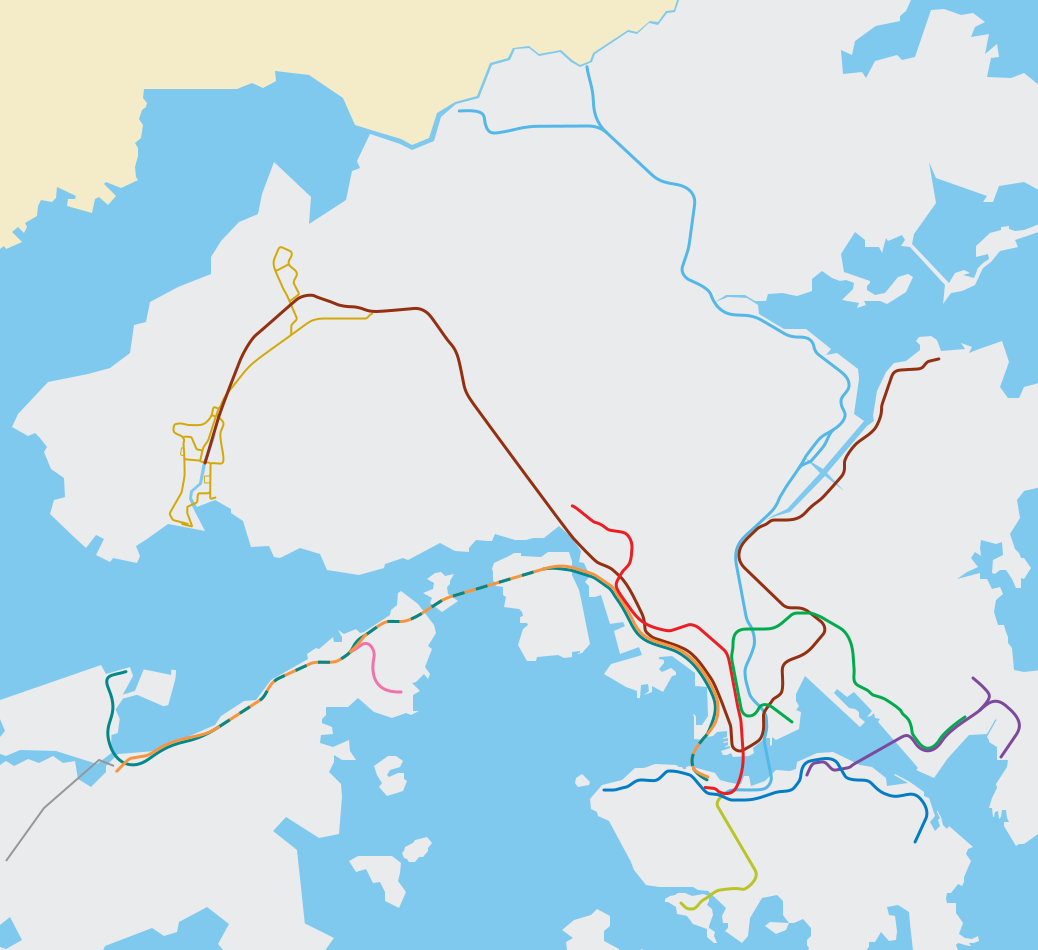
English: Blank svg route map for MTR (EN), the Hong Kong metro/subway system. It does not mean to be wholly accurate but offers a roughly geographical sense of Hong Kong territories and the MTR system. |
||
| SVG genesis | This map was created with Adobe Illustrator. |
||
| ದಿನಾಂಕ | |||
| ಆಕರ | Edited based on File:Hong Kong Railway Route Map en.svg | ||
| ಸೃಷ್ಟಿಕರ್ತ |
Peterwhy, based on works by Sameboat; File:ISL ga map.png, File:TWL ga map.png, File:KTL ga map.png, File:LAR ga map.png |
||
| ಅನುಮತಿ (ಈ ಕಡತವನ್ನು ಮರುಬಳಕೆ ಮಾಡಲಾಗುತ್ತಿದೆ) |
|
||
| Georeferencing | If inappropriate please set warp_status = skip to hide. | ||
| ಇತರೆ ಆವೃತ್ತಿಗಳು | File:Hong Kong Railway Route Map en.svg, File:Hong Kong Railway Route Map zh.svg, File:Hong Kong Railway Route Map de.svg, File:Hong Kong Railway Route Map 2007 en.svg, File:Hong Kong MTR Route Map 2007 en.svg |
ಕಡತದ ಇತಿಹಾಸ
ದಿನ/ಕಾಲ ಒತ್ತಿದರೆ ಆ ಸಮಯದಲ್ಲಿ ಈ ಕಡತದ ವಸ್ತುಸ್ಥಿತಿ ತೋರುತ್ತದೆ.
| ದಿನ/ಕಾಲ | ಕಿರುನೋಟ | ಆಯಾಮಗಳು | ಬಳಕೆದಾರ | ಟಿಪ್ಪಣಿ | |
|---|---|---|---|---|---|
| ಪ್ರಸಕ್ತ | ೦೬:೩೨, ೧೫ ಮೇ ೨೦೨೨ | | ೧,೦೩೮ × ೯೫೦ (೨೩ KB) | Jc86035 | East Rail Line cross-harbour extension |
| ೧೩:೫೯, ೨೯ ಜೂನ್ ೨೦೨೧ |  | ೧,೦೩೮ × ೯೫೦ (೨೩ KB) | Sameboat | Tuen Ma Line and Airport island expansion | |
| ೦೫:೩೭, ೨೧ ಜೂನ್ ೨೦೨೦ |  | ೧,೦೩೮ × ೯೫೦ (೨೩ KB) | Sameboat | Tuen Ma line | |
| ೧೯:೪೨, ೩೧ ಡಿಸೆಂಬರ್ ೨೦೧೬ |  | ೧,೦೩೮ × ೯೫೦ (೨೨ KB) | Jc86035 | line colours | |
| ೧೫:೪೪, ೨೯ ಡಿಸೆಂಬರ್ ೨೦೧೬ |  | ೧,೦೩೮ × ೯೫೦ (೨೨ KB) | Jc86035 | fixed | |
| ೧೯:೧೫, ೨೮ ಡಿಸೆಂಬರ್ ೨೦೧೬ |  | ೧,೦೩೮ × ೯೫೦ (೨೫ KB) | Nv7801 | Added South Island Line | |
| ೧೧:೩೨, ೨೯ ಅಕ್ಟೋಬರ್ ೨೦೧೬ |  | ೧,೦೩೮ × ೯೫೦ (೨೨ KB) | Jc86035 | KTE moved 2px | |
| ೧೦:೨೨, ೨೯ ಅಕ್ಟೋಬರ್ ೨೦೧೬ |  | ೧,೦೩೮ × ೯೫೦ (೨೨ KB) | Jc86035 | m | |
| ೧೦:೧೯, ೨೯ ಅಕ್ಟೋಬರ್ ೨೦೧೬ |  | ೧,೦೩೮ × ೯೫೦ (೨೨ KB) | Jc86035 | m | |
| ೧೦:೧೨, ೨೯ ಅಕ್ಟೋಬರ್ ೨೦೧೬ |  | ೧,೦೩೮ × ೯೫೦ (೨೨ KB) | Jc86035 | again |
ಕಡತ ಬಳಕೆ
ಈ ಕೆಳಗಿನ 4 ಪುಟಗಳು ಈ ಚಿತ್ರಕ್ಕೆ ಸಂಪರ್ಕ ಹೊಂದಿವೆ:
ಜಾಗತಿಕ ಕಡತ ಉಪಯೋಗ
ಈ ಕಡತವನ್ನು ಕೆಳಗಿನ ಬೇರೆ ವಿಕಿಗಳೂ ಉಪಯೋಗಿಸುತ್ತಿವೆ:
- ar.wikipedia.org ಮೇಲೆ ಬಳಕೆ
- as.wikipedia.org ಮೇಲೆ ಬಳಕೆ
- az.wikipedia.org ಮೇಲೆ ಬಳಕೆ
- bh.wikipedia.org ಮೇಲೆ ಬಳಕೆ
- ca.wikipedia.org ಮೇಲೆ ಬಳಕೆ
- ceb.wikipedia.org ಮೇಲೆ ಬಳಕೆ
- cs.wikipedia.org ಮೇಲೆ ಬಳಕೆ
- da.wikipedia.org ಮೇಲೆ ಬಳಕೆ
- diq.wikipedia.org ಮೇಲೆ ಬಳಕೆ
- en.wikipedia.org ಮೇಲೆ ಬಳಕೆ
- Yuen Long station
- Tsuen Wan West station
- Kam Sheung Road station
- Tsuen Wan station
- Mei Foo station
- Lai King station
- Lai Chi Kok station
- Cheung Sha Wan station
- Sham Shui Po station
- Kwai Fong station
- Tai Wo Hau station
- Kwai Hing station
- Prince Edward station
- Mong Kok station
- Yau Ma Tei station
- University station (MTR)
- Tuen Mun station
- Siu Hong station
- Tin Shui Wai station
- Long Ping station
- Nam Cheong station
- Po Lam station
- Hang Hau station
- Tseung Kwan O station
- Tiu Keng Leng station
- Sunny Bay station
- Tai Po Market station
- Hong Kong Railway Museum
- Central station (MTR)
- East Tsim Sha Tsui station
- Tsing Yi station
- Admiralty station (MTR)
- Diamond Hill station
ಈ ಫೈಲ್ನ ಹೆಚ್ಚು ಜಾಗತಿಕ ಬಳಕೆಯನ್ನು ವೀಕ್ಷಿಸಿ.