
ಚಿತ್ರ:Haute-Normandie region relief location map.jpg

ಈ ಮುನ್ನೋಟ ಗಾತ್ರ:೪೬೫ × ೬೦೦ ಪಿಕ್ಸೆಲ್ಗಳು. ಇತರ ರೆಸಲ್ಯೂಶನ್ಗಳು: ೧೮೬ × ೨೪೦ ಪಿಕ್ಸೆಲ್ಗಳು | ೩೭೨ × ೪೮೦ ಪಿಕ್ಸೆಲ್ಗಳು | ೯೬೯ × ೧,೨೫೦ ಪಿಕ್ಸೆಲ್ಗಳು.
ಮೂಲ ಕಡತ (೯೬೯ × ೧,೨೫೦ ಚಿತ್ರಬಿಂದು, ಫೈಲಿನ ಗಾತ್ರ: ೨೯೪ KB, MIME ಪ್ರಕಾರ: image/jpeg)
ಈ ಫೈಲು ವಿಕಿಮೀಡಿಯ ಕಾಮನ್ಸ್ನಲ್ಲಿ ಇರುವುದು. ಅಲ್ಲಿನ ವಿವರಣೆ ಪುಟವನ್ನೇ ಕೆಳಗೆ ತೋರಿಸಲಾಗಿದೆ. ಕಾಮನ್ಸ್ ಕೃತಿಸ್ವಾಮ್ಯತೆಯಿಂದ ಮುಕ್ತ ಫೈಲುಗಳ ಒಂದು ಆಗರ. ಅಲ್ಲಿ ನೀವೂ ಸಹಕರಿಸಬಹುದು. |
ಸಾರಾಂಶ
| Camera location | | View this and other nearby images on: OpenStreetMap |
|---|
| ವಿವರ |
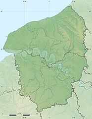
English: Blank physical map of the region of Upper Normandy, France, for geo-location purpose, with distinct boundaries for regions, departments and arrondissements.
Français : Carte physique vierge de la région de Haute-Normandie, France, destinée à la géolocalisation, avec limite distincte des régions, départements et arrondissements. Scales:
Equirectangular projection, WGS84 datum
Geographic limits of the map:
|
||
| ದಿನಾಂಕ | |||
| ಆಕರ |
ಸ್ವಂತ ಕೆಲಸ
|
||
| ಕರ್ತೃ | Eric Gaba (Sting - fr:Sting) | ||
| ಅನುಮತಿ (ಈ ಕಡತವನ್ನು ಮರುಬಳಕೆ ಮಾಡಲಾಗುತ್ತಿದೆ) |
|
||
| ಇತರೆ ಆವೃತ್ತಿಗಳು |
|

ಪರವಾನಗಿ
Eric Gaba, Wikimedia Commons user Sting, the copyright holder of this work, hereby publishes it under the following license:
ಈ ಕಡತ ಕ್ರಿಯೇಟಿವ್ ಕಾಮನ್ಸ್ Attribution
-Share Alike 3.0 Unported ಪರವಾನಗಿ ಹೊಂದಿದೆ.
ವೈಶಿಷ್ಟ್ಯ: Eric Gaba, Wikimedia Commons user Sting
- ನೀವು ಮುಕ್ತ:
- ಹಂಚಿಕೆಗೆ – ಕೆಲಸವನ್ನು ನಕಲು ಮಾಡಲು, ವಿತರಣೆ ಮತ್ತು ಸಾಗಿಸಲು
- ರೀಮಿಕ್ಸ್ ಮಾಡಲು – ಕೆಲಸವನ್ನು ಬಳಸಿಕೊಳ್ಳಲು
- ಈ ಕೆಳಗಿನ ಷರತ್ತುಗಳಲ್ಲಿ:
- ವೈಶಿಷ್ಟ್ಯ – ನೀವು ಸೂಕ್ತವಾದ ಕ್ರೆಡಿಟ್ ನೀಡಬೇಕು, ಪರವಾನಗಿಗೆ ಲಿಂಕ್ ಅನ್ನು ಒದಗಿಸಬೇಕು ಮತ್ತು ಯಾವುದೇ ಬದಲಾವಣೆಗಳನ್ನು ಮಾಡಿದ್ದರೆ ಸೂಚಿಸಬೇಕು. ನೀವು ಯಾವುದೇ ಸಮಂಜಸವಾದ ರೀತಿಯಲ್ಲಿ ಮಾಡಬಹುದು, ಆದರೆ ಪರವಾನಗಿದಾರರು ನಿಮ್ಮನ್ನು ಅಥವಾ ನಿಮ್ಮ ಯಾವುದೇ ಬಳಕೆಯನ್ನು ಅನುಮೋದಿಸಿದಂತೆ ರೀತಿಯಲ್ಲಿ ಉಪಯೋಗಿಸಬಾರದು.
- ಇರುವುದರಂತೆಯೇ ಹಂಚು – ನೀವು ರೀಮಿಕ್ಸ್ ಮಾಡಿದರೆ, ರೂಪಾಂತರಗೊಳಿಸಿದರೆ ಅಥವಾ ವಸ್ತುವಿನ ಮೇಲೆ ನಿರ್ಮಿಸಿದರೆ, ನಿಮ್ಮ ಕೊಡುಗೆಗಳನ್ನು ನೀವು ಮೂಲದಂತೆ ಅದೇ ಅಥವಾ ಹೊಂದಾಣಿಕೆಯ ಪರವಾನಗಿ ಅಡಿಯಲ್ಲಿ ವಿತರಿಸಬೇಕು.
ಕಡತದ ಇತಿಹಾಸ
ದಿನ/ಕಾಲ ಒತ್ತಿದರೆ ಆ ಸಮಯದಲ್ಲಿ ಈ ಕಡತದ ವಸ್ತುಸ್ಥಿತಿ ತೋರುತ್ತದೆ.
| ದಿನ/ಕಾಲ | ಕಿರುನೋಟ | ಆಯಾಮಗಳು | ಬಳಕೆದಾರ | ಟಿಪ್ಪಣಿ | |
|---|---|---|---|---|---|
| ಪ್ರಸಕ್ತ | ೦೨:೪೫, ೧೯ ಜುಲೈ ೨೦೧೦ | | ೯೬೯ × ೧,೨೫೦ (೨೯೪ KB) | Sting | Color profile |
| ೨೨:೩೩, ೧೦ ಮಾರ್ಚ್ ೨೦೧೦ |  | ೯೬೯ × ೧,೨೫೦ (೩೦೨ KB) | Sting | == {{int:filedesc}} == {{Location|49|21|45|N|00|56|15|E|scale:500000}} <br/> {{Information |Description={{en|Blank physical map of the region of Upper Normandy, France, for geo-location purpose, with distinct boundaries for regions, |
ಕಡತ ಬಳಕೆ
ಈ ಕೆಳಗಿನ ಪುಟವು ಈ ಚಿತ್ರಕ್ಕೆ ಸಂಪರ್ಕ ಹೊಂದಿದೆ:
ಜಾಗತಿಕ ಕಡತ ಉಪಯೋಗ
ಈ ಕಡತವನ್ನು ಕೆಳಗಿನ ಬೇರೆ ವಿಕಿಗಳೂ ಉಪಯೋಗಿಸುತ್ತಿವೆ:
- ar.wikipedia.org ಮೇಲೆ ಬಳಕೆ
- bg.wikipedia.org ಮೇಲೆ ಬಳಕೆ
- ca.wikipedia.org ಮೇಲೆ ಬಳಕೆ
- ceb.wikipedia.org ಮೇಲೆ ಬಳಕೆ
- ce.wikipedia.org ಮೇಲೆ ಬಳಕೆ
- cs.wikipedia.org ಮೇಲೆ ಬಳಕೆ
- de.wikipedia.org ಮೇಲೆ ಬಳಕೆ
- el.wikipedia.org ಮೇಲೆ ಬಳಕೆ
- en.wikipedia.org ಮೇಲೆ ಬಳಕೆ
- eo.wikipedia.org ಮೇಲೆ ಬಳಕೆ
- es.wikipedia.org ಮೇಲೆ ಬಳಕೆ
- fa.wikipedia.org ಮೇಲೆ ಬಳಕೆ
- fr.wikipedia.org ಮೇಲೆ ಬಳಕೆ
- Bataille de Mortemer
- Circuit de Rouen-les-Essarts
- Parc éolien en mer de Fécamp
- Projet:Cartographie/Cartes standards/France
- Parc éolien en mer des Deux-Côtes
- Modèle:Géolocalisation/Haute-Normandie
- Modèle:Géolocdual/Haute-Normandie
- Modèle:Géolocalisation/Haute-Normandie/Documentation
- Wikipédia:Atelier graphique/Cartes/Archives/juin 2010
- Circuit de Dieppe
- Lac de Caniel
- Utilisateur:Wikisoft*/Projet:Cartographie/Géolocalisation/Maintenance/Images des régions françaises
- Projet:Cartographie/Géolocalisation/Maintenance/Images des régions françaises
- Abbaye Saint-Laurent de Beaubec
- Combat de la Rougemare et des Flamants
- Module:Carte/données/haute-normandie
- gl.wikipedia.org ಮೇಲೆ ಬಳಕೆ
- gv.wikipedia.org ಮೇಲೆ ಬಳಕೆ
- he.wikipedia.org ಮೇಲೆ ಬಳಕೆ
- ja.wikipedia.org ಮೇಲೆ ಬಳಕೆ
- kk.wikipedia.org ಮೇಲೆ ಬಳಕೆ
- ko.wikipedia.org ಮೇಲೆ ಬಳಕೆ
- la.wikipedia.org ಮೇಲೆ ಬಳಕೆ
- lrc.wikipedia.org ಮೇಲೆ ಬಳಕೆ
- ms.wikipedia.org ಮೇಲೆ ಬಳಕೆ
- pcd.wikipedia.org ಮೇಲೆ ಬಳಕೆ
- pl.wikipedia.org ಮೇಲೆ ಬಳಕೆ
- pl.wikibooks.org ಮೇಲೆ ಬಳಕೆ
ಈ ಫೈಲ್ನ ಹೆಚ್ಚು ಜಾಗತಿಕ ಬಳಕೆಯನ್ನು ವೀಕ್ಷಿಸಿ.