
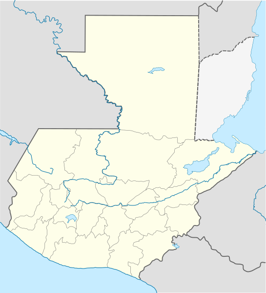
ಚಿತ್ರ:Guatemala location map.svg

Size of this PNG preview of this SVG file: ೫೪೫ × ೫೯೯ ಪಿಕ್ಸೆಲ್ಗಳು. ಇತರ ರೆಸಲ್ಯೂಶನ್ಗಳು: ೨೧೮ × ೨೪೦ ಪಿಕ್ಸೆಲ್ಗಳು | ೪೩೬ × ೪೮೦ ಪಿಕ್ಸೆಲ್ಗಳು | ೬೯೮ × ೭೬೮ ಪಿಕ್ಸೆಲ್ಗಳು | ೯೩೧ × ೧,೦೨೪ ಪಿಕ್ಸೆಲ್ಗಳು | ೧,೮೬೨ × ೨,೦೪೮ ಪಿಕ್ಸೆಲ್ಗಳು | ೯೮೨ × ೧,೦೮೦ ಪಿಕ್ಸೆಲ್ಗಳು.
ಮೂಲ ಕಡತ (SVG ಫೈಲು, ಸುಮಾರಾಗಿ ೯೮೨ × ೧,೦೮೦ ಚಿತ್ರಬಿಂದುಗಳು, ಫೈಲಿನ ಗಾತ್ರ: ೧೨೦ KB)
ಈ ಫೈಲು ವಿಕಿಮೀಡಿಯ ಕಾಮನ್ಸ್ನಲ್ಲಿ ಇರುವುದು. ಅಲ್ಲಿನ ವಿವರಣೆ ಪುಟವನ್ನೇ ಕೆಳಗೆ ತೋರಿಸಲಾಗಿದೆ. ಕಾಮನ್ಸ್ ಕೃತಿಸ್ವಾಮ್ಯತೆಯಿಂದ ಮುಕ್ತ ಫೈಲುಗಳ ಒಂದು ಆಗರ. ಅಲ್ಲಿ ನೀವೂ ಸಹಕರಿಸಬಹುದು. |
ಸಾರಾಂಶ
| ವಿವರ |
Deutsch: Positionskarte von Guatemala
Quadratische Plattkarte Русский: Карта расположения Гватемалы
English: Location map of Guatemala
Equirectangular projection, Geographic limits of the map:
Հայերեն: Գվատեմալայի տեղորոշման քարտեզ
Ուղղանկյուն պրոյեկցիա։ Քարտեզում աշխարհագրական սահմանները.
|
||
| ದಿನಾಂಕ | |||
| ಆಕರ | |||
| ಕರ್ತೃ |
|
||
| SVG genesis | This W3C-invalid vector image was created with Adobe Illustrator, and with Inkscape.
|
ಪರವಾನಗಿ
ಈ ಕಡತ ಕ್ರಿಯೇಟಿವ್ ಕಾಮನ್ಸ್ Attribution
-Share Alike 3.0 Unported ಪರವಾನಗಿ ಹೊಂದಿದೆ.
- ನೀವು ಮುಕ್ತ:
- ಹಂಚಿಕೆಗೆ – ಕೆಲಸವನ್ನು ನಕಲು ಮಾಡಲು, ವಿತರಣೆ ಮತ್ತು ಸಾಗಿಸಲು
- ರೀಮಿಕ್ಸ್ ಮಾಡಲು – ಕೆಲಸವನ್ನು ಬಳಸಿಕೊಳ್ಳಲು
- ಈ ಕೆಳಗಿನ ಷರತ್ತುಗಳಲ್ಲಿ:
- ವೈಶಿಷ್ಟ್ಯ – ನೀವು ಸೂಕ್ತವಾದ ಕ್ರೆಡಿಟ್ ನೀಡಬೇಕು, ಪರವಾನಗಿಗೆ ಲಿಂಕ್ ಅನ್ನು ಒದಗಿಸಬೇಕು ಮತ್ತು ಯಾವುದೇ ಬದಲಾವಣೆಗಳನ್ನು ಮಾಡಿದ್ದರೆ ಸೂಚಿಸಬೇಕು. ನೀವು ಯಾವುದೇ ಸಮಂಜಸವಾದ ರೀತಿಯಲ್ಲಿ ಮಾಡಬಹುದು, ಆದರೆ ಪರವಾನಗಿದಾರರು ನಿಮ್ಮನ್ನು ಅಥವಾ ನಿಮ್ಮ ಯಾವುದೇ ಬಳಕೆಯನ್ನು ಅನುಮೋದಿಸಿದಂತೆ ರೀತಿಯಲ್ಲಿ ಉಪಯೋಗಿಸಬಾರದು.
- ಇರುವುದರಂತೆಯೇ ಹಂಚು – ನೀವು ರೀಮಿಕ್ಸ್ ಮಾಡಿದರೆ, ರೂಪಾಂತರಗೊಳಿಸಿದರೆ ಅಥವಾ ವಸ್ತುವಿನ ಮೇಲೆ ನಿರ್ಮಿಸಿದರೆ, ನಿಮ್ಮ ಕೊಡುಗೆಗಳನ್ನು ನೀವು ಮೂಲದಂತೆ ಅದೇ ಅಥವಾ ಹೊಂದಾಣಿಕೆಯ ಪರವಾನಗಿ ಅಡಿಯಲ್ಲಿ ವಿತರಿಸಬೇಕು.
Original upload log
This image is a derivative work of the following images:
- File:Guatemala Departments.svg licensed with Cc-by-sa-3.0, Cc-by-sa-3.0/ru, GFDL
- 2009-10-24T20:10:21Z Daryona 982x1080 (139456 Bytes) {{Information |Description={{en|1=Guatemala map}} {{ru|1=Карта гватемалы с департаментами}} |Source={{own}} |Author=[[User:Daryona|Daryona]] |Date=2009-10-24 |Permission= |other_versions= }} [[Ca
- File:Mexico location map.svg licensed with Cc-by-3.0, GFDL
- 2009-03-11T18:34:05Z NordNordWest 2029x1326 (882028 Bytes) {{Information |Description= {{de|Positionskarte von [[:de:Mexiko|Mexiko]]}} Quadratische Plattkarte, N-S-Streckung 110 %. Geographische Begrenzung der Karte: * N: 33.3° N * S: 14.2° N * W: 118.5° W * O: 86.3° W {{en|Locat
Uploaded with derivativeFX
ಕಡತದ ಇತಿಹಾಸ
ದಿನ/ಕಾಲ ಒತ್ತಿದರೆ ಆ ಸಮಯದಲ್ಲಿ ಈ ಕಡತದ ವಸ್ತುಸ್ಥಿತಿ ತೋರುತ್ತದೆ.
| ದಿನ/ಕಾಲ | ಕಿರುನೋಟ | ಆಯಾಮಗಳು | ಬಳಕೆದಾರ | ಟಿಪ್ಪಣಿ | |
|---|---|---|---|---|---|
| ಪ್ರಸಕ್ತ | ೦೦:೪೧, ೧೯ ಅಕ್ಟೋಬರ್ ೨೦೨೨ | | ೯೮೨ × ೧,೦೮೦ (೧೨೦ KB) | Janitoalevic | Fixing |
| ೦೦:೨೯, ೧೯ ಅಕ್ಟೋಬರ್ ೨೦೨೨ |  | ೯೮೨ × ೧,೦೮೦ (೧೦೨ KB) | Janitoalevic | Added disputed territory | |
| ೦೨:೩೫, ೨೭ ಅಕ್ಟೋಬರ್ ೨೦೦೯ |  | ೯೮೨ × ೧,೦೮೦ (೧೫೪ KB) | Spischot | {{Information |Description={{de|Positionskarte von Guatemala}} Quadratische Plattkarte {{en|Location map of Guatemala}} Equirectangular projection, Geographic limits of the map: * N: 18.05° N * S: 13.54° N * W: 9 |
ಕಡತ ಬಳಕೆ
ಈ ಕೆಳಗಿನ ಪುಟವು ಈ ಚಿತ್ರಕ್ಕೆ ಸಂಪರ್ಕ ಹೊಂದಿದೆ:
ಜಾಗತಿಕ ಕಡತ ಉಪಯೋಗ
ಈ ಕಡತವನ್ನು ಕೆಳಗಿನ ಬೇರೆ ವಿಕಿಗಳೂ ಉಪಯೋಗಿಸುತ್ತಿವೆ:
- af.wikipedia.org ಮೇಲೆ ಬಳಕೆ
- an.wikipedia.org ಮೇಲೆ ಬಳಕೆ
- ar.wikipedia.org ಮೇಲೆ ಬಳಕೆ
- ast.wikipedia.org ಮೇಲೆ ಬಳಕೆ
- Puerto San José
- San Pedro Sacatepéquez (Guatemala)
- Ciudá de Guatemala
- Volcán Santa María
- Volcán de Fueu
- Módulu:Mapa de llocalización/datos/Guatemala/usu
- Uaxactún
- Quiriguá
- Terremotu de Guatemala de 1902
- Campusantu de la Ciudá de Guatemala
- Aeropuertu Bananera
- Aeropuertu de Coatepeque
- Aeropuertu de Cobán
- Aeropuertu de Huehuetenango
- Aeropuertu de Playa Grande
- Aeropuertu de Puerto Barrio
- Aeropuertu de Puerto San José
- Aeropuertu de Quetzaltenango
- Aeropuertu de Quiché
- Aeropuertu de Retalhuleu
- Puerto Barrio
- Puertu Quetzal
- Santo Tomás de Castilla
- Plantía:Mapa de llocalización de Guatemala
- Volcán San Pedro (Guatemala)
- az.wikipedia.org ಮೇಲೆ ಬಳಕೆ
- ba.wikipedia.org ಮೇಲೆ ಬಳಕೆ
- be-tarask.wikipedia.org ಮೇಲೆ ಬಳಕೆ
- be.wikipedia.org ಮೇಲೆ ಬಳಕೆ
- bg.wikipedia.org ಮೇಲೆ ಬಳಕೆ
- bn.wikipedia.org ಮೇಲೆ ಬಳಕೆ
- bs.wikipedia.org ಮೇಲೆ ಬಳಕೆ
ಈ ಫೈಲ್ನ ಹೆಚ್ಚು ಜಾಗತಿಕ ಬಳಕೆಯನ್ನು ವೀಕ್ಷಿಸಿ.