
ಚಿತ್ರ:Georgia location map.svg

Size of this PNG preview of this SVG file: ೮೦೦ × ೪೨೬ ಪಿಕ್ಸೆಲ್ಗಳು. ಇತರ ರೆಸಲ್ಯೂಶನ್ಗಳು: ೩೨೦ × ೧೭೦ ಪಿಕ್ಸೆಲ್ಗಳು | ೬೪೦ × ೩೪೧ ಪಿಕ್ಸೆಲ್ಗಳು | ೧,೦೨೪ × ೫೪೫ ಪಿಕ್ಸೆಲ್ಗಳು | ೧,೨೮೦ × ೬೮೧ ಪಿಕ್ಸೆಲ್ಗಳು | ೨,೫೬೦ × ೧,೩೬೩ ಪಿಕ್ಸೆಲ್ಗಳು | ೧,೭೧೫ × ೯೧೩ ಪಿಕ್ಸೆಲ್ಗಳು.
ಮೂಲ ಕಡತ (SVG ಫೈಲು, ಸುಮಾರಾಗಿ ೧,೭೧೫ × ೯೧೩ ಚಿತ್ರಬಿಂದುಗಳು, ಫೈಲಿನ ಗಾತ್ರ: ೧೪೧ KB)
ಈ ಫೈಲು ವಿಕಿಮೀಡಿಯ ಕಾಮನ್ಸ್ನಲ್ಲಿ ಇರುವುದು. ಅಲ್ಲಿನ ವಿವರಣೆ ಪುಟವನ್ನೇ ಕೆಳಗೆ ತೋರಿಸಲಾಗಿದೆ. ಕಾಮನ್ಸ್ ಕೃತಿಸ್ವಾಮ್ಯತೆಯಿಂದ ಮುಕ್ತ ಫೈಲುಗಳ ಒಂದು ಆಗರ. ಅಲ್ಲಿ ನೀವೂ ಸಹಕರಿಸಬಹುದು. |
ಸಾರಾಂಶ
| ವಿವರ |
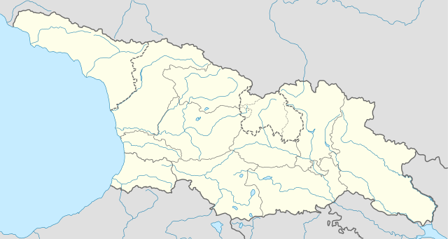
Deutsch: Positionskarte von Georgien
Quadratische Plattkarte, N-S-Streckung 135 %. Geographische Begrenzung der Karte:
English: Location map of Georgia
Equirectangular projection, N/S stretching 135 %. Geographic limits of the map:
|
| ದಿನಾಂಕ | |
| ಆಕರ |
ಸ್ವಂತ ಕೆಲಸ, using
|
| ಕರ್ತೃ | NordNordWest |
| ಅನುಮತಿ (ಈ ಕಡತವನ್ನು ಮರುಬಳಕೆ ಮಾಡಲಾಗುತ್ತಿದೆ) |
I, the copyright holder of this work, hereby publish it under the following license: ಈ ಕಡತ ಕ್ರಿಯೇಟಿವ್ ಕಾಮನ್ಸ್ Attribution
-Share Alike 3.0 Unported ಪರವಾನಗಿ ಹೊಂದಿದೆ.
|
| ಇತರೆ ಆವೃತ್ತಿಗಳು |
|


ಕಡತದ ಇತಿಹಾಸ
ದಿನ/ಕಾಲ ಒತ್ತಿದರೆ ಆ ಸಮಯದಲ್ಲಿ ಈ ಕಡತದ ವಸ್ತುಸ್ಥಿತಿ ತೋರುತ್ತದೆ.
| ದಿನ/ಕಾಲ | ಕಿರುನೋಟ | ಆಯಾಮಗಳು | ಬಳಕೆದಾರ | ಟಿಪ್ಪಣಿ | |
|---|---|---|---|---|---|
| ಪ್ರಸಕ್ತ | ೧೫:೪೩, ೨೮ ಅಕ್ಟೋಬರ್ ೨೦೧೮ | | ೧,೭೧೫ × ೯೧೩ (೧೪೧ KB) | NordNordWest | Reverted to version as of 11:58, 25 May 2013 (UTC), COM:OVERWRITE |
| ೧೪:೪೪, ೨೮ ಅಕ್ಟೋಬರ್ ೨೦೧೮ |  | ೧,೭೧೫ × ೯೧೩ (೧೪೭ KB) | Lamensi | De facto independence | |
| ೧೭:೨೮, ೨೫ ಮೇ ೨೦೧೩ |  | ೧,೭೧೫ × ೯೧೩ (೧೪೧ KB) | NordNordWest | Reverted to version as of 16:47, 24 July 2011, COM:OVERWRITE, too important to change without discussion | |
| ೧೭:೨೮, ೨೫ ಮೇ ೨೦೧೩ |  | ೧,೭೧೫ × ೯೧೩ (೧೪೧ KB) | NordNordWest | Reverted to version as of 16:47, 24 July 2011, COM:OVERWRITE, too important to change without discussion | |
| ೦೪:೧೯, ೨೫ ಮೇ ೨೦೧೩ |  | ೧,೭೧೫ × ೯೧೩ (೧೪೯ KB) | Giorgi Balakhadze | South Ossetian Autonomous Region was revoked on December 10, 1990 by the Supreme Soviet of the Georgian SSR. So it's not correct to show it in modern maps. [http://en.wikipedia.org/wiki/South_Ossetian_Autonomous_Oblast] | |
| ೨೨:೧೭, ೨೪ ಜುಲೈ ೨೦೧೧ |  | ೧,೭೧೫ × ೯೧೩ (೧೪೧ KB) | NordNordWest | corr | |
| ೧೪:೦೧, ೧೦ ಸೆಪ್ಟೆಂಬರ್ ೨೦೦೯ |  | ೧,೭೧೬ × ೯೧೩ (೨೭೦ KB) | NordNordWest | ||
| ೦೨:೧೬, ೧೦ ಸೆಪ್ಟೆಂಬರ್ ೨೦೦೯ |  | ೧,೭೧೬ × ೮೭೯ (೨೭೧ KB) | NordNordWest | =={{int:filedesc}}== {{Information |Description= {{de|Positionskarte von Georgien}} Quadratische Plattkarte, N-S-Streckung 130 %. Geographische Begrenzung der Karte: * N: 43.7° N * S: 40.9° N * W: 39.8° O * O: 46.9° O {{en|Location ma |
ಕಡತ ಬಳಕೆ
ಈ ಕೆಳಗಿನ ಪುಟವು ಈ ಚಿತ್ರಕ್ಕೆ ಸಂಪರ್ಕ ಹೊಂದಿದೆ:
ಜಾಗತಿಕ ಕಡತ ಉಪಯೋಗ
ಈ ಕಡತವನ್ನು ಕೆಳಗಿನ ಬೇರೆ ವಿಕಿಗಳೂ ಉಪಯೋಗಿಸುತ್ತಿವೆ:
- af.wikipedia.org ಮೇಲೆ ಬಳಕೆ
- an.wikipedia.org ಮೇಲೆ ಬಳಕೆ
- ast.wikipedia.org ಮೇಲೆ ಬಳಕೆ
- av.wikipedia.org ಮೇಲೆ ಬಳಕೆ
- azb.wikipedia.org ಮೇಲೆ ಬಳಕೆ
- az.wikipedia.org ಮೇಲೆ ಬಳಕೆ
- Qaqra
- Tbilisi
- Faxralı
- Dmanisi
- Kəpənəkçi (Bolnisi)
- Sadaxlı
- Kəpənəkçi (Sarvan)
- Saraçlı (Borçalı)
- Qızılhacılı (Marneuli)
- İmirhəsən
- Yırğançay
- Qoçulu (Borçalı)
- Aşağı Qarabulaq
- Yuxarı Qarabulaq
- Arıxlı
- Rustavi
- Səfərli (Başkeçid)
- Aşağı Oruzman
- Soğanlıq
- Marabda
- Söyüdlü (Başkeçid)
- Qaracalar (Qarayazı)
- Salamməlik
- Saqareco
- Məmişlər (Başkeçid)
- Tbilisi Azərbaycan Teatrı
- Təkəli (Marneuli)
- Ağaməmmədli (Marneuli)
ಈ ಫೈಲ್ನ ಹೆಚ್ಚು ಜಾಗತಿಕ ಬಳಕೆಯನ್ನು ವೀಕ್ಷಿಸಿ.