
ಚಿತ್ರ:Denbighshire UK location map.svg

Size of this PNG preview of this SVG file: ೩೯೭ × ೬೦೦ ಪಿಕ್ಸೆಲ್ಗಳು. ಇತರ ರೆಸಲ್ಯೂಶನ್ಗಳು: ೧೫೯ × ೨೪೦ ಪಿಕ್ಸೆಲ್ಗಳು | ೩೧೮ × ೪೮೦ ಪಿಕ್ಸೆಲ್ಗಳು | ೫೦೮ × ೭೬೮ ಪಿಕ್ಸೆಲ್ಗಳು | ೬೭೮ × ೧,೦೨೪ ಪಿಕ್ಸೆಲ್ಗಳು | ೧,೩೫೬ × ೨,೦೪೮ ಪಿಕ್ಸೆಲ್ಗಳು | ೮೬೪ × ೧,೩೦೫ ಪಿಕ್ಸೆಲ್ಗಳು.
ಮೂಲ ಕಡತ (SVG ಫೈಲು, ಸುಮಾರಾಗಿ ೮೬೪ × ೧,೩೦೫ ಚಿತ್ರಬಿಂದುಗಳು, ಫೈಲಿನ ಗಾತ್ರ: ೭೬೭ KB)
ಈ ಫೈಲು ವಿಕಿಮೀಡಿಯ ಕಾಮನ್ಸ್ನಲ್ಲಿ ಇರುವುದು. ಅಲ್ಲಿನ ವಿವರಣೆ ಪುಟವನ್ನೇ ಕೆಳಗೆ ತೋರಿಸಲಾಗಿದೆ. ಕಾಮನ್ಸ್ ಕೃತಿಸ್ವಾಮ್ಯತೆಯಿಂದ ಮುಕ್ತ ಫೈಲುಗಳ ಒಂದು ಆಗರ. ಅಲ್ಲಿ ನೀವೂ ಸಹಕರಿಸಬಹುದು. |
| ವಿವರ |
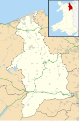
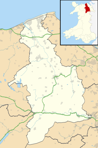
Blank map of Denbighshire, UK with the following information shown:
Equirectangular map projection on WGS 84 datum, with N/S stretched 165% Geographic limits:
|
| ದಿನಾಂಕ | |
| ಆಕರ |
|
| ಕರ್ತೃ | Nilfanion, created using Ordnance Survey data |
| ಅನುಮತಿ (ಈ ಕಡತವನ್ನು ಮರುಬಳಕೆ ಮಾಡಲಾಗುತ್ತಿದೆ) |
ಈ ಕಡತ ಕ್ರಿಯೇಟಿವ್ ಕಾಮನ್ಸ್ Attribution
-Share Alike 3.0 Unported ಪರವಾನಗಿ ಹೊಂದಿದೆ. ವೈಶಿಷ್ಟ್ಯ: Contains Ordnance Survey data © Crown copyright and database right
|
| ಇತರೆ ಆವೃತ್ತಿಗಳು | File:Denbighshire UK map.svg - Blank map |
ಕಡತದ ಇತಿಹಾಸ
ದಿನ/ಕಾಲ ಒತ್ತಿದರೆ ಆ ಸಮಯದಲ್ಲಿ ಈ ಕಡತದ ವಸ್ತುಸ್ಥಿತಿ ತೋರುತ್ತದೆ.
| ದಿನ/ಕಾಲ | ಕಿರುನೋಟ | ಆಯಾಮಗಳು | ಬಳಕೆದಾರ | ಟಿಪ್ಪಣಿ | |
|---|---|---|---|---|---|
| ಪ್ರಸಕ್ತ | ೦೧:೦೨, ೨೭ ಸೆಪ್ಟೆಂಬರ್ ೨೦೧೦ | | ೮೬೪ × ೧,೩೦೫ (೭೬೭ KB) | Nilfanion | {{Information |Description=Blank map of Denbighshire, UK with the following information shown: *Administrative borders *Coastline, lakes and rivers *Roads and railways *Urban areas Equirectangular map projection on WGS 84 datum, with N |
ಕಡತ ಬಳಕೆ
ಈ ಕೆಳಗಿನ ಪುಟವು ಈ ಚಿತ್ರಕ್ಕೆ ಸಂಪರ್ಕ ಹೊಂದಿದೆ:
ಜಾಗತಿಕ ಕಡತ ಉಪಯೋಗ
ಈ ಕಡತವನ್ನು ಕೆಳಗಿನ ಬೇರೆ ವಿಕಿಗಳೂ ಉಪಯೋಗಿಸುತ್ತಿವೆ:
- ar.wikipedia.org ಮೇಲೆ ಬಳಕೆ
- azb.wikipedia.org ಮೇಲೆ ಬಳಕೆ
- ceb.wikipedia.org ಮೇಲೆ ಬಳಕೆ
- cy.wikipedia.org ಮೇಲೆ ಬಳಕೆ
- da.wikipedia.org ಮೇಲೆ ಬಳಕೆ
- en.wikipedia.org ಮೇಲೆ ಬಳಕೆ
- Llangollen
- List of monastic houses in Wales
- Ruthin
- Denbighshire
- Rhyl
- St Asaph
- Prestatyn
- Rhuddlan
- Corwen
- Denbigh
- Bodelwyddan
- Gwyddelwern
- Loggerheads, Denbighshire
- Castell Dinas Brân
- Cynwyd, Denbighshire
- Nantglyn
- Llandyrnog
- Glyndyfrdwy
- Llanarmon-yn-Iâl
- Glan Clwyd Hospital
- Denbigh Community Hospital
- H.M. Stanley Hospital
- Llangollen Community Hospital
- Prestatyn Community Hospital
- Ruthin Community Hospital
- Pot Hole quarry
- Llandegla
- Henllan
- Meliden
- Dyserth
- Llanferres
- Llanelidan
- Tremeirchion
- Trefnant
- Llandrillo, Denbighshire
- Cader
- Bodfari
- Bontuchel
- Maeshafn
- RAF Prestatyn
- Llanfair Dyffryn Clwyd
- Tafarn-y-Gelyn
- Eryrys
- User:Arwel Parry/sandbox/Infobox Browser test
ಈ ಫೈಲ್ನ ಹೆಚ್ಚು ಜಾಗತಿಕ ಬಳಕೆಯನ್ನು ವೀಕ್ಷಿಸಿ.