
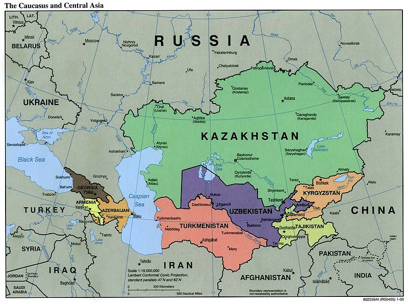
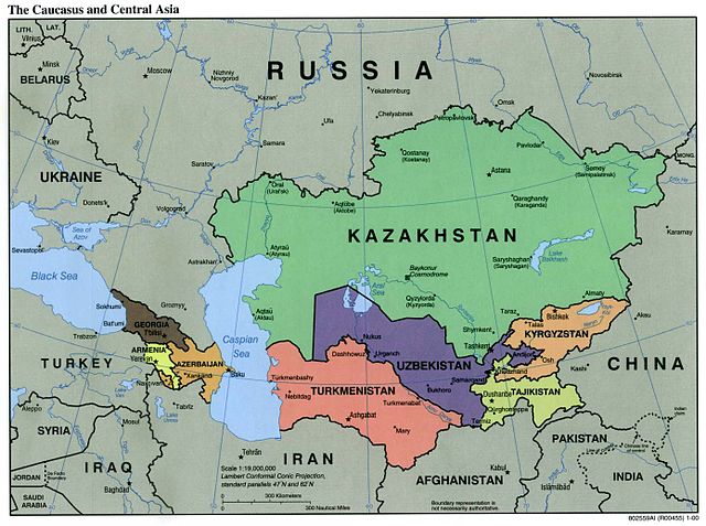
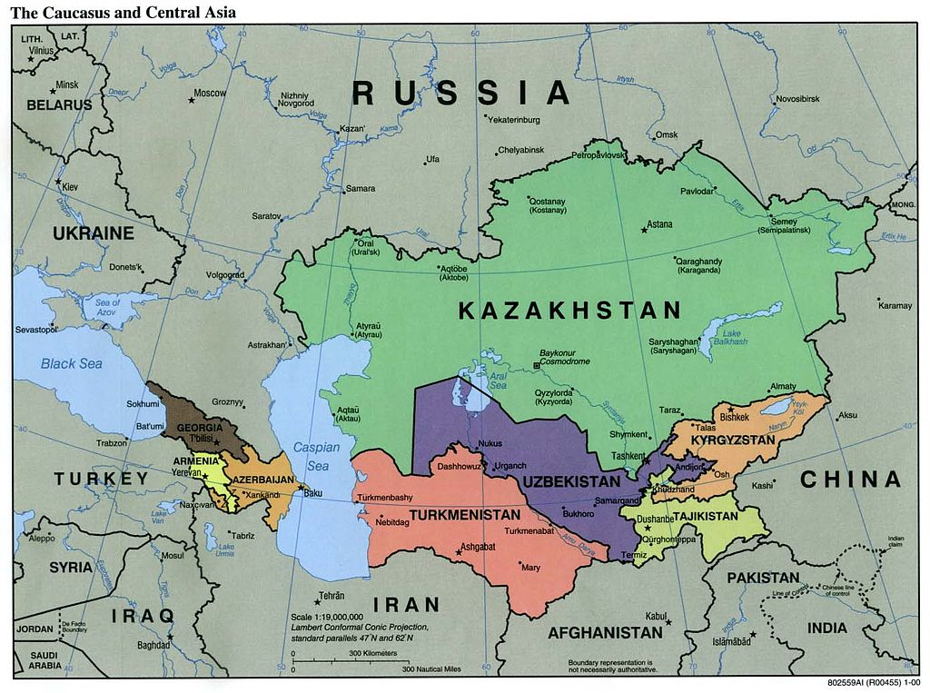
ಚಿತ್ರ:Caucasus central asia political map 2000.jpg

ಈ ಮುನ್ನೋಟ ಗಾತ್ರ:೮೦೦ × ೫೯೬ ಪಿಕ್ಸೆಲ್ಗಳು. ಇತರ ರೆಸಲ್ಯೂಶನ್ಗಳು: ೩೨೦ × ೨೩೯ ಪಿಕ್ಸೆಲ್ಗಳು | ೬೪೦ × ೪೭೭ ಪಿಕ್ಸೆಲ್ಗಳು | ೧,೦೨೪ × ೭೬೩ ಪಿಕ್ಸೆಲ್ಗಳು | ೧,೨೮೦ × ೯೫೪ ಪಿಕ್ಸೆಲ್ಗಳು | ೧,೩೯೦ × ೧,೦೩೬ ಪಿಕ್ಸೆಲ್ಗಳು.
ಮೂಲ ಕಡತ (೧,೩೯೦ × ೧,೦೩೬ ಚಿತ್ರಬಿಂದು, ಫೈಲಿನ ಗಾತ್ರ: ೧೬೪ KB, MIME ಪ್ರಕಾರ: image/jpeg)
ಈ ಫೈಲು ವಿಕಿಮೀಡಿಯ ಕಾಮನ್ಸ್ನಲ್ಲಿ ಇರುವುದು. ಅಲ್ಲಿನ ವಿವರಣೆ ಪುಟವನ್ನೇ ಕೆಳಗೆ ತೋರಿಸಲಾಗಿದೆ. ಕಾಮನ್ಸ್ ಕೃತಿಸ್ವಾಮ್ಯತೆಯಿಂದ ಮುಕ್ತ ಫೈಲುಗಳ ಒಂದು ಆಗರ. ಅಲ್ಲಿ ನೀವೂ ಸಹಕರಿಸಬಹುದು. |
| ವಿವರ | Political Map of the Caucasus and Central Asia | ||||||
| ಆಕರ | http://ftp.lib.utexas.edu/maps/kazakhstan.html (CIA-Scans) | ||||||
| ಕರ್ತೃ | CIA | ||||||
| ಅನುಮತಿ (ಈ ಕಡತವನ್ನು ಮರುಬಳಕೆ ಮಾಡಲಾಗುತ್ತಿದೆ) |
|
||||||
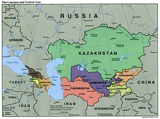
| ಇತರೆ ಆವೃತ್ತಿಗಳು | Derivative works of this file: Central Asia - political map.svg | ||||||

ಕಡತದ ಇತಿಹಾಸ
ದಿನ/ಕಾಲ ಒತ್ತಿದರೆ ಆ ಸಮಯದಲ್ಲಿ ಈ ಕಡತದ ವಸ್ತುಸ್ಥಿತಿ ತೋರುತ್ತದೆ.
| ದಿನ/ಕಾಲ | ಕಿರುನೋಟ | ಆಯಾಮಗಳು | ಬಳಕೆದಾರ | ಟಿಪ್ಪಣಿ | |
|---|---|---|---|---|---|
| ಪ್ರಸಕ್ತ | ೦೬:೫೦, ೯ ನವೆಂಬರ್ ೨೦೦೪ | | ೧,೩೯೦ × ೧,೦೩೬ (೧೬೪ KB) | Annalog~commonswiki | The Caucasus and Central Asia Political Map 2000 |
ಕಡತ ಬಳಕೆ
ಈ ಫೈಲನ್ನು ಬಳಸುವ ಯಾವ ಪುಟಗಳೂ ಇಲ್ಲ.
ಜಾಗತಿಕ ಕಡತ ಉಪಯೋಗ
ಈ ಕಡತವನ್ನು ಕೆಳಗಿನ ಬೇರೆ ವಿಕಿಗಳೂ ಉಪಯೋಗಿಸುತ್ತಿವೆ:
- en.wikipedia.org ಮೇಲೆ ಬಳಕೆ
- es.wikipedia.org ಮೇಲೆ ಬಳಕೆ
- id.wikipedia.org ಮೇಲೆ ಬಳಕೆ
- jv.wikipedia.org ಮೇಲೆ ಬಳಕೆ
- min.wikipedia.org ಮೇಲೆ ಬಳಕೆ
- ml.wikipedia.org ಮೇಲೆ ಬಳಕೆ
- ro.wikipedia.org ಮೇಲೆ ಬಳಕೆ
- te.wikipedia.org ಮೇಲೆ ಬಳಕೆ
- th.wikipedia.org ಮೇಲೆ ಬಳಕೆ
- tl.wikipedia.org ಮೇಲೆ ಬಳಕೆ
- zh-min-nan.wikipedia.org ಮೇಲೆ ಬಳಕೆ