
ಚಿತ್ರ:Canarias-loc.svg

Size of this PNG preview of this SVG file: ೫೧೨ × ೨೭೭ ಪಿಕ್ಸೆಲ್ಗಳು. ಇತರ ರೆಸಲ್ಯೂಶನ್ಗಳು: ೩೨೦ × ೧೭೩ ಪಿಕ್ಸೆಲ್ಗಳು | ೬೪೦ × ೩೪೬ ಪಿಕ್ಸೆಲ್ಗಳು | ೧,೦೨೪ × ೫೫೪ ಪಿಕ್ಸೆಲ್ಗಳು | ೧,೨೮೦ × ೬೯೩ ಪಿಕ್ಸೆಲ್ಗಳು | ೨,೫೬೦ × ೧,೩೮೫ ಪಿಕ್ಸೆಲ್ಗಳು.
ಮೂಲ ಕಡತ (SVG ಫೈಲು, ಸುಮಾರಾಗಿ ೫೧೨ × ೨೭೭ ಚಿತ್ರಬಿಂದುಗಳು, ಫೈಲಿನ ಗಾತ್ರ: ೩.೦೯ MB)
ಈ ಫೈಲು ವಿಕಿಮೀಡಿಯ ಕಾಮನ್ಸ್ನಲ್ಲಿ ಇರುವುದು. ಅಲ್ಲಿನ ವಿವರಣೆ ಪುಟವನ್ನೇ ಕೆಳಗೆ ತೋರಿಸಲಾಗಿದೆ. ಕಾಮನ್ಸ್ ಕೃತಿಸ್ವಾಮ್ಯತೆಯಿಂದ ಮುಕ್ತ ಫೈಲುಗಳ ಒಂದು ಆಗರ. ಅಲ್ಲಿ ನೀವೂ ಸಹಕರಿಸಬಹುದು. |
ಸಾರಾಂಶ
This locator map was created with Inkscape.
| ವಿವರ |
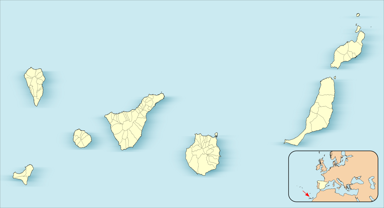
English: Location map of Canary Islands
Equirectangular projection, N/S stretching 130 %. Geographic limits of the map:
Español: Mapa de localización de las Islas Canarias
Proyección equirrectangular (cilíndrica equidistante), N/S estirada 130 %. Límites geográficos del mapa:
|
| ದಿನಾಂಕ | |
| ಆಕರ | Own work based on: EspañaLoc.svg by HansenBCN |
| ಕರ್ತೃ | Miguillen |
|
This map has been made or improved in the Spanish Taller de Cartografía (Map Lab). You can propose maps to improve as well.
|
ಪರವಾನಗಿ
Miguillen, the copyright holder of this work, hereby publishes it under the following license:
ಈ ಕಡತ ಕ್ರಿಯೇಟಿವ್ ಕಾಮನ್ಸ್ Attribution
-Share Alike 3.0 Unported ಪರವಾನಗಿ ಹೊಂದಿದೆ.
ವೈಶಿಷ್ಟ್ಯ: Miguillen
- ನೀವು ಮುಕ್ತ:
- ಹಂಚಿಕೆಗೆ – ಕೆಲಸವನ್ನು ನಕಲು ಮಾಡಲು, ವಿತರಣೆ ಮತ್ತು ಸಾಗಿಸಲು
- ರೀಮಿಕ್ಸ್ ಮಾಡಲು – ಕೆಲಸವನ್ನು ಬಳಸಿಕೊಳ್ಳಲು
- ಈ ಕೆಳಗಿನ ಷರತ್ತುಗಳಲ್ಲಿ:
- ವೈಶಿಷ್ಟ್ಯ – ನೀವು ಸೂಕ್ತವಾದ ಕ್ರೆಡಿಟ್ ನೀಡಬೇಕು, ಪರವಾನಗಿಗೆ ಲಿಂಕ್ ಅನ್ನು ಒದಗಿಸಬೇಕು ಮತ್ತು ಯಾವುದೇ ಬದಲಾವಣೆಗಳನ್ನು ಮಾಡಿದ್ದರೆ ಸೂಚಿಸಬೇಕು. ನೀವು ಯಾವುದೇ ಸಮಂಜಸವಾದ ರೀತಿಯಲ್ಲಿ ಮಾಡಬಹುದು, ಆದರೆ ಪರವಾನಗಿದಾರರು ನಿಮ್ಮನ್ನು ಅಥವಾ ನಿಮ್ಮ ಯಾವುದೇ ಬಳಕೆಯನ್ನು ಅನುಮೋದಿಸಿದಂತೆ ರೀತಿಯಲ್ಲಿ ಉಪಯೋಗಿಸಬಾರದು.
- ಇರುವುದರಂತೆಯೇ ಹಂಚು – ನೀವು ರೀಮಿಕ್ಸ್ ಮಾಡಿದರೆ, ರೂಪಾಂತರಗೊಳಿಸಿದರೆ ಅಥವಾ ವಸ್ತುವಿನ ಮೇಲೆ ನಿರ್ಮಿಸಿದರೆ, ನಿಮ್ಮ ಕೊಡುಗೆಗಳನ್ನು ನೀವು ಮೂಲದಂತೆ ಅದೇ ಅಥವಾ ಹೊಂದಾಣಿಕೆಯ ಪರವಾನಗಿ ಅಡಿಯಲ್ಲಿ ವಿತರಿಸಬೇಕು.
ಕಡತದ ಇತಿಹಾಸ
ದಿನ/ಕಾಲ ಒತ್ತಿದರೆ ಆ ಸಮಯದಲ್ಲಿ ಈ ಕಡತದ ವಸ್ತುಸ್ಥಿತಿ ತೋರುತ್ತದೆ.
| ದಿನ/ಕಾಲ | ಕಿರುನೋಟ | ಆಯಾಮಗಳು | ಬಳಕೆದಾರ | ಟಿಪ್ಪಣಿ | |
|---|---|---|---|---|---|
| ಪ್ರಸಕ್ತ | ೨೨:೫೭, ೩ ಜೂನ್ ೨೦೧೨ | | ೫೧೨ × ೨೭೭ (೩.೦೯ MB) | Miguillen | |
| ೨೧:೫೬, ೩ ಜೂನ್ ೨೦೧೨ |  | ೫೧೨ × ೨೬೪ (೩.೧ MB) | Miguillen | ||
| ೨೧:೨೮, ೩ ಜೂನ್ ೨೦೧೨ |  | ೫೧೨ × ೨೬೪ (೩.೧ MB) | Miguillen | actualizo | |
| ೨೧:೦೯, ೨೧ ನವೆಂಬರ್ ೨೦೧೦ |  | ೫೧೨ × ೨೯೦ (೧೩೦ KB) | Miguillen | Estiro un 130% | |
| ೨೩:೧೦, ೧೮ ನವೆಂಬರ್ ೨೦೧೦ |  | ೫೧೨ × ೨೨೩ (೭೬ KB) | Miguillen | amplio área | |
| ೨೩:೦೯, ೧೮ ನವೆಂಬರ್ ೨೦೧೦ | ೫೧೨ × ೧೯೨ (೮೩ KB) | Miguillen | == {{int:filedesc}} == {{Information |Description={{en|Location map of Canary Island}} Equirectangular projection, N/S stretching 130 %. Geographic limits of the map: * N: ° N * S: ° N * W: ° O * E: ° O {{es|Mapa de localiza |
ಕಡತ ಬಳಕೆ
ಈ ಕೆಳಗಿನ ಪುಟವು ಈ ಚಿತ್ರಕ್ಕೆ ಸಂಪರ್ಕ ಹೊಂದಿದೆ:
ಜಾಗತಿಕ ಕಡತ ಉಪಯೋಗ
ಈ ಕಡತವನ್ನು ಕೆಳಗಿನ ಬೇರೆ ವಿಕಿಗಳೂ ಉಪಯೋಗಿಸುತ್ತಿವೆ:
- an.wikipedia.org ಮೇಲೆ ಬಳಕೆ
- Las Palmas de Gran Canaria
- Santa Cruz de Tenerife
- San Cristóbal de La Laguna
- Valverde (El Hierro)
- Gran Canaria Arena
- Pabillón Insular Santiago Martín
- Granadilla de Abona
- Plantilla:Mapa de localización Islas Canarias
- Adeje
- Agulo
- Arafo
- Arona
- Candelaria (Tenerife)
- Barlovento (Santa Cruz de Tenerife)
- Breña Alta
- Breña Baja
- El Paso
- Santa Cruz de La Palma
- San Sebastián de la Gomera
- Alajeró
- Arico
- Buenavista del Norte
- Fuencaliente de la Palma
- Icod de los Vinos
- La Orotava
- Puerto de la Cruz
- Tazacorte
- Tijarafe
- La Matanza de Acentejo
- La Victoria de Acentejo
- Santiago del Teide
- El Sauzal
- Tacoronte
- El Tanque
- Tegueste
- Valle Gran Rey
- Villa de Mazo
- Fasnia
- Garachico
- Los Llanos de Aridane
- Puntallana
- La Frontera (El Hierro)
- Garafía
- La Guancha
- Guía de Isora
- Güímar
- Hermigua
- El Pinar de El Hierro
- Puntagorda
- Los Realejos
ಈ ಫೈಲ್ನ ಹೆಚ್ಚು ಜಾಗತಿಕ ಬಳಕೆಯನ್ನು ವೀಕ್ಷಿಸಿ.