
ಚಿತ್ರ:Canada Southern Quebec location map.png
ಇದಕ್ಕಿಂತ ಹೆಚ್ಚಿನ ವಿವರವಾದ ನೋಟ ಇಲ್ಲ.
Canada_Southern_Quebec_location_map.png (೫೩೫ × ೪೩೫ ಚಿತ್ರಬಿಂದು, ಫೈಲಿನ ಗಾತ್ರ: ೧೩೩ KB, MIME ಪ್ರಕಾರ: image/png)
ಈ ಫೈಲು ವಿಕಿಮೀಡಿಯ ಕಾಮನ್ಸ್ನಲ್ಲಿ ಇರುವುದು. ಅಲ್ಲಿನ ವಿವರಣೆ ಪುಟವನ್ನೇ ಕೆಳಗೆ ತೋರಿಸಲಾಗಿದೆ. ಕಾಮನ್ಸ್ ಕೃತಿಸ್ವಾಮ್ಯತೆಯಿಂದ ಮುಕ್ತ ಫೈಲುಗಳ ಒಂದು ಆಗರ. ಅಲ್ಲಿ ನೀವೂ ಸಹಕರಿಸಬಹುದು. |
ಸಾರಾಂಶ
| ವಿವರ |
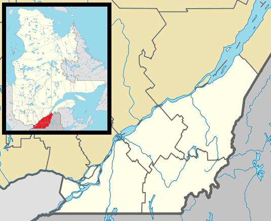
English: Map of southern Québec Province within Canada, for use in location map templates. Français : Carte du sud du Québec. |
| ದಿನಾಂಕ | (UTC) |
| ಆಕರ |
This file was derived from: Canada Quebec location map 2.svg:  |
| ಕರ್ತೃ |
|

|
This locator map image could be re-created using vector graphics as an SVG file. This has several advantages; see Commons:Media for cleanup for more information. If an SVG form of this image is available, please upload it and afterwards replace this template with
{{vector version available|new image name}}.
It is recommended to name the SVG file “Canada Southern Quebec location map.svg”—then the template Vector version available (or Vva) does not need the new image name parameter. |
ಪರವಾನಗಿ
I, the copyright holder of this work, hereby publish it under the following license:
| I, the copyright holder of this work, release this work into the public domain. This applies worldwide. In some countries this may not be legally possible; if so: I grant anyone the right to use this work for any purpose, without any conditions, unless such conditions are required by law. |
Original upload log
This image is a derivative work of the following images:
- File:Canada_Quebec_location_map_2.svg licensed with PD-self
- 2009-09-24T18:30:53Z Hanhil 2316x2822 (2687510 Bytes) {{Information |Description={{en|1=Québec Province within Canada.}} {{es|1=Provincia de Quebec en Canadá.}} |Source=Based on [[:Image:Canada_Quebec_location_map.svg]] |Author=~~~~ based on [[User:EOZyo|EOZyo]] |Date=2009-09-
Uploaded with derivativeFX
ಕಡತದ ಇತಿಹಾಸ
ದಿನ/ಕಾಲ ಒತ್ತಿದರೆ ಆ ಸಮಯದಲ್ಲಿ ಈ ಕಡತದ ವಸ್ತುಸ್ಥಿತಿ ತೋರುತ್ತದೆ.
| ದಿನ/ಕಾಲ | ಕಿರುನೋಟ | ಆಯಾಮಗಳು | ಬಳಕೆದಾರ | ಟಿಪ್ಪಣಿ | |
|---|---|---|---|---|---|
| ಪ್ರಸಕ್ತ | ೦೯:೧೨, ೨ ಮೇ ೨೦೧೩ | | ೫೩೫ × ೪೩೫ (೧೩೩ KB) | Gordalmighty | boundary fix |
| ೨೦:೧೬, ೧ ಮೇ ೨೦೧೩ |  | ೫೩೫ × ೪೩೫ (೧೩೨ KB) | Gordalmighty | colour problem | |
| ೧೦:೫೫, ೧ ಮೇ ೨೦೧೩ |  | ೫೩೫ × ೪೩೫ (೧೩೩ KB) | Gordalmighty | uploaded proper file | |
| ೧೦:೧೭, ೧ ಮೇ ೨೦೧೩ |  | ೫೩೫ × ೪೩೫ (೧೦೨ KB) | Gordalmighty | boundary fix | |
| ೦೦:೪೨, ೨೪ ಏಪ್ರಿಲ್ ೨೦೧೩ |  | ೫೨೦ × ೪೨೦ (೯೩ KB) | Gordalmighty | localized map to south of Saint Lawrence River & added colour | |
| ೦೫:೪೩, ೧೫ ಡಿಸೆಂಬರ್ ೨೦೧೨ |  | ೬೦೦ × ೪೦೦ (೯೨ KB) | P199 | == {{int:filedesc}} == {{Information |Description={{en|1=Map of southern Québec Province within Canada, for use in location map templates.}} |Source={{Derived from|Canada_Quebec_location_map_2.svg|display=50}} |Date=2012-12-15 00:12 (UTC) |Author=*[[:... |
ಕಡತ ಬಳಕೆ
ಈ ಕೆಳಗಿನ ಪುಟವು ಈ ಚಿತ್ರಕ್ಕೆ ಸಂಪರ್ಕ ಹೊಂದಿದೆ:
ಜಾಗತಿಕ ಕಡತ ಉಪಯೋಗ
ಈ ಕಡತವನ್ನು ಕೆಳಗಿನ ಬೇರೆ ವಿಕಿಗಳೂ ಉಪಯೋಗಿಸುತ್ತಿವೆ:
- ar.wikipedia.org ಮೇಲೆ ಬಳಕೆ
- ca.wikipedia.org ಮೇಲೆ ಬಳಕೆ
- ceb.wikipedia.org ಮೇಲೆ ಬಳಕೆ
- diq.wikipedia.org ಮೇಲೆ ಬಳಕೆ
- el.wikipedia.org ಮೇಲೆ ಬಳಕೆ
- en.wikipedia.org ಮೇಲೆ ಬಳಕೆ
- Longueuil
- Westmount
- Dorval
- Hampstead, Quebec
- Mount Royal, Quebec
- L'Île-Dorval
- Sainte-Anne-de-Bellevue
- Laval, Quebec
- Sherbrooke
- Stanstead, Quebec
- Saint-Jean-sur-Richelieu
- Granby, Quebec
- Châteauguay
- Lévis
- Victoriaville
- Saint-Hyacinthe
- Beaconsfield, Quebec
- Baie-D'Urfé
- Lennoxville, Quebec
- Pointe-Claire
- Thetford Mines
- Saint-Hubert, Quebec
- Saint-Georges, Quebec
- Boucherville
- Pointe-Fortune, Quebec
- Rigaud, Quebec
- Vaudreuil-Dorion
- Richmond, Quebec
- Greenfield Park, Quebec
- Saint-Lambert, Montérégie
- Brossard
- Dollard-des-Ormeaux
- Sorel-Tracy
- Sainte-Julie, Quebec
- Salaberry-de-Valleyfield
- Saint-Bruno-de-Montarville
- Saint-Constant, Quebec
- Kirkland, Quebec
- Chambly, Quebec
- Varennes, Quebec
- Beloeil, Quebec
- La Prairie, Quebec
- Sainte-Catherine, Quebec
- Magog, Quebec
ಈ ಫೈಲ್ನ ಹೆಚ್ಚು ಜಾಗತಿಕ ಬಳಕೆಯನ್ನು ವೀಕ್ಷಿಸಿ.