
ಚಿತ್ರ:Canada Quebec location map-conic proj2.svg

Size of this PNG preview of this SVG file: ೫೩೮ × ೫೯೯ ಪಿಕ್ಸೆಲ್ಗಳು. ಇತರ ರೆಸಲ್ಯೂಶನ್ಗಳು: ೨೧೬ × ೨೪೦ ಪಿಕ್ಸೆಲ್ಗಳು | ೪೩೧ × ೪೮೦ ಪಿಕ್ಸೆಲ್ಗಳು | ೬೯೦ × ೭೬೮ ಪಿಕ್ಸೆಲ್ಗಳು | ೯೨೦ × ೧,೦೨೪ ಪಿಕ್ಸೆಲ್ಗಳು | ೧,೮೪೦ × ೨,೦೪೮ ಪಿಕ್ಸೆಲ್ಗಳು | ೧,೧೮೪ × ೧,೩೧೮ ಪಿಕ್ಸೆಲ್ಗಳು.
ಮೂಲ ಕಡತ (SVG ಫೈಲು, ಸುಮಾರಾಗಿ ೧,೧೮೪ × ೧,೩೧೮ ಚಿತ್ರಬಿಂದುಗಳು, ಫೈಲಿನ ಗಾತ್ರ: ೮೯೯ KB)
ಈ ಫೈಲು ವಿಕಿಮೀಡಿಯ ಕಾಮನ್ಸ್ನಲ್ಲಿ ಇರುವುದು. ಅಲ್ಲಿನ ವಿವರಣೆ ಪುಟವನ್ನೇ ಕೆಳಗೆ ತೋರಿಸಲಾಗಿದೆ. ಕಾಮನ್ಸ್ ಕೃತಿಸ್ವಾಮ್ಯತೆಯಿಂದ ಮುಕ್ತ ಫೈಲುಗಳ ಒಂದು ಆಗರ. ಅಲ್ಲಿ ನೀವೂ ಸಹಕರಿಸಬಹುದು. |
ಸಾರಾಂಶ
| ವಿವರ |
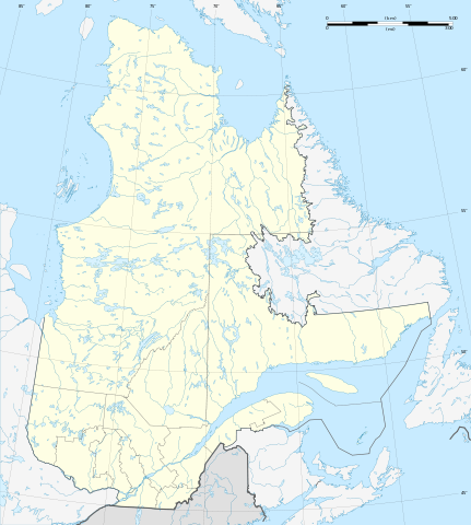
Français : Carte administrative vierge de la province de Québec, Canada, destinée à la géolocalisation.
Scale: 1:7,720,000 (precision: 1,930 m)Equidistant conic A projection, WGS84 datum *Standard parallel: 53° 45' N *Central meridian: 068° 25' 30" W *Origin latitude: 53° 45' N Geographic limits of the map: *Central meridian: 068° 25' 30" W *Top: 63° 27' N (at center) *Bottom: 44° 30' N (at center) |
| ದಿನಾಂಕ | (UTC) |
| ಆಕರ |
This file was derived from: Canada Quebec location map-conic proj.svg |
| ಕರ್ತೃ |
|
ಪರವಾನಗಿ
I, the copyright holder of this work, hereby publish it under the following licenses:
ಈ ಕಡತ ಕ್ರಿಯೇಟಿವ್ ಕಾಮನ್ಸ್ Attribution
-Share Alike 3.0 Unported ಪರವಾನಗಿ ಹೊಂದಿದೆ.
- ನೀವು ಮುಕ್ತ:
- ಹಂಚಿಕೆಗೆ – ಕೆಲಸವನ್ನು ನಕಲು ಮಾಡಲು, ವಿತರಣೆ ಮತ್ತು ಸಾಗಿಸಲು
- ರೀಮಿಕ್ಸ್ ಮಾಡಲು – ಕೆಲಸವನ್ನು ಬಳಸಿಕೊಳ್ಳಲು
- ಈ ಕೆಳಗಿನ ಷರತ್ತುಗಳಲ್ಲಿ:
- ವೈಶಿಷ್ಟ್ಯ – ನೀವು ಸೂಕ್ತವಾದ ಕ್ರೆಡಿಟ್ ನೀಡಬೇಕು, ಪರವಾನಗಿಗೆ ಲಿಂಕ್ ಅನ್ನು ಒದಗಿಸಬೇಕು ಮತ್ತು ಯಾವುದೇ ಬದಲಾವಣೆಗಳನ್ನು ಮಾಡಿದ್ದರೆ ಸೂಚಿಸಬೇಕು. ನೀವು ಯಾವುದೇ ಸಮಂಜಸವಾದ ರೀತಿಯಲ್ಲಿ ಮಾಡಬಹುದು, ಆದರೆ ಪರವಾನಗಿದಾರರು ನಿಮ್ಮನ್ನು ಅಥವಾ ನಿಮ್ಮ ಯಾವುದೇ ಬಳಕೆಯನ್ನು ಅನುಮೋದಿಸಿದಂತೆ ರೀತಿಯಲ್ಲಿ ಉಪಯೋಗಿಸಬಾರದು.
- ಇರುವುದರಂತೆಯೇ ಹಂಚು – ನೀವು ರೀಮಿಕ್ಸ್ ಮಾಡಿದರೆ, ರೂಪಾಂತರಗೊಳಿಸಿದರೆ ಅಥವಾ ವಸ್ತುವಿನ ಮೇಲೆ ನಿರ್ಮಿಸಿದರೆ, ನಿಮ್ಮ ಕೊಡುಗೆಗಳನ್ನು ನೀವು ಮೂಲದಂತೆ ಅದೇ ಅಥವಾ ಹೊಂದಾಣಿಕೆಯ ಪರವಾನಗಿ ಅಡಿಯಲ್ಲಿ ವಿತರಿಸಬೇಕು.

|
GNU ಉಚಿತ ಡಾಕ್ಯುಮೆಂಟೇಶನ್ ಪರವಾನಗಿ, ಆವೃತ್ತಿಯ ನಿಯಮಗಳ ಅಡಿಯಲ್ಲಿ ಈ ಡಾಕ್ಯುಮೆಂಟ್ ಅನ್ನು ನಕಲಿಸಲು, ವಿತರಿಸಲು ಮತ್ತು/ಅಥವಾ ಮಾರ್ಪಡಿಸಲು ಅನುಮತಿಯನ್ನು ನೀಡಲಾಗಿದೆ. 1.2 ಅಥವಾ ಯಾವುದೇ ನಂತರದ ಆವೃತ್ತಿಯನ್ನು ಉಚಿತ ಸಾಫ್ಟ್ವೇರ್ ಫೌಂಡೇಶನ್ ಪ್ರಕಟಿಸಿದೆ; ಯಾವುದೇ ಅಸ್ಥಿರ ವಿಭಾಗಗಳಿಲ್ಲದೆ, ಮುಖ ಪಠ್ಯಗಳಿಲ್ಲ ಮತ್ತು ಹಿಂದಿನ ಕವರ್ ಪಠ್ಯಗಳಿಲ್ಲ. ಪರವಾನಗಿಯ ಪ್ರತಿಯನ್ನು GNU ಉಚಿತ ಡಾಕ್ಯುಮೆಂಟೇಶನ್ ಪರವಾನಗಿ ಎಂಬ ವಿಭಾಗದಲ್ಲಿ ಸೇರಿಸಲಾಗಿದೆ. |
ನಿಮ್ಮಿಚ್ಛೆಯ ಪರವಾನಗಿಯನ್ನು ನೀವು ಆರಿಸಿಕೊಳ್ಳಬಹುದು.
Original upload log
This image is a derivative work of the following images:
- File:Canada_Quebec_location_map-conic_proj.svg licensed with Cc-by-sa-3.0, GFDL
- 2009-11-13T18:07:27Z Sting 1184x1318 (920781 Bytes) Oups ! (position of one layer)
- 2009-11-13T17:41:40Z Sting 1184x1318 (920772 Bytes) == {{int:filedesc}} == {{Location|53|58|30|N|68|25|30|W|scale:7000000}} {{Information |Description={{en|Blank administrative map of the [[:en:Provinces and territories of Canada|province]] of [[:en:Quebec|Quebec]], [[:en:Can
ಕಡತದ ಇತಿಹಾಸ
ದಿನ/ಕಾಲ ಒತ್ತಿದರೆ ಆ ಸಮಯದಲ್ಲಿ ಈ ಕಡತದ ವಸ್ತುಸ್ಥಿತಿ ತೋರುತ್ತದೆ.
| ದಿನ/ಕಾಲ | ಕಿರುನೋಟ | ಆಯಾಮಗಳು | ಬಳಕೆದಾರ | ಟಿಪ್ಪಣಿ | |
|---|---|---|---|---|---|
| ಪ್ರಸಕ್ತ | ೧೪:೨೩, ೧೯ ಆಗಸ್ಟ್ ೨೦೧೨ | | ೧,೧೮೪ × ೧,೩೧೮ (೮೯೯ KB) | NordNordWest | == {{int:filedesc}} == {{Information |Description={{de|1=Positionskarte von Québec, Kanada}} {{en|Blank administrative map of the province of Quebec, [[:en:Canad... |
ಕಡತ ಬಳಕೆ
ಈ ಕೆಳಗಿನ ಪುಟವು ಈ ಚಿತ್ರಕ್ಕೆ ಸಂಪರ್ಕ ಹೊಂದಿದೆ:
ಜಾಗತಿಕ ಕಡತ ಉಪಯೋಗ
ಈ ಕಡತವನ್ನು ಕೆಳಗಿನ ಬೇರೆ ವಿಕಿಗಳೂ ಉಪಯೋಗಿಸುತ್ತಿವೆ:
- ar.wikipedia.org ಮೇಲೆ ಬಳಕೆ
- de.wikipedia.org ಮೇಲೆ ಬಳಕೆ
- Centre Bell
- Olympiastadion Montreal
- Québec-Brücke
- Flughafen Montreal-Trudeau
- Wasserkraftwerk Robert-Bourassa
- Aréna Iamgold
- Aréna Jacques Plante
- Centre Air Creebec
- Centre Georges-Vézina
- Centre Henry-Leonard
- Centre Marcel Dionne
- Colisée Desjardins
- Colisée Pepsi
- Colisée Financière Sun Life
- Stade Canac
- Le Nordais
- Forum de Montréal
- Victoria Skating Rink
- Montreal Arena
- Charlevoix (Krater)
- Wikipedia:Kartenwerkstatt/Positionskarten/Nordamerika
- Phare de Pointe-au-Père
- Pont de l’île d’Orléans
- Édifice Marie-Guyart
- Pont Pierre-Laporte
- Phare du Haut-Fond Prince
- Pont de la Concorde
- Pont Jacques-Cartier
- Centre Robert-Guertin
- Stade Saputo
- Centre Gervais Auto
- Flughafen Québec
- 1000 de La Gauchetière
- Tour de la Bourse
- Hafen von Montreal
- 1250 René-Lévesque
- Tour de la Banque Royale
- Maison de Radio-Canada
- Stade Percival-Molson
- Complexe sportif Claude-Robillard
- Édifice Hydro-Québec
- Wasserkraftwerk Beauharnois
- Wasserkraftwerk Bersimis-2
- Wasserkraftwerk Bersimis-1
- Wasserkraftwerk Brisay
- Wasserkraftwerk Laforge-1
- Wasserkraftwerk Laforge-2
- Wasserkraftwerk La Grande-2-A
- Wasserkraftwerk La Grande-1
ಈ ಫೈಲ್ನ ಹೆಚ್ಚು ಜಾಗತಿಕ ಬಳಕೆಯನ್ನು ವೀಕ್ಷಿಸಿ.