
ಚಿತ್ರ:Canada Manitoba location map 2.svg

Size of this PNG preview of this SVG file: ೪೮೬ × ೫೯೯ ಪಿಕ್ಸೆಲ್ಗಳು. ಇತರ ರೆಸಲ್ಯೂಶನ್ಗಳು: ೧೯೫ × ೨೪೦ ಪಿಕ್ಸೆಲ್ಗಳು | ೩೮೯ × ೪೮೦ ಪಿಕ್ಸೆಲ್ಗಳು | ೬೨೩ × ೭೬೮ ಪಿಕ್ಸೆಲ್ಗಳು | ೮೩೧ × ೧,೦೨೪ ಪಿಕ್ಸೆಲ್ಗಳು | ೧,೬೬೧ × ೨,೦೪೮ ಪಿಕ್ಸೆಲ್ಗಳು | ೧,೫೧೨ × ೧,೮೬೪ ಪಿಕ್ಸೆಲ್ಗಳು.
ಮೂಲ ಕಡತ (SVG ಫೈಲು, ಸುಮಾರಾಗಿ ೧,೫೧೨ × ೧,೮೬೪ ಚಿತ್ರಬಿಂದುಗಳು, ಫೈಲಿನ ಗಾತ್ರ: ೫೯೯ KB)
ಈ ಫೈಲು ವಿಕಿಮೀಡಿಯ ಕಾಮನ್ಸ್ನಲ್ಲಿ ಇರುವುದು. ಅಲ್ಲಿನ ವಿವರಣೆ ಪುಟವನ್ನೇ ಕೆಳಗೆ ತೋರಿಸಲಾಗಿದೆ. ಕಾಮನ್ಸ್ ಕೃತಿಸ್ವಾಮ್ಯತೆಯಿಂದ ಮುಕ್ತ ಫೈಲುಗಳ ಒಂದು ಆಗರ. ಅಲ್ಲಿ ನೀವೂ ಸಹಕರಿಸಬಹುದು. |
ಸಾರಾಂಶ
| ವಿವರ |
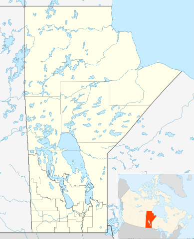
Quadratische Plattkarte, N-S-Streckung 170 %. Geographische Begrenzung der Karte:
Equirectangular projection, N/S stretching 170 %. Geographic limits of the map:
|
| ದಿನಾಂಕ | |
| ಆಕರ | ಸ್ವಂತ ಕೆಲಸ, File:Canada_Manitoba_location_map.svg by NordNordWest |
| ಕರ್ತೃ | Hanhil 17:29, 24 September 2009 (UTC) |
| ಅನುಮತಿ (ಈ ಕಡತವನ್ನು ಮರುಬಳಕೆ ಮಾಡಲಾಗುತ್ತಿದೆ) |
I, the copyright holder of this work, hereby publish it under the following license: ಈ ಕಡತ ಕ್ರಿಯೇಟಿವ್ ಕಾಮನ್ಸ್ Attribution
-Share Alike 3.0 Unported ಪರವಾನಗಿ ಹೊಂದಿದೆ.
|
| SVG genesis |
ಕಡತದ ಇತಿಹಾಸ
ದಿನ/ಕಾಲ ಒತ್ತಿದರೆ ಆ ಸಮಯದಲ್ಲಿ ಈ ಕಡತದ ವಸ್ತುಸ್ಥಿತಿ ತೋರುತ್ತದೆ.
| ದಿನ/ಕಾಲ | ಕಿರುನೋಟ | ಆಯಾಮಗಳು | ಬಳಕೆದಾರ | ಟಿಪ್ಪಣಿ | |
|---|---|---|---|---|---|
| ಪ್ರಸಕ್ತ | ೧೩:೦೧, ೩ ಫೆಬ್ರವರಿ ೨೦೧೯ | | ೧,೫೧೨ × ೧,೮೬೪ (೫೯೯ KB) | JoKalliauer | valid id-names |
| ೨೨:೫೯, ೨೪ ಸೆಪ್ಟೆಂಬರ್ ೨೦೦೯ |  | ೧,೫೧೨ × ೧,೮೬೪ (೯೦೬ KB) | Hanhil | {{Information |Description= {{de|Positionskarte von Manitoba, Kanada}} Quadratische Plattkarte, N-S-Streckung 170 %. Geographische Begrenzung der Karte: * N: 60.3° N * S: 48.7° N * W: 104.0° W * O: 88.0° W {{en|Location |
ಕಡತ ಬಳಕೆ
ಈ ಕೆಳಗಿನ 2 ಪುಟಗಳು ಈ ಚಿತ್ರಕ್ಕೆ ಸಂಪರ್ಕ ಹೊಂದಿವೆ:
ಜಾಗತಿಕ ಕಡತ ಉಪಯೋಗ
ಈ ಕಡತವನ್ನು ಕೆಳಗಿನ ಬೇರೆ ವಿಕಿಗಳೂ ಉಪಯೋಗಿಸುತ್ತಿವೆ:
- ar.wikipedia.org ಮೇಲೆ ಬಳಕೆ
- azb.wikipedia.org ಮೇಲೆ ಬಳಕೆ
- ba.wikipedia.org ಮೇಲೆ ಬಳಕೆ
- bg.wikipedia.org ಮೇಲೆ ಬಳಕೆ
- ca.wikipedia.org ಮೇಲೆ ಬಳಕೆ
- ceb.wikipedia.org ಮೇಲೆ ಬಳಕೆ
- en.wikipedia.org ಮೇಲೆ ಬಳಕೆ
- Gilbert Plains
- Neelin
- Cree
- The Pas
- Fort Garry
- Brandon, Manitoba
- Flin Flon
- Churchill, Manitoba
- Grunthal, Manitoba
- Lynn Lake
- International Peace Garden
- Birtle, Manitoba
- Portage la Prairie
- Dauphin, Manitoba
- Roblin, Manitoba
- Dominion City
- Manitou, Manitoba
- Forrest, Manitoba
- Thompson, Manitoba
- Steinbach, Manitoba
- Lower Fort Garry
- Deloraine, Manitoba
- Winnipegosis
- Sainte Rose du Lac
- Gunton, Manitoba
- Pisew Falls Provincial Park
- Hamiota, Manitoba
- CFB Shilo
- Winkler, Manitoba
- Boissevain, Manitoba
- Cranberry Portage
- Selkirk, Manitoba
- Morden, Manitoba
- Clearwater, Manitoba
- Souris, Manitoba
- Niverville, Manitoba
- Bakers Narrows
- Dugald, Manitoba
- Swan River, Manitoba
ಈ ಫೈಲ್ನ ಹೆಚ್ಚು ಜಾಗತಿಕ ಬಳಕೆಯನ್ನು ವೀಕ್ಷಿಸಿ.