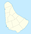
ಚಿತ್ರ:Barbados location map.svg
ಗೋಚರ

Size of this PNG preview of this SVG file: ೫೩೯ × ೫೯೯ ಪಿಕ್ಸೆಲ್ಗಳು. ಇತರ ರೆಸಲ್ಯೂಶನ್ಗಳು: ೨೧೬ × ೨೪೦ ಪಿಕ್ಸೆಲ್ಗಳು | ೪೩೨ × ೪೮೦ ಪಿಕ್ಸೆಲ್ಗಳು | ೬೯೧ × ೭೬೮ ಪಿಕ್ಸೆಲ್ಗಳು | ೯೨೧ × ೧,೦೨೪ ಪಿಕ್ಸೆಲ್ಗಳು | ೧,೮೪೩ × ೨,೦೪೮ ಪಿಕ್ಸೆಲ್ಗಳು | ೧,೨೦೫ × ೧,೩೩೯ ಪಿಕ್ಸೆಲ್ಗಳು.
ಮೂಲ ಕಡತ (SVG ಫೈಲು, ಸುಮಾರಾಗಿ ೧,೨೦೫ × ೧,೩೩೯ ಚಿತ್ರಬಿಂದುಗಳು, ಫೈಲಿನ ಗಾತ್ರ: ೧೨೫ KB)
ಕಡತದ ಇತಿಹಾಸ
ದಿನ/ಕಾಲ ಒತ್ತಿದರೆ ಆ ಸಮಯದಲ್ಲಿ ಈ ಕಡತದ ವಸ್ತುಸ್ಥಿತಿ ತೋರುತ್ತದೆ.
| ದಿನ/ಕಾಲ | ಕಿರುನೋಟ | ಆಯಾಮಗಳು | ಬಳಕೆದಾರ | ಟಿಪ್ಪಣಿ | |
|---|---|---|---|---|---|
| ಪ್ರಸಕ್ತ | ೧೯:೪೨, ೨೨ ನವೆಂಬರ್ ೨೦೦೯ |  | ೧,೨೦೫ × ೧,೩೩೯ (೧೨೫ KB) | Carport | {{Information |Description={{de|1=Positionskarte von {{w|Barbados|Barbados|de}}. Geographische Begrenzungen der Karte: * N: 13.349° N * S: 13,034° N * W: 59,690° W * E: 59,399° W}} {{en|1=Location map of {{w|Barbados}}. Geographic limits of the map: |
ಕಡತ ಬಳಕೆ
ಈ ಕೆಳಗಿನ ಪುಟವು ಈ ಚಿತ್ರಕ್ಕೆ ಸಂಪರ್ಕ ಹೊಂದಿದೆ:
ಜಾಗತಿಕ ಕಡತ ಉಪಯೋಗ
ಈ ಕಡತವನ್ನು ಕೆಳಗಿನ ಬೇರೆ ವಿಕಿಗಳೂ ಉಪಯೋಗಿಸುತ್ತಿವೆ:
- af.wikipedia.org ಮೇಲೆ ಬಳಕೆ
- als.wikipedia.org ಮೇಲೆ ಬಳಕೆ
- an.wikipedia.org ಮೇಲೆ ಬಳಕೆ
- ar.wikipedia.org ಮೇಲೆ ಬಳಕೆ
- ast.wikipedia.org ಮೇಲೆ ಬಳಕೆ
- az.wikipedia.org ಮೇಲೆ ಬಳಕೆ
- ba.wikipedia.org ಮೇಲೆ ಬಳಕೆ
- be.wikipedia.org ಮೇಲೆ ಬಳಕೆ
- bg.wikipedia.org ಮೇಲೆ ಬಳಕೆ
- bn.wikipedia.org ಮೇಲೆ ಬಳಕೆ
- bs.wikipedia.org ಮೇಲೆ ಬಳಕೆ
- ceb.wikipedia.org ಮೇಲೆ ಬಳಕೆ
- Plantilya:Location map Barbados
- South Point
- Saint Philip
- Saint John
- Saint George
- Pelican Island
- Pelican Islet
- Long Bay
- Crab Hill
- North Point
- Mount Misery
- Round Rock
- Green Point
- Indian River
- Bell Point
- Christchurch (pagklaro)
- Lambert Point
- Horse Hill
- Bridgetown
- Freshwater Bay
- Saint Andrews
- Greenland
- Cave Bay
ಈ ಫೈಲ್ನ ಹೆಚ್ಚು ಜಾಗತಿಕ ಬಳಕೆಯನ್ನು ವೀಕ್ಷಿಸಿ.
