
ಚಿತ್ರ:Australia Victoria Towong Shire location map.svg

Size of this PNG preview of this SVG file: ೫೩೪ × ೩೯೨ ಪಿಕ್ಸೆಲ್ಗಳು. ಇತರ ರೆಸಲ್ಯೂಶನ್ಗಳು: ೩೨೦ × ೨೩೫ ಪಿಕ್ಸೆಲ್ಗಳು | ೬೪೦ × ೪೭೦ ಪಿಕ್ಸೆಲ್ಗಳು | ೧,೦೨೪ × ೭೫೨ ಪಿಕ್ಸೆಲ್ಗಳು | ೧,೨೮೦ × ೯೪೦ ಪಿಕ್ಸೆಲ್ಗಳು | ೨,೫೬೦ × ೧,೮೭೯ ಪಿಕ್ಸೆಲ್ಗಳು.
ಮೂಲ ಕಡತ (SVG ಫೈಲು, ಸುಮಾರಾಗಿ ೫೩೪ × ೩೯೨ ಚಿತ್ರಬಿಂದುಗಳು, ಫೈಲಿನ ಗಾತ್ರ: ೭೧೪ KB)
ಈ ಫೈಲು ವಿಕಿಮೀಡಿಯ ಕಾಮನ್ಸ್ನಲ್ಲಿ ಇರುವುದು. ಅಲ್ಲಿನ ವಿವರಣೆ ಪುಟವನ್ನೇ ಕೆಳಗೆ ತೋರಿಸಲಾಗಿದೆ. ಕಾಮನ್ಸ್ ಕೃತಿಸ್ವಾಮ್ಯತೆಯಿಂದ ಮುಕ್ತ ಫೈಲುಗಳ ಒಂದು ಆಗರ. ಅಲ್ಲಿ ನೀವೂ ಸಹಕರಿಸಬಹುದು. |
| ವಿವರ |
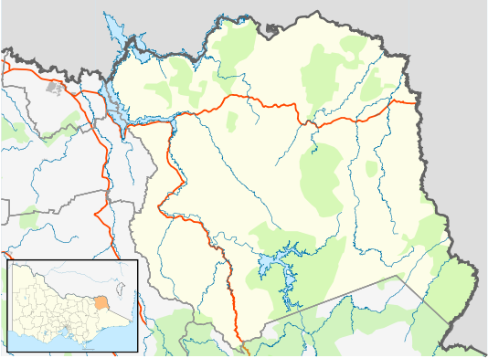
English: Blank map of w:Towong Shire, Victoria, Australia, with the following information shown:
Geographic limits:
|
||
| ಆಕರ | ಸ್ವಂತ ಕೆಲಸ + VicMap Lite | ||
| ಕರ್ತೃ | Cassowary |

ಕಡತದ ಇತಿಹಾಸ
ದಿನ/ಕಾಲ ಒತ್ತಿದರೆ ಆ ಸಮಯದಲ್ಲಿ ಈ ಕಡತದ ವಸ್ತುಸ್ಥಿತಿ ತೋರುತ್ತದೆ.
| ದಿನ/ಕಾಲ | ಕಿರುನೋಟ | ಆಯಾಮಗಳು | ಬಳಕೆದಾರ | ಟಿಪ್ಪಣಿ | |
|---|---|---|---|---|---|
| ಪ್ರಸಕ್ತ | ೨೦:೦೦, ೧೮ ಫೆಬ್ರವರಿ ೨೦೧೧ | | ೫೩೪ × ೩೯೨ (೭೧೪ KB) | Cassowary | {{Information |Description ={{en|1=Blank map of w:Towong Shire, Victoria, Australia, with the following information shown: * LGA boundaries * Coastline, lakes and rivers * Highways and freeways * Urban areas * Parks Geographic limits: * North: 35. |
ಕಡತ ಬಳಕೆ
ಈ ಕೆಳಗಿನ ಪುಟವು ಈ ಚಿತ್ರಕ್ಕೆ ಸಂಪರ್ಕ ಹೊಂದಿದೆ:
ಜಾಗತಿಕ ಕಡತ ಉಪಯೋಗ
ಈ ಕಡತವನ್ನು ಕೆಳಗಿನ ಬೇರೆ ವಿಕಿಗಳೂ ಉಪಯೋಗಿಸುತ್ತಿವೆ:
- ar.wikipedia.org ಮೇಲೆ ಬಳಕೆ
- ceb.wikipedia.org ಮೇಲೆ ಬಳಕೆ
- en.wikipedia.org ಮೇಲೆ ಬಳಕೆ
- Tallangatta
- Corryong
- Shire of Towong
- Bellbridge, Victoria
- Mitta Mitta, Victoria
- Dartmouth, Victoria
- Tintaldra
- Walwa, Victoria
- Bethanga, Victoria
- Eskdale, Victoria
- Template:Towns in Towong Shire
- Cudgewa, Victoria
- Pine Mountain (Victoria)
- Towong, Victoria
- Granya
- Koetong
- Module:Location map/data/Australia Victoria Shire of Towong/doc
- Biggara
- Huon, Victoria
- Old Tallangatta
- Towong Upper
- Bullioh
- Berringama
- Module:Location map/data/Australia Victoria Shire of Towong
- User:Viatori/sandbox
- Shelley, Victoria
- Colac Colac, Victoria
- User:ThylacineHunter/LGA
- fa.wikipedia.org ಮೇಲೆ ಬಳಕೆ
- ja.wikipedia.org ಮೇಲೆ ಬಳಕೆ
- si.wikipedia.org ಮೇಲೆ ಬಳಕೆ
- tr.wikipedia.org ಮೇಲೆ ಬಳಕೆ
- uz.wikipedia.org ಮೇಲೆ ಬಳಕೆ
- war.wikipedia.org ಮೇಲೆ ಬಳಕೆ