
ಚಿತ್ರ:Australia Tasmania location map.svg

ಮೂಲ ಕಡತ (SVG ಫೈಲು, ಸುಮಾರಾಗಿ ೭೮೦ × ೯೫೭ ಚಿತ್ರಬಿಂದುಗಳು, ಫೈಲಿನ ಗಾತ್ರ: ೨೪೪ KB)
ಈ ಫೈಲು ವಿಕಿಮೀಡಿಯ ಕಾಮನ್ಸ್ನಲ್ಲಿ ಇರುವುದು. ಅಲ್ಲಿನ ವಿವರಣೆ ಪುಟವನ್ನೇ ಕೆಳಗೆ ತೋರಿಸಲಾಗಿದೆ. ಕಾಮನ್ಸ್ ಕೃತಿಸ್ವಾಮ್ಯತೆಯಿಂದ ಮುಕ್ತ ಫೈಲುಗಳ ಒಂದು ಆಗರ. ಅಲ್ಲಿ ನೀವೂ ಸಹಕರಿಸಬಹುದು. |
ಸಾರಾಂಶ
| ವಿವರ |
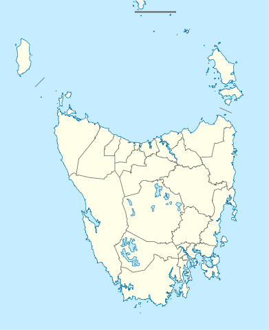
Quadratische Plattkarte, N-S-Streckung 135 %. Geographische Begrenzung der Karte:
Equirectangular projection, N/S stretching 135 %. Geographic limits of the map:
|
||
| ದಿನಾಂಕ | |||
| ಆಕರ |
ಸ್ವಂತ ಕೆಲಸ, using
|
||
| ಕರ್ತೃ | NordNordWest | ||
| ಅನುಮತಿ (ಈ ಕಡತವನ್ನು ಮರುಬಳಕೆ ಮಾಡಲಾಗುತ್ತಿದೆ) |
This file is licensed under the Creative Commons Attribution-Share Alike 3.0 Germany license.
 |
||
| SVG genesis | This map was created with unknown tool.
|


ಕಡತದ ಇತಿಹಾಸ
ದಿನ/ಕಾಲ ಒತ್ತಿದರೆ ಆ ಸಮಯದಲ್ಲಿ ಈ ಕಡತದ ವಸ್ತುಸ್ಥಿತಿ ತೋರುತ್ತದೆ.
| ದಿನ/ಕಾಲ | ಕಿರುನೋಟ | ಆಯಾಮಗಳು | ಬಳಕೆದಾರ | ಟಿಪ್ಪಣಿ | |
|---|---|---|---|---|---|
| ಪ್ರಸಕ್ತ | ೦೩:೩೮, ೫ ಏಪ್ರಿಲ್ ೨೦೧೦ | | ೭೮೦ × ೯೫೭ (೨೪೪ KB) | Chumwa | Reverted to version as of 16:36, 29 December 2009 |
| ೦೩:೨೨, ೫ ಏಪ್ರಿಲ್ ೨೦೧೦ |  | ೭೮೦ × ೯೫೭ (೧೯೦ KB) | Roke~commonswiki | local government low salience, dont appear on general use maps | |
| ೨೨:೦೬, ೨೯ ಡಿಸೆಂಬರ್ ೨೦೦೯ |  | ೭೮೦ × ೯೫೭ (೨೪೪ KB) | NordNordWest | ||
| ೨೧:೫೩, ೨೯ ಡಿಸೆಂಬರ್ ೨೦೦೯ |  | ೭೮೦ × ೯೫೭ (೨೪೪ KB) | NordNordWest | =={{int:filedesc}}== {{Information |Description= {{de|Positionskarte von Tasmanien, Australien}} Quadratische Plattkarte, N-S-Streckung 135 %. Geographische Begrenzung der Karte: * N: 39.0° S * S: 44.0° S * W: 143.5� |
ಕಡತ ಬಳಕೆ
ಈ ಕೆಳಗಿನ ಪುಟವು ಈ ಚಿತ್ರಕ್ಕೆ ಸಂಪರ್ಕ ಹೊಂದಿದೆ:
ಜಾಗತಿಕ ಕಡತ ಉಪಯೋಗ
ಈ ಕಡತವನ್ನು ಕೆಳಗಿನ ಬೇರೆ ವಿಕಿಗಳೂ ಉಪಯೋಗಿಸುತ್ತಿವೆ:
- af.wikipedia.org ಮೇಲೆ ಬಳಕೆ
- ar.wikipedia.org ಮೇಲೆ ಬಳಕೆ
- ast.wikipedia.org ಮೇಲೆ ಬಳಕೆ
- azb.wikipedia.org ಮೇಲೆ ಬಳಕೆ
- az.wikipedia.org ಮೇಲೆ ಬಳಕೆ
- ba.wikipedia.org ಮೇಲೆ ಬಳಕೆ
- be.wikipedia.org ಮೇಲೆ ಬಳಕೆ
- bg.wikipedia.org ಮೇಲೆ ಬಳಕೆ
- ceb.wikipedia.org ಮೇಲೆ ಬಳಕೆ
- ckb.wikipedia.org ಮೇಲೆ ಬಳಕೆ
- cs.wikipedia.org ಮೇಲೆ ಬಳಕೆ
- de.wikipedia.org ಮೇಲೆ ಬಳಕೆ
- Hobart
- Launceston (Tasmanien)
- George Town (Tasmanien)
- Port Arthur (Tasmanien)
- Freycinet-Nationalpark
- Mount-Field-Nationalpark
- Cradle-Mountain-Lake-St.-Clair-Nationalpark
- Ben-Lomond-Nationalpark
- Walls-of-Jerusalem-Nationalpark
- Westbury (Tasmanien)
- Devonport (Tasmanien)
- Strahan (Tasmanien)
- Latrobe (Tasmanien)
- Mount-William-Nationalpark
- Kent-Group-Nationalpark
- Vorlage:Positionskarte Australien Tasmanien
- Douglas-Apsley-Nationalpark
- Hartz-Mountains-Nationalpark
- Mole-Creek-Karst-Nationalpark
- Narawntapu-Nationalpark
- Rocky-Cape-Nationalpark
ಈ ಫೈಲ್ನ ಹೆಚ್ಚು ಜಾಗತಿಕ ಬಳಕೆಯನ್ನು ವೀಕ್ಷಿಸಿ.