
ಚಿತ್ರ:Australia Capital Territory location map.svg

Size of this PNG preview of this SVG file: ೪೧೪ × ೬೦೦ ಪಿಕ್ಸೆಲ್ಗಳು. ಇತರ ರೆಸಲ್ಯೂಶನ್ಗಳು: ೧೬೬ × ೨೪೦ ಪಿಕ್ಸೆಲ್ಗಳು | ೩೩೧ × ೪೮೦ ಪಿಕ್ಸೆಲ್ಗಳು | ೫೩೦ × ೭೬೮ ಪಿಕ್ಸೆಲ್ಗಳು | ೭೦೭ × ೧,೦೨೪ ಪಿಕ್ಸೆಲ್ಗಳು | ೧,೪೧೪ × ೨,೦೪೮ ಪಿಕ್ಸೆಲ್ಗಳು | ೪೭೭ × ೬೯೧ ಪಿಕ್ಸೆಲ್ಗಳು.
ಮೂಲ ಕಡತ (SVG ಫೈಲು, ಸುಮಾರಾಗಿ ೪೭೭ × ೬೯೧ ಚಿತ್ರಬಿಂದುಗಳು, ಫೈಲಿನ ಗಾತ್ರ: ೨೭೨ KB)
ಈ ಫೈಲು ವಿಕಿಮೀಡಿಯ ಕಾಮನ್ಸ್ನಲ್ಲಿ ಇರುವುದು. ಅಲ್ಲಿನ ವಿವರಣೆ ಪುಟವನ್ನೇ ಕೆಳಗೆ ತೋರಿಸಲಾಗಿದೆ. ಕಾಮನ್ಸ್ ಕೃತಿಸ್ವಾಮ್ಯತೆಯಿಂದ ಮುಕ್ತ ಫೈಲುಗಳ ಒಂದು ಆಗರ. ಅಲ್ಲಿ ನೀವೂ ಸಹಕರಿಸಬಹುದು. |
| ವಿವರ |
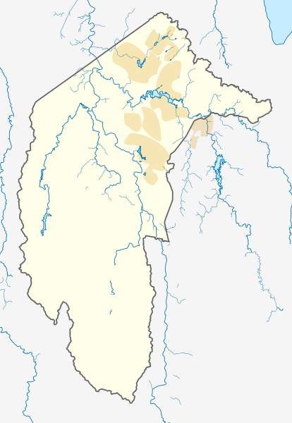
Deutsch: Positionskarte des Australian Capital Territory, Australien.
Mercator-Projektion. Geographische Begrenzungen der Karte:
English: Location map of the Australian Capital Territory, Australia.
Mercator projection. Geographic limits of the map:
|
|||
| ದಿನಾಂಕ |
Original Version: 2012-12-19 |
|||
| ಆಕರ | ಸ್ವಂತ ಕೆಲಸ, using OpenStreetMap data. Urban areas redrawn using OpenStreetMap data current at date above. | |||
| ಕರ್ತೃ |
Original Version: Carport |
|||
| ಅನುಮತಿ (ಈ ಕಡತವನ್ನು ಮರುಬಳಕೆ ಮಾಡಲಾಗುತ್ತಿದೆ) |
ಈ ಕಡತ ಕ್ರಿಯೇಟಿವ್ ಕಾಮನ್ಸ್ Attribution
-Share Alike 3.0 Unported ಪರವಾನಗಿ ಹೊಂದಿದೆ.
|
ಕಡತದ ಇತಿಹಾಸ
ದಿನ/ಕಾಲ ಒತ್ತಿದರೆ ಆ ಸಮಯದಲ್ಲಿ ಈ ಕಡತದ ವಸ್ತುಸ್ಥಿತಿ ತೋರುತ್ತದೆ.
| ದಿನ/ಕಾಲ | ಕಿರುನೋಟ | ಆಯಾಮಗಳು | ಬಳಕೆದಾರ | ಟಿಪ್ಪಣಿ | |
|---|---|---|---|---|---|
| ಪ್ರಸಕ್ತ | ೧೫:೦೯, ೨ ಜೂನ್ ೨೦೧೩ | | ೪೭೭ × ೬೯೧ (೨೭೨ KB) | Nbound | Back to more neutral colours |
| ೧೫:೦೧, ೨ ಜೂನ್ ೨೦೧೩ |  | ೪೭೭ × ೬೯೧ (೨೭೨ KB) | Nbound | Redraw urban areas | |
| ೦೨:೨೭, ೨೦ ಡಿಸೆಂಬರ್ ೨೦೧೨ |  | ೪೭೭ × ೬೯೧ (೨೭೪ KB) | Carport | {{Information |Description={{de|1=Positionskarte des {{w|Australian Capital Territory|3=de}}, {{w|Australien|3=de}}. Mercator-Projektion. Geographische Begrenzungen der Karte: * N: 35.1° S * S: 35.96° S * W: 148.72° O * O: 149.45° O }} [[Category... |
ಕಡತ ಬಳಕೆ
ಈ ಕೆಳಗಿನ ಪುಟವು ಈ ಚಿತ್ರಕ್ಕೆ ಸಂಪರ್ಕ ಹೊಂದಿದೆ:
ಜಾಗತಿಕ ಕಡತ ಉಪಯೋಗ
ಈ ಕಡತವನ್ನು ಕೆಳಗಿನ ಬೇರೆ ವಿಕಿಗಳೂ ಉಪಯೋಗಿಸುತ್ತಿವೆ:
- af.wikipedia.org ಮೇಲೆ ಬಳಕೆ
- bg.wikipedia.org ಮೇಲೆ ಬಳಕೆ
- bn.wikipedia.org ಮೇಲೆ ಬಳಕೆ
- ceb.wikipedia.org ಮೇಲೆ ಬಳಕೆ
- de.wikipedia.org ಮೇಲೆ ಬಳಕೆ
- Canberra
- Black Mountain Tower
- Flughafen Canberra
- Yarralumla
- Kaleen (Stadtteil)
- Mount Majura
- Mount Taylor (Australien)
- Mount Ainslie
- Black Mountain (Australian Capital Territory)
- Lake Burley Griffin
- Capital Hill
- Lake Ginninderra
- Lake Tuggeranong
- Canberra Stadium
- Mount Stromlo
- National Zoo and Aquarium
- Manuka Oval
- Giralang
- Vorlage:Infobox Stausee
- Vorlage:Infobox Stausee/Doku
- Wikipedia:Kartenwerkstatt/Positionskarten/Australien und Ozeanien
- Vorlage:Infobox Ort in Australien
- Vorlage:Infobox Ort in Australien/Doku
- Vorlage:Positionskarte Australien Capital Territory
- Benutzer:Rr2000/Vorlagentest Ort in Australien
- Bimberi Peak
- Mount Franklin (Australian Capital Territory)
- Strathnairn
- en.wikipedia.org ಮೇಲೆ ಬಳಕೆ
- Namadgi National Park
- Tidbinbilla Nature Reserve
- Fyshwick, Australian Capital Territory
- Mount Ainslie
- Lake Burley Griffin
- Molonglo River
- Acton, Australian Capital Territory
- Weston, Australian Capital Territory
- Civic, Australian Capital Territory
- Yarralumla, Australian Capital Territory
- Deakin, Australian Capital Territory
- Black Mountain (Australian Capital Territory)
- Campbell, Australian Capital Territory
- Reid, Australian Capital Territory
- Canberra Airport
- Braddon, Australian Capital Territory
ಈ ಫೈಲ್ನ ಹೆಚ್ಚು ಜಾಗತಿಕ ಬಳಕೆಯನ್ನು ವೀಕ್ಷಿಸಿ.