
ಚಿತ್ರ:Argentina Buenos Aires City location map.svg

Size of this PNG preview of this SVG file: ೫೮೯ × ೬೦೦ ಪಿಕ್ಸೆಲ್ಗಳು. ಇತರ ರೆಸಲ್ಯೂಶನ್ಗಳು: ೨೩೬ × ೨೪೦ ಪಿಕ್ಸೆಲ್ಗಳು | ೪೭೧ × ೪೮೦ ಪಿಕ್ಸೆಲ್ಗಳು | ೭೫೪ × ೭೬೮ ಪಿಕ್ಸೆಲ್ಗಳು | ೧,೦೦೬ × ೧,೦೨೪ ಪಿಕ್ಸೆಲ್ಗಳು | ೨,೦೧೧ × ೨,೦೪೮ ಪಿಕ್ಸೆಲ್ಗಳು | ೧,೧೫೨ × ೧,೧೭೩ ಪಿಕ್ಸೆಲ್ಗಳು.
ಮೂಲ ಕಡತ (SVG ಫೈಲು, ಸುಮಾರಾಗಿ ೧,೧೫೨ × ೧,೧೭೩ ಚಿತ್ರಬಿಂದುಗಳು, ಫೈಲಿನ ಗಾತ್ರ: ೫೪ KB)
ಈ ಫೈಲು ವಿಕಿಮೀಡಿಯ ಕಾಮನ್ಸ್ನಲ್ಲಿ ಇರುವುದು. ಅಲ್ಲಿನ ವಿವರಣೆ ಪುಟವನ್ನೇ ಕೆಳಗೆ ತೋರಿಸಲಾಗಿದೆ. ಕಾಮನ್ಸ್ ಕೃತಿಸ್ವಾಮ್ಯತೆಯಿಂದ ಮುಕ್ತ ಫೈಲುಗಳ ಒಂದು ಆಗರ. ಅಲ್ಲಿ ನೀವೂ ಸಹಕರಿಸಬಹುದು. |
ಸಾರಾಂಶ
| ವಿವರ |
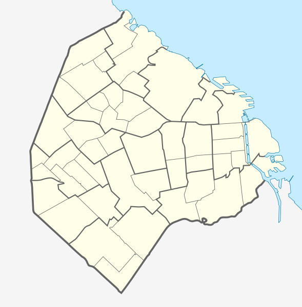
Quadratische Plattkarte. Geographische Begrenzung der Karte:
Equirectangular projection. Geographic limits of the map:
|
| ದಿನಾಂಕ | |
| ಆಕರ |
ಸ್ವಂತ ಕೆಲಸ using |
| ಕರ್ತೃ | NordNordWest and OpenStreetMap contributors |

|
This map has been made or improved in the German Kartenwerkstatt (Map Lab). You can propose maps to improve as well.
|
ಪರವಾನಗಿ
This file is licensed under the Creative Commons Attribution-Share Alike 2.0 Generic license.
- ನೀವು ಮುಕ್ತ:
- ಹಂಚಿಕೆಗೆ – ಕೆಲಸವನ್ನು ನಕಲು ಮಾಡಲು, ವಿತರಣೆ ಮತ್ತು ಸಾಗಿಸಲು
- ರೀಮಿಕ್ಸ್ ಮಾಡಲು – ಕೆಲಸವನ್ನು ಬಳಸಿಕೊಳ್ಳಲು
- ಈ ಕೆಳಗಿನ ಷರತ್ತುಗಳಲ್ಲಿ:
- ವೈಶಿಷ್ಟ್ಯ – ನೀವು ಸೂಕ್ತವಾದ ಕ್ರೆಡಿಟ್ ನೀಡಬೇಕು, ಪರವಾನಗಿಗೆ ಲಿಂಕ್ ಅನ್ನು ಒದಗಿಸಬೇಕು ಮತ್ತು ಯಾವುದೇ ಬದಲಾವಣೆಗಳನ್ನು ಮಾಡಿದ್ದರೆ ಸೂಚಿಸಬೇಕು. ನೀವು ಯಾವುದೇ ಸಮಂಜಸವಾದ ರೀತಿಯಲ್ಲಿ ಮಾಡಬಹುದು, ಆದರೆ ಪರವಾನಗಿದಾರರು ನಿಮ್ಮನ್ನು ಅಥವಾ ನಿಮ್ಮ ಯಾವುದೇ ಬಳಕೆಯನ್ನು ಅನುಮೋದಿಸಿದಂತೆ ರೀತಿಯಲ್ಲಿ ಉಪಯೋಗಿಸಬಾರದು.
- ಇರುವುದರಂತೆಯೇ ಹಂಚು – ನೀವು ರೀಮಿಕ್ಸ್ ಮಾಡಿದರೆ, ರೂಪಾಂತರಗೊಳಿಸಿದರೆ ಅಥವಾ ವಸ್ತುವಿನ ಮೇಲೆ ನಿರ್ಮಿಸಿದರೆ, ನಿಮ್ಮ ಕೊಡುಗೆಗಳನ್ನು ನೀವು ಮೂಲದಂತೆ ಅದೇ ಅಥವಾ ಹೊಂದಾಣಿಕೆಯ ಪರವಾನಗಿ ಅಡಿಯಲ್ಲಿ ವಿತರಿಸಬೇಕು.
ಕಡತದ ಇತಿಹಾಸ
ದಿನ/ಕಾಲ ಒತ್ತಿದರೆ ಆ ಸಮಯದಲ್ಲಿ ಈ ಕಡತದ ವಸ್ತುಸ್ಥಿತಿ ತೋರುತ್ತದೆ.
| ದಿನ/ಕಾಲ | ಕಿರುನೋಟ | ಆಯಾಮಗಳು | ಬಳಕೆದಾರ | ಟಿಪ್ಪಣಿ | |
|---|---|---|---|---|---|
| ಪ್ರಸಕ್ತ | ೧೭:೦೩, ೧೭ ಮಾರ್ಚ್ ೨೦೧೨ | | ೧,೧೫೨ × ೧,೧೭೩ (೫೪ KB) | NordNordWest | == {{int:filedesc}} == {{Information |Description= {{de|Positionskarte der Stadt Buenos Aires, Argentinien}} Quadratische Plattkarte. Geographische Begrenzung der Karte: * N: 34.5205861° S * S: 34.7143027° S *... |
ಕಡತ ಬಳಕೆ
ಈ ಕೆಳಗಿನ ಪುಟವು ಈ ಚಿತ್ರಕ್ಕೆ ಸಂಪರ್ಕ ಹೊಂದಿದೆ:
ಜಾಗತಿಕ ಕಡತ ಉಪಯೋಗ
ಈ ಕಡತವನ್ನು ಕೆಳಗಿನ ಬೇರೆ ವಿಕಿಗಳೂ ಉಪಯೋಗಿಸುತ್ತಿವೆ:
- ar.wikipedia.org ಮೇಲೆ ಬಳಕೆ
- ast.wikipedia.org ಮೇಲೆ ಬಳಕೆ
- ba.wikipedia.org ಮೇಲೆ ಬಳಕೆ
- bs.wikipedia.org ಮೇಲೆ ಬಳಕೆ
- ceb.wikipedia.org ಮೇಲೆ ಬಳಕೆ
- da.wikipedia.org ಮೇಲೆ ಬಳಕೆ
- de.wikipedia.org ಮೇಲೆ ಬಳಕೆ
- Estadio José Amalfitani
- La Bombonera
- Estadio Monumental Antonio Vespucio Liberti
- Estadio Islas Malvinas
- Estadio Arquitecto Ricardo Etcheverry
- República Cromañón
- Wikipedia:Kartenwerkstatt/Positionskarten/Südamerika
- Zoo Buenos Aires
- Bahnhof Buenos Aires Federico Lacroze
- Bahnhof Buenos Aires Plaza Constitución
- Historisches Nationalmuseum (Argentinien)
- Buenos Aires Lawn Tennis Club
- Estadio Pedro Bidegain
- Kavanagh-Gebäude
- Estadio Nueva España
- Estadio Tomás Adolfo Ducó
- Vorlage:Positionskarte Argentinien Stadt Buenos Aires
- SAFICO-Gebäude
- Puerto Nuevo (Buenos Aires)
- Torre Espacial
- Puente de la Mujer
- en.wikipedia.org ಮೇಲೆ ಬಳಕೆ
- 1978 FIFA World Cup
- Constitución railway station
- User:Onceler/Sandbox14
- Retiro railway station
- Once railway station
- Buenos Aires Belgrano Sur Line railway station
- Federico Lacroze railway station
- Module:Location map/data/Argentina Buenos Aires/doc
- Estrugamou Building
- 8N
- Hospital Muñiz
- Faena Arts Center
- Central Station (Buenos Aires)
- Casa Amarilla
- Del Parque railway station
- Retiro Belgrano railway station
- Retiro Mitre railway station
- Retiro San Martín railway station
- Module:Location map/data/Argentina Buenos Aires
ಈ ಫೈಲ್ನ ಹೆಚ್ಚು ಜಾಗತಿಕ ಬಳಕೆಯನ್ನು ವೀಕ್ಷಿಸಿ.