
ಚಿತ್ರ:Arad Josephinische Landesaufnahme pg24-27.jpg

ಈ ಮುನ್ನೋಟ ಗಾತ್ರ:೮೦೦ × ೫೩೪ ಪಿಕ್ಸೆಲ್ಗಳು. ಇತರ ರೆಸಲ್ಯೂಶನ್ಗಳು: ೩೨೦ × ೨೧೪ ಪಿಕ್ಸೆಲ್ಗಳು | ೬೪೦ × ೪೨೭ ಪಿಕ್ಸೆಲ್ಗಳು | ೧,೦೨೪ × ೬೮೩ ಪಿಕ್ಸೆಲ್ಗಳು | ೧,೨೮೦ × ೮೫೪ ಪಿಕ್ಸೆಲ್ಗಳು | ೨,೫೬೦ × ೧,೭೦೯ ಪಿಕ್ಸೆಲ್ಗಳು | ೮,೫೭೦ × ೫,೭೨೦ ಪಿಕ್ಸೆಲ್ಗಳು.
ಮೂಲ ಕಡತ (೮,೫೭೦ × ೫,೭೨೦ ಚಿತ್ರಬಿಂದು, ಫೈಲಿನ ಗಾತ್ರ: ೨೭.೯೪ MB, MIME ಪ್ರಕಾರ: image/jpeg)
ಈ ಫೈಲು ವಿಕಿಮೀಡಿಯ ಕಾಮನ್ಸ್ನಲ್ಲಿ ಇರುವುದು. ಅಲ್ಲಿನ ವಿವರಣೆ ಪುಟವನ್ನೇ ಕೆಳಗೆ ತೋರಿಸಲಾಗಿದೆ. ಕಾಮನ್ಸ್ ಕೃತಿಸ್ವಾಮ್ಯತೆಯಿಂದ ಮುಕ್ತ ಫೈಲುಗಳ ಒಂದು ಆಗರ. ಅಲ್ಲಿ ನೀವೂ ಸಹಕರಿಸಬಹುದು. |
| Name shown on the map Nume din hartă |
Administrative unit Unitate administrativă |
Romanian name Numele românesc |
Hungarian name Numele unguresc |
German name Numele german |
Country today Ţara de astăzi |
|---|---|---|---|---|---|
| Bel Zerénd | Bihar Bihar vármegye Comitatul Bihor Komitat Bihar |
Zerindu Mic [Belzerind, Luntreni] | Bélzerénd, Bélzerind, Bélselénd, Kiszerind, Zerind | Romania | |
| Fekete Gyarmat | Arad Arad vármegye Comitatul Arad Komitat Arad |
Iermata Neagră | Feketegyarmat, Gyarmat | Romania | |
| Miske | Arad | Mişca | Tőzmiske, Miske | Romania | |
| Nagy Zerénd | Arad | Zerind [Zerindul Mare] | Nagyzerénd, Nagyzerind, Nagyselénd, Zerind | Romania | |
| Ond | Bihar | Ant | Ant | Romania | |
| Tamásda | Bihar | Tămaşda | Tamáshida, Tamásd | Romania |
ಸಾರಾಂಶ
| ವಿವರ |
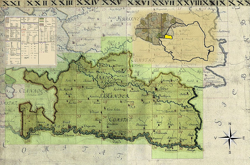
English: Kingdom of Hungary, 1782-85. Josephinische Landesaufnahme pg.24-27. Counties shown on the map: 1. Bihar County 2. Bekeser County 3. Arad County Română: Harta Iosefină a Regatului Ungariei, 1782-85. Josephinische Landesaufnahme pg.24-27. Comitate prezentate pe hartă: 1. Comitatul Bihor 2. Comitatul Bichiş 3. Comitatul Arad |
||||
| ದಿನಾಂಕ | ೧೭೮೨ - ೧೭೮೫ | ||||
| ಆಕರ | Österreichisches Staatsarchiv, Kriegsarchiv | ||||
| ಕರ್ತೃ | Historische Militärkarte der österreichisch-ungarischen Monarchie | ||||
| ಅನುಮತಿ (ಈ ಕಡತವನ್ನು ಮರುಬಳಕೆ ಮಾಡಲಾಗುತ್ತಿದೆ) |
|
||||
Clickable Map of the Arad County
ಕಡತದ ಇತಿಹಾಸ
ದಿನ/ಕಾಲ ಒತ್ತಿದರೆ ಆ ಸಮಯದಲ್ಲಿ ಈ ಕಡತದ ವಸ್ತುಸ್ಥಿತಿ ತೋರುತ್ತದೆ.
| ದಿನ/ಕಾಲ | ಕಿರುನೋಟ | ಆಯಾಮಗಳು | ಬಳಕೆದಾರ | ಟಿಪ್ಪಣಿ | |
|---|---|---|---|---|---|
| ಪ್ರಸಕ್ತ | ೧೨:೩೯, ೧ ಏಪ್ರಿಲ್ ೨೦೧೦ | | ೮,೫೭೦ × ೫,೭೨೦ (೨೭.೯೪ MB) | Asybaris01 | {{Information |Description={{ro|1=Arad Josephinische Landesaufnahme pg24-27}} |Source={{own}} |Author=Asybaris01 |Date=1782-1785 |Permission= |other_versions= }} Category:Josephinische Landaufnahme |
ಕಡತ ಬಳಕೆ
ಈ ಫೈಲನ್ನು ಬಳಸುವ ಯಾವ ಪುಟಗಳೂ ಇಲ್ಲ.
ಜಾಗತಿಕ ಕಡತ ಉಪಯೋಗ
ಈ ಕಡತವನ್ನು ಕೆಳಗಿನ ಬೇರೆ ವಿಕಿಗಳೂ ಉಪಯೋಗಿಸುತ್ತಿವೆ:
- arz.wikipedia.org ಮೇಲೆ ಬಳಕೆ
- de.wikipedia.org ಮೇಲೆ ಬಳಕೆ
- hu.wikipedia.org ಮೇಲೆ ಬಳಕೆ
- ro.wikipedia.org ಮೇಲೆ ಬಳಕೆ
- tt.wikipedia.org ಮೇಲೆ ಬಳಕೆ
- www.wikidata.org ಮೇಲೆ ಬಳಕೆ