
ಚಿತ್ರ:Antarctica relief location map.jpg

ಈ ಮುನ್ನೋಟ ಗಾತ್ರ:೬೦೦ × ೬೦೦ ಪಿಕ್ಸೆಲ್ಗಳು. ಇತರ ರೆಸಲ್ಯೂಶನ್ಗಳು: ೨೪೦ × ೨೪೦ ಪಿಕ್ಸೆಲ್ಗಳು | ೪೮೦ × ೪೮೦ ಪಿಕ್ಸೆಲ್ಗಳು | ೭೬೮ × ೭೬೮ ಪಿಕ್ಸೆಲ್ಗಳು | ೧,೦೨೪ × ೧,೦೨೪ ಪಿಕ್ಸೆಲ್ಗಳು | ೧,೪೯೩ × ೧,೪೯೩ ಪಿಕ್ಸೆಲ್ಗಳು.
ಮೂಲ ಕಡತ (೧,೪೯೩ × ೧,೪೯೩ ಚಿತ್ರಬಿಂದು, ಫೈಲಿನ ಗಾತ್ರ: ೪೫೯ KB, MIME ಪ್ರಕಾರ: image/jpeg)
ಈ ಫೈಲು ವಿಕಿಮೀಡಿಯ ಕಾಮನ್ಸ್ನಲ್ಲಿ ಇರುವುದು. ಅಲ್ಲಿನ ವಿವರಣೆ ಪುಟವನ್ನೇ ಕೆಳಗೆ ತೋರಿಸಲಾಗಿದೆ. ಕಾಮನ್ಸ್ ಕೃತಿಸ್ವಾಮ್ಯತೆಯಿಂದ ಮುಕ್ತ ಫೈಲುಗಳ ಒಂದು ಆಗರ. ಅಲ್ಲಿ ನೀವೂ ಸಹಕರಿಸಬಹುದು. |
ಸಾರಾಂಶ
| ವಿವರ |
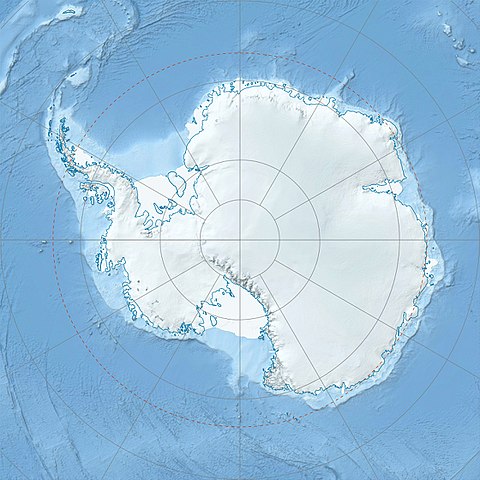
Deutsch: Physische Positionskarte Antarktis, Mittabstandstreue Azimutalprojektion
English: Physical Location map Antarctica, Azimuthal equidistant projection
|
| ದಿನಾಂಕ | |
| ಆಕರ |
ಸ್ವಂತ ಕೆಲಸ
|
| ಕರ್ತೃ | Alexrk2 |
| ಇತರೆ ಆವೃತ್ತಿಗಳು |
|

Derivative works


|
This map has been made or improved in the German Kartenwerkstatt (Map Lab). You can propose maps to improve as well.
|
ಪರವಾನಗಿ
I, the copyright holder of this work, hereby publish it under the following license:
ಈ ಕಡತ ಕ್ರಿಯೇಟಿವ್ ಕಾಮನ್ಸ್ Attribution
-Share Alike 3.0 Unported ಪರವಾನಗಿ ಹೊಂದಿದೆ.
- ನೀವು ಮುಕ್ತ:
- ಹಂಚಿಕೆಗೆ – ಕೆಲಸವನ್ನು ನಕಲು ಮಾಡಲು, ವಿತರಣೆ ಮತ್ತು ಸಾಗಿಸಲು
- ರೀಮಿಕ್ಸ್ ಮಾಡಲು – ಕೆಲಸವನ್ನು ಬಳಸಿಕೊಳ್ಳಲು
- ಈ ಕೆಳಗಿನ ಷರತ್ತುಗಳಲ್ಲಿ:
- ವೈಶಿಷ್ಟ್ಯ – ನೀವು ಸೂಕ್ತವಾದ ಕ್ರೆಡಿಟ್ ನೀಡಬೇಕು, ಪರವಾನಗಿಗೆ ಲಿಂಕ್ ಅನ್ನು ಒದಗಿಸಬೇಕು ಮತ್ತು ಯಾವುದೇ ಬದಲಾವಣೆಗಳನ್ನು ಮಾಡಿದ್ದರೆ ಸೂಚಿಸಬೇಕು. ನೀವು ಯಾವುದೇ ಸಮಂಜಸವಾದ ರೀತಿಯಲ್ಲಿ ಮಾಡಬಹುದು, ಆದರೆ ಪರವಾನಗಿದಾರರು ನಿಮ್ಮನ್ನು ಅಥವಾ ನಿಮ್ಮ ಯಾವುದೇ ಬಳಕೆಯನ್ನು ಅನುಮೋದಿಸಿದಂತೆ ರೀತಿಯಲ್ಲಿ ಉಪಯೋಗಿಸಬಾರದು.
- ಇರುವುದರಂತೆಯೇ ಹಂಚು – ನೀವು ರೀಮಿಕ್ಸ್ ಮಾಡಿದರೆ, ರೂಪಾಂತರಗೊಳಿಸಿದರೆ ಅಥವಾ ವಸ್ತುವಿನ ಮೇಲೆ ನಿರ್ಮಿಸಿದರೆ, ನಿಮ್ಮ ಕೊಡುಗೆಗಳನ್ನು ನೀವು ಮೂಲದಂತೆ ಅದೇ ಅಥವಾ ಹೊಂದಾಣಿಕೆಯ ಪರವಾನಗಿ ಅಡಿಯಲ್ಲಿ ವಿತರಿಸಬೇಕು.
ಕಡತದ ಇತಿಹಾಸ
ದಿನ/ಕಾಲ ಒತ್ತಿದರೆ ಆ ಸಮಯದಲ್ಲಿ ಈ ಕಡತದ ವಸ್ತುಸ್ಥಿತಿ ತೋರುತ್ತದೆ.
| ದಿನ/ಕಾಲ | ಕಿರುನೋಟ | ಆಯಾಮಗಳು | ಬಳಕೆದಾರ | ಟಿಪ್ಪಣಿ | |
|---|---|---|---|---|---|
| ಪ್ರಸಕ್ತ | ೧೩:೨೨, ೨೬ ಜುಲೈ ೨೦೧೭ | | ೧,೪೯೩ × ೧,೪೯೩ (೪೫೯ KB) | Amga | Reverted to version as of 16:03, 3 May 2011 (UTC). This is used in location maps, so don't rotate it! |
| ೦೫:೩೦, ೨೬ ಜುಲೈ ೨೦೧೭ |  | ೧,೪೮೮ × ೧,೪೯೩ (೪೫೮ KB) | SteinsplitterBot | Bot: Image rotated by 90° | |
| ೨೧:೩೩, ೩ ಮೇ ೨೦೧೧ |  | ೧,೪೯೩ × ೧,೪೯೩ (೪೫೯ KB) | Alexrk2 | light blue hypso colors | |
| ೦೨:೫೪, ೨೨ ಫೆಬ್ರವರಿ ೨೦೧೦ |  | ೧,೫೦೦ × ೧,೫೦೦ (೮೧೮ KB) | Alexrk2 | == Summary == {{Information |Description= {{de|Physische Positionskarte Antarktis, Mittabstandstreue Azimutalprojektion}} {{en|Physical Location map Antarctica, Azimuthal equidistant projection}} * Longitude of central |
ಕಡತ ಬಳಕೆ
ಈ ಫೈಲನ್ನು ಬಳಸುವ ಯಾವ ಪುಟಗಳೂ ಇಲ್ಲ.
ಜಾಗತಿಕ ಕಡತ ಉಪಯೋಗ
ಈ ಕಡತವನ್ನು ಕೆಳಗಿನ ಬೇರೆ ವಿಕಿಗಳೂ ಉಪಯೋಗಿಸುತ್ತಿವೆ:
- af.wikipedia.org ಮೇಲೆ ಬಳಕೆ
- ar.wikipedia.org ಮೇಲೆ ಬಳಕೆ
- arz.wikipedia.org ಮೇಲೆ ಬಳಕೆ
- ast.wikipedia.org ಮೇಲೆ ಬಳಕೆ
- az.wikipedia.org ಮೇಲೆ ಬಳಕೆ
- Şablon:Yer xəritəsi Antarktida
- Antarktik yarımadası
- Şablon:Yer xəritəsi Antarktida (fiziki)
- Antarktik boğazı
- Jerlaş boğazı
- Bransfild boğazı
- Lemeir boğazı
- Vostok gölü
- Friksel gölü
- Mak-Medro boğazı
- Veddell dənizi
- Birlik dənizi
- Riser-Larsen dənizi
- Kosmonavtlar dənizi
- Mouson dənizi
- Dürvil dənizi
- Somov dənizi
- Kral VII Haakon dənizi
- Deyvis dənizi
- Lazarev dənizi
- Bellinshauzen dənizi
- Amundsen dənizi
- Ross dənizi
- Skotia dənizi
- Mouson yarımadası
- Hat Point yarımadası
- I Aleksandr Torpağı
- Berkner
- Ross adası
- Erebus vulkanı
- Saypl
- Terston
- Karney
- Ruzvelt adası (Antarktida)
- Sifre burnu
- Cənubi Şetland adaları
- Cənubi Orkney adaları
- Koroneyşen
ಈ ಫೈಲ್ನ ಹೆಚ್ಚು ಜಾಗತಿಕ ಬಳಕೆಯನ್ನು ವೀಕ್ಷಿಸಿ.