
ಚಿತ್ರ:Anguilla location map.svg

Size of this PNG preview of this SVG file: ೬೬೪ × ೫೯೯ ಪಿಕ್ಸೆಲ್ಗಳು. ಇತರ ರೆಸಲ್ಯೂಶನ್ಗಳು: ೨೬೬ × ೨೪೦ ಪಿಕ್ಸೆಲ್ಗಳು | ೫೩೨ × ೪೮೦ ಪಿಕ್ಸೆಲ್ಗಳು | ೮೫೧ × ೭೬೮ ಪಿಕ್ಸೆಲ್ಗಳು | ೧,೧೩೪ × ೧,೦೨೪ ಪಿಕ್ಸೆಲ್ಗಳು | ೨,೨೬೯ × ೨,೦೪೮ ಪಿಕ್ಸೆಲ್ಗಳು | ೧,೭೭೭ × ೧,೬೦೪ ಪಿಕ್ಸೆಲ್ಗಳು.
ಮೂಲ ಕಡತ (SVG ಫೈಲು, ಸುಮಾರಾಗಿ ೧,೭೭೭ × ೧,೬೦೪ ಚಿತ್ರಬಿಂದುಗಳು, ಫೈಲಿನ ಗಾತ್ರ: ೫೬ KB)
ಈ ಫೈಲು ವಿಕಿಮೀಡಿಯ ಕಾಮನ್ಸ್ನಲ್ಲಿ ಇರುವುದು. ಅಲ್ಲಿನ ವಿವರಣೆ ಪುಟವನ್ನೇ ಕೆಳಗೆ ತೋರಿಸಲಾಗಿದೆ. ಕಾಮನ್ಸ್ ಕೃತಿಸ್ವಾಮ್ಯತೆಯಿಂದ ಮುಕ್ತ ಫೈಲುಗಳ ಒಂದು ಆಗರ. ಅಲ್ಲಿ ನೀವೂ ಸಹಕರಿಸಬಹುದು. |
ಸಾರಾಂಶ
| ವಿವರ |
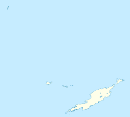
Deutsch: Positionskarte von Anguilla
Geographische Begrenzung der Karte:
English: Location map of Anguilla
Geographic limits of the map:
|
||||||||||||
| ದಿನಾಂಕ | |||||||||||||
| ಆಕರ | ಸ್ವಂತ ಕೆಲಸ | ||||||||||||
| ಕರ್ತೃ | NordNordWest | ||||||||||||
| ಅನುಮತಿ (ಈ ಕಡತವನ್ನು ಮರುಬಳಕೆ ಮಾಡಲಾಗುತ್ತಿದೆ) |
|
||||||||||||
| ಇತರೆ ಆವೃತ್ತಿಗಳು | Derivative works of this file: Anguilla islands.svg |

|
This map has been made or improved in the German Kartenwerkstatt (Map Lab). You can propose maps to improve as well.
|
ಕಡತದ ಇತಿಹಾಸ
ದಿನ/ಕಾಲ ಒತ್ತಿದರೆ ಆ ಸಮಯದಲ್ಲಿ ಈ ಕಡತದ ವಸ್ತುಸ್ಥಿತಿ ತೋರುತ್ತದೆ.
| ದಿನ/ಕಾಲ | ಕಿರುನೋಟ | ಆಯಾಮಗಳು | ಬಳಕೆದಾರ | ಟಿಪ್ಪಣಿ | |
|---|---|---|---|---|---|
| ಪ್ರಸಕ್ತ | ೦೦:೦೪, ೪ ಮೇ ೨೦೧೦ | | ೧,೭೭೭ × ೧,೬೦೪ (೫೬ KB) | NordNordWest | == {{int:filedesc}} == {{Information |Description= {{de|Positionskarte von Anguilla}} Geographische Begrenzung der Karte: * N: 18.62° N * S: 18.14° N * W: 63.46° W * O: 62.90° W {{en|Location map of Anguilla}} Geograp |
ಕಡತ ಬಳಕೆ
ಈ ಕೆಳಗಿನ ಪುಟವು ಈ ಚಿತ್ರಕ್ಕೆ ಸಂಪರ್ಕ ಹೊಂದಿದೆ:
ಜಾಗತಿಕ ಕಡತ ಉಪಯೋಗ
ಈ ಕಡತವನ್ನು ಕೆಳಗಿನ ಬೇರೆ ವಿಕಿಗಳೂ ಉಪಯೋಗಿಸುತ್ತಿವೆ:
- af.wikipedia.org ಮೇಲೆ ಬಳಕೆ
- an.wikipedia.org ಮೇಲೆ ಬಳಕೆ
- ar.wikipedia.org ಮೇಲೆ ಬಳಕೆ
- ast.wikipedia.org ಮೇಲೆ ಬಳಕೆ
- ba.wikipedia.org ಮೇಲೆ ಬಳಕೆ
- be.wikipedia.org ಮೇಲೆ ಬಳಕೆ
- bg.wikipedia.org ಮೇಲೆ ಬಳಕೆ
- bs.wikipedia.org ಮೇಲೆ ಬಳಕೆ
- ceb.wikipedia.org ಮೇಲೆ ಬಳಕೆ
- Anguilla
- Gumagamit:Lsj/Test
- Plantilya:Location map United Kingdom Anguilla
- Sandy Island
- Long Bay
- Great Bay
- Shoal Bay
- West Point
- West Cay
- Sandy Point
- Long Rock
- Little Island
- Blowing Rock
- Windward Point
- Warner Point
- The Valley
- Valley
- Stoney Bay
- Spring Bay
- Sombrero (pagklaro)
- Hat Island
- Sombrero Island
- Snake Point
- Lovers Point
- Seal Rocks
- Seal Island
- Seal Islets
- Seal Islands
- Scrub Island
- Scrub Islet
- Savannah Bay
- Sand Island
- Sandy Hill Bay
- Road Point
- Road Bay
- North Side
ಈ ಫೈಲ್ನ ಹೆಚ್ಚು ಜಾಗತಿಕ ಬಳಕೆಯನ್ನು ವೀಕ್ಷಿಸಿ.