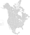
ಚಿತ್ರ:North America second level political division 2.svg

Page contents not supported in other languages.
ವಿಕಿಪೀಡಿಯದಿಂದ, ಇದು ಮುಕ್ತ ಹಾಗೂ ಸ್ವತಂತ್ರ ವಿಶ್ವಕೋಶ

ಮೂಲ ಕಡತ(SVG ಫೈಲು, ಸುಮಾರಾಗಿ ೫೧೨ × ೫೯೬ ಚಿತ್ರಬಿಂದುಗಳು, ಫೈಲಿನ ಗಾತ್ರ: ೧೩೨ KB)

ಸಾರಾಂಶ

ವಿವರ
English: Map of North America and its second-level political divisions. Canadian provinces, US and Mexican states. Canada, Mexico, United States.

Non-contiguous parts of a states/provinces are "grouped" together with the main area of the state/provinces, so any state/provinces can be coloured in completion with one click anywhere on the state/provinces's area.

Also, all states/provinces have a "id" attached to them, making them easy to find. Select "find" and then enter in the state/provinces's ISO 3166-2 code in the "id" field to find it. The codes can be found here (Canada), here (USA) and here (Mexico).
ದಿನಾಂಕ
ಆಕರ

Canada and US map: BlankMap-USA-states-Canada-provinces, HI closer.svg by Lokal_Profil.
Mexico map: Mexico template.svg by Mario Fuente Cid
Combined by Alex Covarrubias.

 
The SVG code is valid.
 
This vector image was created with Inkscape, and then manually edited
.
 
W3C-validity not checked.
ಕರ್ತೃ Alex Covarrubias
ಅನುಮತಿ
(ಈ ಕಡತವನ್ನು ಮರುಬಳಕೆ ಮಾಡಲಾಗುತ್ತಿದೆ)
w:en:Creative Commons
ವೈಶಿಷ್ಟ್ಯ ಇರುವುದರಂತೆಯೇ ಹಂಚು
This file is licensed under the Creative Commons Attribution-Share Alike 2.5 Generic license.
ನೀವು ಮುಕ್ತ:
  • ಹಂಚಿಕೆಗೆ – ಕೆಲಸವನ್ನು ನಕಲು ಮಾಡಲು, ವಿತರಣೆ ಮತ್ತು ಸಾಗಿಸಲು
  • ರೀಮಿಕ್ಸ್ ಮಾಡಲು – ಕೆಲಸವನ್ನು ಬಳಸಿಕೊಳ್ಳಲು
ಈ ಕೆಳಗಿನ ಷರತ್ತುಗಳಲ್ಲಿ:
  • ವೈಶಿಷ್ಟ್ಯ – ನೀವು ಸೂಕ್ತವಾದ ಕ್ರೆಡಿಟ್ ನೀಡಬೇಕು, ಪರವಾನಗಿಗೆ ಲಿಂಕ್ ಅನ್ನು ಒದಗಿಸಬೇಕು ಮತ್ತು ಯಾವುದೇ ಬದಲಾವಣೆಗಳನ್ನು ಮಾಡಿದ್ದರೆ ಸೂಚಿಸಬೇಕು. ನೀವು ಯಾವುದೇ ಸಮಂಜಸವಾದ ರೀತಿಯಲ್ಲಿ ಮಾಡಬಹುದು, ಆದರೆ ಪರವಾನಗಿದಾರರು ನಿಮ್ಮನ್ನು ಅಥವಾ ನಿಮ್ಮ ಯಾವುದೇ ಬಳಕೆಯನ್ನು ಅನುಮೋದಿಸಿದಂತೆ ರೀತಿಯಲ್ಲಿ ಉಪಯೋಗಿಸಬಾರದು.
  • ಇರುವುದರಂತೆಯೇ ಹಂಚು – ನೀವು ರೀಮಿಕ್ಸ್ ಮಾಡಿದರೆ, ರೂಪಾಂತರಗೊಳಿಸಿದರೆ ಅಥವಾ ವಸ್ತುವಿನ ಮೇಲೆ ನಿರ್ಮಿಸಿದರೆ, ನಿಮ್ಮ ಕೊಡುಗೆಗಳನ್ನು ನೀವು ಮೂಲದಂತೆ ಅದೇ ಅಥವಾ ಹೊಂದಾಣಿಕೆಯ ಪರವಾನಗಿ ಅಡಿಯಲ್ಲಿ ವಿತರಿಸಬೇಕು.
ಇತರೆ ಆವೃತ್ತಿಗಳು

Derivative works of this file:

Captions

Add a one-line explanation of what this file represents

Items portrayed in this file

depicts ಇಂಗ್ಲಿಷ್

copyright status ಇಂಗ್ಲಿಷ್

copyrighted ಇಂಗ್ಲಿಷ್

೭ ಅಕ್ಟೋಬರ್ 2007

ಕಡತದ ಇತಿಹಾಸ

ದಿನ/ಕಾಲ ಒತ್ತಿದರೆ ಆ ಸಮಯದಲ್ಲಿ ಈ ಕಡತದ ವಸ್ತುಸ್ಥಿತಿ ತೋರುತ್ತದೆ.

ದಿನ/ಕಾಲಕಿರುನೋಟಆಯಾಮಗಳುಬಳಕೆದಾರಟಿಪ್ಪಣಿ
ಪ್ರಸಕ್ತ೦೭:೨೧, ೨೩ ನವೆಂಬರ್ ೨೦೨೦೦೭:೨೧, ೨೩ ನವೆಂಬರ್ ೨೦೨೦ ವರೆಗಿನ ಆವೃತ್ತಿಯ ಕಿರುನೋಟ೫೧೨ × ೫೯೬ (೧೩೨ KB)Ponderosapine210Added the prominent islands of Manitoulin (Ontario) and Isle Royale (Michigan) to the Great Lakes.
೦೪:೩೭, ೨ ಜೂನ್ ೨೦೧೯೦೪:೩೭, ೨ ಜೂನ್ ೨೦೧೯ ವರೆಗಿನ ಆವೃತ್ತಿಯ ಕಿರುನೋಟ೫೧೨ × ೫೯೬ (೧೩೦ KB)Fluffy89502added territories, made DC visible, adjusted mexican borders
೧೭:೫೩, ೪ ಏಪ್ರಿಲ್ ೨೦೧೪೧೭:೫೩, ೪ ಏಪ್ರಿಲ್ ೨೦೧೪ ವರೆಗಿನ ಆವೃತ್ತಿಯ ಕಿರುನೋಟ೧,೭೧೨ × ೧,೯೯೨ (೨೭೦ KB)Lommesmade the borders between the mexican subdivisions the same size as their canadian / us counterparts.
೦೪:೫೩, ೯ ಡಿಸೆಂಬರ್ ೨೦೦೭೦೪:೫೩, ೯ ಡಿಸೆಂಬರ್ ೨೦೦೭ ವರೆಗಿನ ಆವೃತ್ತಿಯ ಕಿರುನೋಟ೧,೭೧೨ × ೧,೯೯೨ (೩೨೭ KB)Lokal ProfilCode cleanup
೧೩:೨೫, ೭ ಅಕ್ಟೋಬರ್ ೨೦೦೭೧೩:೨೫, ೭ ಅಕ್ಟೋಬರ್ ೨೦೦೭ ವರೆಗಿನ ಆವೃತ್ತಿಯ ಕಿರುನೋಟ೧,೭೧೨ × ೧,೯೯೨ (೩೪೨ KB)AlexCovarrubias== Summary == {{Information |Description=Map of North America and its second-level political divisions. Canadian provinces, US and Mexican states. Canada, Mexico, United States. |Source=Canada and US map by Alan Rockefeller. Mexico map by Alex Covarrubias

ಈ ಫೈಲನ್ನು ಬಳಸುವ ಯಾವ ಪುಟಗಳೂ ಇಲ್ಲ.

ಜಾಗತಿಕ ಕಡತ ಉಪಯೋಗ

ಈ ಕಡತವನ್ನು ಕೆಳಗಿನ ಬೇರೆ ವಿಕಿಗಳೂ ಉಪಯೋಗಿಸುತ್ತಿವೆ:

ಮೇಲ್ದರ್ಜೆ ಮಾಹಿತಿ