
ಚಿತ್ರ:India Kerala location map.svg

ಮೂಲ ಕಡತ (SVG ಫೈಲು, ಸುಮಾರಾಗಿ ೮೭೪ × ೧,೨೭೪ ಚಿತ್ರಬಿಂದುಗಳು, ಫೈಲಿನ ಗಾತ್ರ: ೩೫೦ KB)
ಈ ಫೈಲು ವಿಕಿಮೀಡಿಯ ಕಾಮನ್ಸ್ನಲ್ಲಿ ಇರುವುದು. ಅಲ್ಲಿನ ವಿವರಣೆ ಪುಟವನ್ನೇ ಕೆಳಗೆ ತೋರಿಸಲಾಗಿದೆ. ಕಾಮನ್ಸ್ ಕೃತಿಸ್ವಾಮ್ಯತೆಯಿಂದ ಮುಕ್ತ ಫೈಲುಗಳ ಒಂದು ಆಗರ. ಅಲ್ಲಿ ನೀವೂ ಸಹಕರಿಸಬಹುದು. |
ಸಾರಾಂಶ
| ವಿವರ |
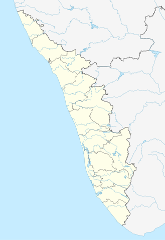
Quadratische Plattkarte, N-S-Streckung 102 %. Geographische Begrenzung der Karte:
Equirectangular projection, N/S stretching 102 %. Geographic limits of the map:
|
|
| ದಿನಾಂಕ | ||
| ಆಕರ |
ಸ್ವಂತ ಕೆಲಸ, using
|
|
| ಕರ್ತೃ | NordNordWest | |
| ಅನುಮತಿ (ಈ ಕಡತವನ್ನು ಮರುಬಳಕೆ ಮಾಡಲಾಗುತ್ತಿದೆ) |
This file is licensed under the Creative Commons Attribution-Share Alike 3.0 Germany license.
 ಈ ಕಡತ ಕ್ರಿಯೇಟಿವ್ ಕಾಮನ್ಸ್ Attribution
-Share Alike 3.0 Unported ಪರವಾನಗಿ ಹೊಂದಿದೆ.
|


|
This map has been made or improved in the German Kartenwerkstatt (Map Lab). You can propose maps to improve as well.
|
ಕಡತದ ಇತಿಹಾಸ
ದಿನ/ಕಾಲ ಒತ್ತಿದರೆ ಆ ಸಮಯದಲ್ಲಿ ಈ ಕಡತದ ವಸ್ತುಸ್ಥಿತಿ ತೋರುತ್ತದೆ.
| ದಿನ/ಕಾಲ | ಕಿರುನೋಟ | ಆಯಾಮಗಳು | ಬಳಕೆದಾರ | ಟಿಪ್ಪಣಿ | |
|---|---|---|---|---|---|
| ಪ್ರಸಕ್ತ | ೨೧:೪೩, ೧೦ ಜೂನ್ ೨೦೨೩ | | ೮೭೪ × ೧,೨೭೪ (೩೫೦ KB) | C1MM | c boundaries |
| ೨೧:೩೪, ೧೦ ಜೂನ್ ೨೦೨೩ |  | ೮೭೪ × ೧,೨೭೪ (೩೫೧ KB) | C1MM | c bounds | |
| ೨೦:೧೧, ೨೨ ಆಗಸ್ಟ್ ೨೦೨೧ |  | ೭೭೫ × ೧,೧೨೯ (೩೯೪ KB) | C1MM | Corrected rivers and dist boundaries | |
| ೨೩:೪೭, ೪ ಮೇ ೨೦೧೨ |  | ೮೨೭ × ೧,೨೦೫ (೧೩೫ KB) | NordNordWest | upd | |
| ೧೫:೦೦, ೧೧ ಮಾರ್ಚ್ ೨೦೧೧ |  | ೮೨೭ × ೧,೨೦೫ (೧೩೨ KB) | NordNordWest | =={{int:filedesc}}== {{Information |Description= {{de|Positionskarte von Kerala, Indien}} Quadratische Plattkarte, N-S-Streckung 102 %. Geographische Begrenzung der Karte: * N: 13.0° N * S: 8.0° N * W: 74.5° O * O: 78.0° |
ಕಡತ ಬಳಕೆ
ಈ ಕೆಳಗಿನ 34 ಪುಟಗಳು ಈ ಚಿತ್ರಕ್ಕೆ ಸಂಪರ್ಕ ಹೊಂದಿವೆ:
- ಅಟ್ಟಿಂಗಲ್
- ಎಡಪ್ಪಲ್ಲಿ
- ಕಝಕೂಟಂ
- ಕರುನಾಗಪಲ್ಲಿ
- ಕಾಞ್ಞಂಗಾಡು
- ಕಾಯಂಕುಲಂ
- ಕುಟ್ಟಿಪ್ಪುರಂ
- ಕೊಟ್ಟಕ್ಕಲ್
- ಕೊಡುಂಗಲ್ಲೂರು
- ಕೊಯಿಲಾಂಡಿ
- ಚತ್ತನ್ನೂರು
- ಚೇರ್ತಾಲ
- ತಲಸ್ಸೆರಿ
- ತವನೂರು
- ಧರ್ಮದಂ
- ನೆಯ್ಯಟ್ಟಿಂಕರ
- ಪಯ್ಯೋಳಿ
- ಪರಸ್ಸಲ
- ಪೂತನಾಥನಿ
- ಪೊನ್ನಾನಿ
- ಬಂದಡ್ಕ
- ಬಲರಾಮಪುರಂ
- ಬೇಕಲ ಕೋಟೆ
- ಮಲಯಾಟ್ಟೂರ್
- ಮಾಹೆ
- ಮುನ್ನಾರ್
- ರಾಮನಾಟ್ಟುಕರ
- ವಟಕರ
- ವದನಪಲ್ಲಿ
- ವಲಾಂಚೇರಿ
- ಹರಿಪಾಡ್
- ಟೆಂಪ್ಲೇಟು:Location map India Kerala
- ಮಾಡ್ಯೂಲ್:Location map/data/India Kerala
- ಮಾಡ್ಯೂಲ್:Location map/data/India Kerala/doc
ಜಾಗತಿಕ ಕಡತ ಉಪಯೋಗ
ಈ ಕಡತವನ್ನು ಕೆಳಗಿನ ಬೇರೆ ವಿಕಿಗಳೂ ಉಪಯೋಗಿಸುತ್ತಿವೆ:
- ar.wikipedia.org ಮೇಲೆ ಬಳಕೆ
- azb.wikipedia.org ಮೇಲೆ ಬಳಕೆ
- باتی چاتالور
- باتی پودوسری
- پیدیکاپارامبو
- پیداوور
- وایاتوپوژا
- وئیلور
- پرووانتانام
- پرووالور
- پرووا (هیندوستان)
- پرونا (هیندوستان)
- پرونیلام
- واوانور
- پرونقوژی
- وانیمال
- وانییامبالام
- ونیکود
- ونجینیسری
- ونقانور
- سارکارا-چیرایینکیژو
- سانتانپارا
- ماژووانور
- ماژوکیر
- کالکونتال
- کالیکاو
- ماترا (هیندوستان)
- ماتیلاکام
- ماتامبا
- کالایاپورام
- کالاتوکاداوو
- کالانجور
- ونقانلور
- ونقولا
- ماروتا, ایندیا
- کالامپالا
- ونقارا, مالاپورام دیستریکت
- ونکیتانقو
- کالاکتی
- واندیتاوالام
- واندانمدو
- واندانپاتال
- وانداماتوم
- وانداژی-یی
- وانداژی-ی
- ونجارامودو
- ونپاکال
- کاکور (هیندوستان)
- ماریاناد
- کاکولیسری
- کاکودی
ಈ ಫೈಲ್ನ ಹೆಚ್ಚು ಜಾಗತಿಕ ಬಳಕೆಯನ್ನು ವೀಕ್ಷಿಸಿ.