
ಚಿತ್ರ:Argyll and Bute UK location map.svg

Size of this PNG preview of this SVG file: ೫೭೯ × ೬೦೦ ಪಿಕ್ಸೆಲ್ಗಳು. ಇತರ ರೆಸಲ್ಯೂಶನ್ಗಳು: ೨೩೨ × ೨೪೦ ಪಿಕ್ಸೆಲ್ಗಳು | ೪೬೩ × ೪೮೦ ಪಿಕ್ಸೆಲ್ಗಳು | ೭೪೧ × ೭೬೮ ಪಿಕ್ಸೆಲ್ಗಳು | ೯೮೮ × ೧,೦೨೪ ಪಿಕ್ಸೆಲ್ಗಳು | ೧,೯೭೭ × ೨,೦೪೮ ಪಿಕ್ಸೆಲ್ಗಳು | ೧,೩೩೬ × ೧,೩೮೪ ಪಿಕ್ಸೆಲ್ಗಳು.
ಮೂಲ ಕಡತ (SVG ಫೈಲು, ಸುಮಾರಾಗಿ ೧,೩೩೬ × ೧,೩೮೪ ಚಿತ್ರಬಿಂದುಗಳು, ಫೈಲಿನ ಗಾತ್ರ: ೩.೬೫ MB)
ಈ ಫೈಲು ವಿಕಿಮೀಡಿಯ ಕಾಮನ್ಸ್ನಲ್ಲಿ ಇರುವುದು. ಅಲ್ಲಿನ ವಿವರಣೆ ಪುಟವನ್ನೇ ಕೆಳಗೆ ತೋರಿಸಲಾಗಿದೆ. ಕಾಮನ್ಸ್ ಕೃತಿಸ್ವಾಮ್ಯತೆಯಿಂದ ಮುಕ್ತ ಫೈಲುಗಳ ಒಂದು ಆಗರ. ಅಲ್ಲಿ ನೀವೂ ಸಹಕರಿಸಬಹುದು. |
| ವಿವರ |
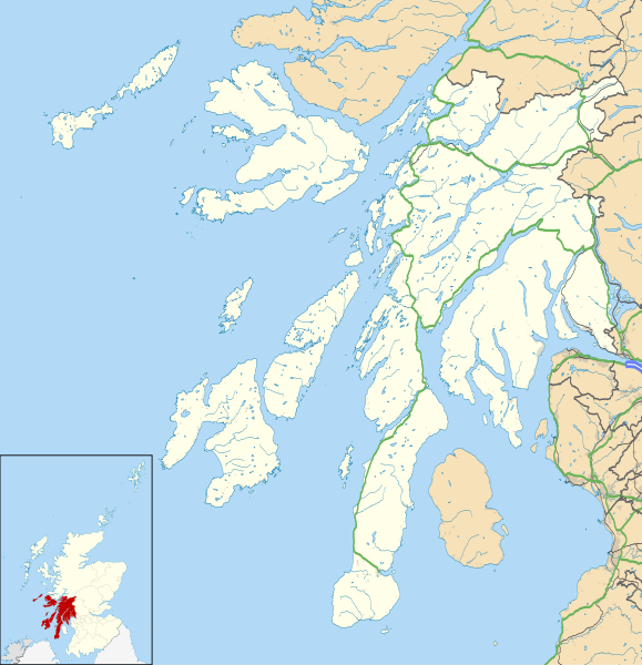
Blank map of Argyll and Bute, UK with the following information shown:
Equirectangular map projection on WGS 84 datum, with N/S stretched 175% Geographic limits:
|
| ದಿನಾಂಕ | |
| ಆಕರ |
|
| ಕರ್ತೃ | Nilfanion, created using Ordnance Survey data |
| ಅನುಮತಿ (ಈ ಕಡತವನ್ನು ಮರುಬಳಕೆ ಮಾಡಲಾಗುತ್ತಿದೆ) |
ಈ ಕಡತ ಕ್ರಿಯೇಟಿವ್ ಕಾಮನ್ಸ್ Attribution
-Share Alike 3.0 Unported ಪರವಾನಗಿ ಹೊಂದಿದೆ. ವೈಶಿಷ್ಟ್ಯ: Contains Ordnance Survey data © Crown copyright and database right
|
| ಇತರೆ ಆವೃತ್ತಿಗಳು | Argyll and Bute UK blank map.svg - Blank map |
| SVG genesis |
ಕಡತದ ಇತಿಹಾಸ
ದಿನ/ಕಾಲ ಒತ್ತಿದರೆ ಆ ಸಮಯದಲ್ಲಿ ಈ ಕಡತದ ವಸ್ತುಸ್ಥಿತಿ ತೋರುತ್ತದೆ.
| ದಿನ/ಕಾಲ | ಕಿರುನೋಟ | ಆಯಾಮಗಳು | ಬಳಕೆದಾರ | ಟಿಪ್ಪಣಿ | |
|---|---|---|---|---|---|
| ಪ್ರಸಕ್ತ | ೦೧:೩೩, ೨೭ ಸೆಪ್ಟೆಂಬರ್ ೨೦೧೦ | | ೧,೩೩೬ × ೧,೩೮೪ (೩.೬೫ MB) | Nilfanion | {{Information |Description=Blank map of Argyll and Bute, UK with the following information shown: *Administrative borders *Coastline, lakes and rivers *Roads and railways *Urban areas Equirectangular map projection on WGS 84 datum, |
ಕಡತ ಬಳಕೆ
ಈ ಕೆಳಗಿನ ಪುಟವು ಈ ಚಿತ್ರಕ್ಕೆ ಸಂಪರ್ಕ ಹೊಂದಿದೆ:
ಜಾಗತಿಕ ಕಡತ ಉಪಯೋಗ
ಈ ಕಡತವನ್ನು ಕೆಳಗಿನ ಬೇರೆ ವಿಕಿಗಳೂ ಉಪಯೋಗಿಸುತ್ತಿವೆ:
- ar.wikipedia.org ಮೇಲೆ ಬಳಕೆ
- ba.wikipedia.org ಮೇಲೆ ಬಳಕೆ
- bg.wikipedia.org ಮೇಲೆ ಬಳಕೆ
- ceb.wikipedia.org ಮೇಲೆ ಬಳಕೆ
- de.wikipedia.org ಮೇಲೆ ಬಳಕೆ
- en.wikipedia.org ಮೇಲೆ ಬಳಕೆ
- List of monastic houses in Scotland
- Argyll and Bute
- Dunoon
- RAF Machrihanish
- Campbeltown Airport
- Rothesay
- Tobermory, Mull
- Lochgilphead
- Mull of Kintyre
- Kilcreggan
- Port Ellen
- Lagavulin
- Ardrishaig
- Kilchurn Castle
- Duart Castle
- RNAS Machrihanish (HMS Landrail)
- Calgary, Mull
- Port Bannatyne
- Crinan, Argyll
- Carradale
- Kennacraig
- Peninver
- Saddell
- Islay Airport
- Bunessan
- Knockan
- Southend, Argyll
- Kintra
- Fionnphort
- Ardlui
- Bowmore
- Craighouse
ಈ ಫೈಲ್ನ ಹೆಚ್ಚು ಜಾಗತಿಕ ಬಳಕೆಯನ್ನು ವೀಕ್ಷಿಸಿ.