
ಚಿತ್ರ:India Uttar Pradesh location map.svg

ಮೂಲ ಕಡತ (SVG ಫೈಲು, ಸುಮಾರಾಗಿ ೧,೦೦೬ × ೯೮೧ ಚಿತ್ರಬಿಂದುಗಳು, ಫೈಲಿನ ಗಾತ್ರ: ೭೭೬ KB)
ಈ ಫೈಲು ವಿಕಿಮೀಡಿಯ ಕಾಮನ್ಸ್ನಲ್ಲಿ ಇರುವುದು. ಅಲ್ಲಿನ ವಿವರಣೆ ಪುಟವನ್ನೇ ಕೆಳಗೆ ತೋರಿಸಲಾಗಿದೆ. ಕಾಮನ್ಸ್ ಕೃತಿಸ್ವಾಮ್ಯತೆಯಿಂದ ಮುಕ್ತ ಫೈಲುಗಳ ಒಂದು ಆಗರ. ಅಲ್ಲಿ ನೀವೂ ಸಹಕರಿಸಬಹುದು. |
ಸಾರಾಂಶ
| ವಿವರ |
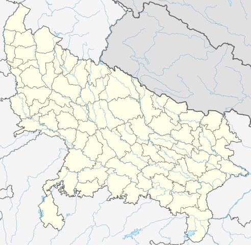
Quadratische Plattkarte, N-S-Streckung 112 %. Geographische Begrenzung der Karte:
Equirectangular projection, N/S stretching 112 %. Geographic limits of the map:
|
|
| ದಿನಾಂಕ | ||
| ಆಕರ |
ಸ್ವಂತ ಕೆಲಸ, using
|
|
| ಕರ್ತೃ | NordNordWest | |
| ಅನುಮತಿ (ಈ ಕಡತವನ್ನು ಮರುಬಳಕೆ ಮಾಡಲಾಗುತ್ತಿದೆ) |
This file is licensed under the Creative Commons Attribution-Share Alike 3.0 Germany license.
 This file is licensed under the Creative Commons Attribution-Share Alike 3.0 Germany license.
|


|
This map has been made or improved in the German Kartenwerkstatt (Map Lab). You can propose maps to improve as well.
|
ಕಡತದ ಇತಿಹಾಸ
ದಿನ/ಕಾಲ ಒತ್ತಿದರೆ ಆ ಸಮಯದಲ್ಲಿ ಈ ಕಡತದ ವಸ್ತುಸ್ಥಿತಿ ತೋರುತ್ತದೆ.
| ದಿನ/ಕಾಲ | ಕಿರುನೋಟ | ಆಯಾಮಗಳು | ಬಳಕೆದಾರ | ಟಿಪ್ಪಣಿ | |
|---|---|---|---|---|---|
| ಪ್ರಸಕ್ತ | ೧೨:೧೦, ೧ ಮೇ ೨೦೨೩ | | ೧,೦೦೬ × ೯೮೧ (೭೭೬ KB) | C1MM | c borders |
| ೧೦:೧೪, ೫ ಜನವರಿ ೨೦೨೨ |  | ೧,೦೬೬ × ೯೨೭ (೭೭೭ KB) | C1MM | Corrected rivers and dist boundaries | |
| ೦೪:೨೪, ೧೩ ಫೆಬ್ರವರಿ ೨೦೨೧ |  | ೯೦೯ × ೮೮೬ (೨೬೨ KB) | C1MM | Added Chhattisgarh | |
| ೦೬:೧೧, ೮ ಜನವರಿ ೨೦೨೧ |  | ೯೦೯ × ೮೮೬ (೨೬೧ KB) | C1MM | Added Amethi district | |
| ೦೨:೫೯, ೨೩ ಏಪ್ರಿಲ್ ೨೦೨೦ |  | ೯೦೯ × ೮೮೬ (೨೪೯ KB) | NordNordWest | Reverted to version as of 19:51, 9 October 2012 (UTC); no need to change colours | |
| ೦೨:೩೦, ೨೩ ಏಪ್ರಿಲ್ ೨೦೨೦ |  | ೯೦೯ × ೮೮೬ (೨೯೨ KB) | C1MM | Fixed rivers | |
| ೦೨:೨೧, ೨೩ ಏಪ್ರಿಲ್ ೨೦೨೦ |  | ೯೦೯ × ೮೮೬ (೨೯೦ KB) | C1MM | Fixed colors and made rivers along borders | |
| ೦೧:೨೧, ೧೦ ಅಕ್ಟೋಬರ್ ೨೦೧೨ |  | ೯೦೯ × ೮೮೬ (೨೪೯ KB) | NordNordWest | =={{int:filedesc}}== {{Information |Description= {{de|Positionskarte von Uttar Pradesh, Indien}} Quadratische Plattkarte, N-S-Streckung 112 %. Geographische Begrenzung der Karte: * N: 30.5° N * S: 23.8° N * W: 77.... |
ಕಡತ ಬಳಕೆ
ಈ ಕೆಳಗಿನ 3 ಪುಟಗಳು ಈ ಚಿತ್ರಕ್ಕೆ ಸಂಪರ್ಕ ಹೊಂದಿವೆ:
ಜಾಗತಿಕ ಕಡತ ಉಪಯೋಗ
ಈ ಕಡತವನ್ನು ಕೆಳಗಿನ ಬೇರೆ ವಿಕಿಗಳೂ ಉಪಯೋಗಿಸುತ್ತಿವೆ:
- ar.wikipedia.org ಮೇಲೆ ಬಳಕೆ
- as.wikipedia.org ಮೇಲೆ ಬಳಕೆ
- awa.wikipedia.org ಮೇಲೆ ಬಳಕೆ
- azb.wikipedia.org ಮೇಲೆ ಬಳಕೆ
- اتاوه
- کینتور
- علیپورا
- فولپور
- فولی (هیندوستان)
- ففنا (هیندوستان)
- فارندا
- سارسای ناوار
- ساروخیپورا
- ساراوان, جاونپور
- ساراسارا, یوتار پرادش
- ساراییا بور
- سارایبیرو
- مداوارا کالا
- سانخنی
- ماوجامپور
- ماسکانوا
- سانای, بوداون
- سامرر (هیندوستان)
- کالاند, ایندیا
- مارتین پوروا
- سامبالهرا
- کاکورا
- سالارپور, بوداون
- کایتورا, جاونپور
- ساییان, آقرا
- ساینتال, یوتار پرادش
- سایفای
- کاقارول
- سایدناقار
- ساهاجانپور
- هالاور
- سافدارقانج
- سادپور, یوتار پرادش
- روپایدیها
- رابارلی
- کادار چووک
ಈ ಫೈಲ್ನ ಹೆಚ್ಚು ಜಾಗತಿಕ ಬಳಕೆಯನ್ನು ವೀಕ್ಷಿಸಿ.