
ಚಿತ್ರ:Estonia location map (2005-2017) no rivers.svg

Size of this PNG preview of this SVG file: ೭೧೮ × ೬೦೦ ಪಿಕ್ಸೆಲ್ಗಳು. ಇತರ ರೆಸಲ್ಯೂಶನ್ಗಳು: ೨೮೭ × ೨೪೦ ಪಿಕ್ಸೆಲ್ಗಳು | ೫೭೫ × ೪೮೦ ಪಿಕ್ಸೆಲ್ಗಳು | ೯೨೦ × ೭೬೮ ಪಿಕ್ಸೆಲ್ಗಳು | ೧,೨೨೬ × ೧,೦೨೪ ಪಿಕ್ಸೆಲ್ಗಳು | ೨,೪೫೨ × ೨,೦೪೮ ಪಿಕ್ಸೆಲ್ಗಳು | ೧,೬೬೮ × ೧,೩೯೩ ಪಿಕ್ಸೆಲ್ಗಳು.
ಮೂಲ ಕಡತ (SVG ಫೈಲು, ಸುಮಾರಾಗಿ ೧,೬೬೮ × ೧,೩೯೩ ಚಿತ್ರಬಿಂದುಗಳು, ಫೈಲಿನ ಗಾತ್ರ: ೪೦೭ KB)
ಈ ಫೈಲು ವಿಕಿಮೀಡಿಯ ಕಾಮನ್ಸ್ನಲ್ಲಿ ಇರುವುದು. ಅಲ್ಲಿನ ವಿವರಣೆ ಪುಟವನ್ನೇ ಕೆಳಗೆ ತೋರಿಸಲಾಗಿದೆ. ಕಾಮನ್ಸ್ ಕೃತಿಸ್ವಾಮ್ಯತೆಯಿಂದ ಮುಕ್ತ ಫೈಲುಗಳ ಒಂದು ಆಗರ. ಅಲ್ಲಿ ನೀವೂ ಸಹಕರಿಸಬಹುದು. |
ಸಾರಾಂಶ
| ವಿವರ |
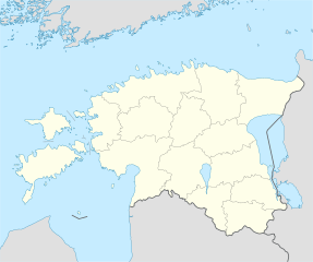
Deutsch: Positionskarte von Estland
Quadratische Plattkarte, N-S-Streckung 180 %. Geographische Begrenzung der Karte:
English: Location map of Estonia
Equirectangular projection, N/S stretching 180 %. Geographic limits of the map:
|
||
| ದಿನಾಂಕ | |||
| ಆಕರ | own work, using United States National Imagery and Mapping Agency data | ||
| ಕರ್ತೃ | NordNordWest | ||
| ಇತರೆ ಆವೃತ್ತಿಗಳು |
Derivative works of this file: |
||
| SVG genesis |
|

_no_rivers.svg)
.svg)
ಪರವಾನಗಿ
I, the copyright holder of this work, hereby publish it under the following licenses:

|
GNU ಉಚಿತ ಡಾಕ್ಯುಮೆಂಟೇಶನ್ ಪರವಾನಗಿ, ಆವೃತ್ತಿಯ ನಿಯಮಗಳ ಅಡಿಯಲ್ಲಿ ಈ ಡಾಕ್ಯುಮೆಂಟ್ ಅನ್ನು ನಕಲಿಸಲು, ವಿತರಿಸಲು ಮತ್ತು/ಅಥವಾ ಮಾರ್ಪಡಿಸಲು ಅನುಮತಿಯನ್ನು ನೀಡಲಾಗಿದೆ. 1.2 ಅಥವಾ ಯಾವುದೇ ನಂತರದ ಆವೃತ್ತಿಯನ್ನು ಉಚಿತ ಸಾಫ್ಟ್ವೇರ್ ಫೌಂಡೇಶನ್ ಪ್ರಕಟಿಸಿದೆ; ಯಾವುದೇ ಅಸ್ಥಿರ ವಿಭಾಗಗಳಿಲ್ಲದೆ, ಮುಖ ಪಠ್ಯಗಳಿಲ್ಲ ಮತ್ತು ಹಿಂದಿನ ಕವರ್ ಪಠ್ಯಗಳಿಲ್ಲ. ಪರವಾನಗಿಯ ಪ್ರತಿಯನ್ನು GNU ಉಚಿತ ಡಾಕ್ಯುಮೆಂಟೇಶನ್ ಪರವಾನಗಿ ಎಂಬ ವಿಭಾಗದಲ್ಲಿ ಸೇರಿಸಲಾಗಿದೆ. |
ಈ ಕಡತ ಕ್ರಿಯೇಟಿವ್ ಕಾಮನ್ಸ್ Attribution
-Share Alike 3.0 Unported ಪರವಾನಗಿ ಹೊಂದಿದೆ.
- ನೀವು ಮುಕ್ತ:
- ಹಂಚಿಕೆಗೆ – ಕೆಲಸವನ್ನು ನಕಲು ಮಾಡಲು, ವಿತರಣೆ ಮತ್ತು ಸಾಗಿಸಲು
- ರೀಮಿಕ್ಸ್ ಮಾಡಲು – ಕೆಲಸವನ್ನು ಬಳಸಿಕೊಳ್ಳಲು
- ಈ ಕೆಳಗಿನ ಷರತ್ತುಗಳಲ್ಲಿ:
- ವೈಶಿಷ್ಟ್ಯ – ನೀವು ಸೂಕ್ತವಾದ ಕ್ರೆಡಿಟ್ ನೀಡಬೇಕು, ಪರವಾನಗಿಗೆ ಲಿಂಕ್ ಅನ್ನು ಒದಗಿಸಬೇಕು ಮತ್ತು ಯಾವುದೇ ಬದಲಾವಣೆಗಳನ್ನು ಮಾಡಿದ್ದರೆ ಸೂಚಿಸಬೇಕು. ನೀವು ಯಾವುದೇ ಸಮಂಜಸವಾದ ರೀತಿಯಲ್ಲಿ ಮಾಡಬಹುದು, ಆದರೆ ಪರವಾನಗಿದಾರರು ನಿಮ್ಮನ್ನು ಅಥವಾ ನಿಮ್ಮ ಯಾವುದೇ ಬಳಕೆಯನ್ನು ಅನುಮೋದಿಸಿದಂತೆ ರೀತಿಯಲ್ಲಿ ಉಪಯೋಗಿಸಬಾರದು.
- ಇರುವುದರಂತೆಯೇ ಹಂಚು – ನೀವು ರೀಮಿಕ್ಸ್ ಮಾಡಿದರೆ, ರೂಪಾಂತರಗೊಳಿಸಿದರೆ ಅಥವಾ ವಸ್ತುವಿನ ಮೇಲೆ ನಿರ್ಮಿಸಿದರೆ, ನಿಮ್ಮ ಕೊಡುಗೆಗಳನ್ನು ನೀವು ಮೂಲದಂತೆ ಅದೇ ಅಥವಾ ಹೊಂದಾಣಿಕೆಯ ಪರವಾನಗಿ ಅಡಿಯಲ್ಲಿ ವಿತರಿಸಬೇಕು.
ನಿಮ್ಮಿಚ್ಛೆಯ ಪರವಾನಗಿಯನ್ನು ನೀವು ಆರಿಸಿಕೊಳ್ಳಬಹುದು.
ಕಡತದ ಇತಿಹಾಸ
ದಿನ/ಕಾಲ ಒತ್ತಿದರೆ ಆ ಸಮಯದಲ್ಲಿ ಈ ಕಡತದ ವಸ್ತುಸ್ಥಿತಿ ತೋರುತ್ತದೆ.
| ದಿನ/ಕಾಲ | ಕಿರುನೋಟ | ಆಯಾಮಗಳು | ಬಳಕೆದಾರ | ಟಿಪ್ಪಣಿ | |
|---|---|---|---|---|---|
| ಪ್ರಸಕ್ತ | ೧೧:೪೪, ೬ ಮೇ ೨೦೧೯ | | ೧,೬೬೮ × ೧,೩೯೩ (೪೦೭ KB) | Lasunncty | fix svg errors and reduce file size |
| ೦೧:೩೫, ೧೦ ಮೇ ೨೦೦೯ |  | ೧,೬೬೮ × ೧,೩೯೩ (೪೬೪ KB) | NordNordWest | some troubles with changing location maps that way | |
| ೨೨:೪೮, ೯ ಮೇ ೨೦೦೯ |  | ೧,೦೦೦ × ೮೩೫ (೬೩೯ KB) | Ahnode | *1. Resized the objects to W:1000px, H:835px. *2. Created two separate layers for Estonia itself and the rest of the world. *3. Subtracted lakes from shape areas and divided area of Estonia into counties to ease future creation of location maps. | |
| ೦೦:೩೩, ೨೬ ಆಗಸ್ಟ್ ೨೦೦೮ |  | ೧,೬೬೮ × ೧,೩೯೩ (೪೬೪ KB) | NordNordWest | size correction | |
| ೧೯:೪೧, ೭ ಜುಲೈ ೨೦೦೮ |  | ೫೫೬ × ೪೬೪ (೪೬೭ KB) | NordNordWest | ||
| ೧೯:೫೫, ೨೯ ಜೂನ್ ೨೦೦೮ |  | ೫೫೬ × ೪೬೪ (೪೬೮ KB) | NordNordWest | {{Information |Description= {{de|Positionskarte von Estland}} Quadratische Plattkarte, N-S-Streckung 180 %. Geographische Begrenzung der Karte: * N: 60.4° N * S: 57.2° N * W: 21.5° O * O: 28.4° O {{en|Location map of [[:en:Estonia|Esto |
ಕಡತ ಬಳಕೆ
ಈ ಕೆಳಗಿನ ಪುಟವು ಈ ಚಿತ್ರಕ್ಕೆ ಸಂಪರ್ಕ ಹೊಂದಿದೆ:
ಜಾಗತಿಕ ಕಡತ ಉಪಯೋಗ
ಈ ಕಡತವನ್ನು ಕೆಳಗಿನ ಬೇರೆ ವಿಕಿಗಳೂ ಉಪಯೋಗಿಸುತ್ತಿವೆ:
- af.wikipedia.org ಮೇಲೆ ಬಳಕೆ
- ba.wikipedia.org ಮೇಲೆ ಬಳಕೆ
- be-tarask.wikipedia.org ಮೇಲೆ ಬಳಕೆ
- Талін
- Шаблён:Лякалізацыйная мапа Эстоніі
- Саарэмаа
- Талінскі ўнівэрсытэт
- Валга
- Выру
- Йыхві
- Вільяндзі
- Харку (возера)
- Выртс’ярв
- Пярну
- Муху
- Йыгева
- Раквэрэ
- Тартускі ўнівэрсытэт
- Тарту
- Шаблён:Пратока
- Шаблён:Пратока/Дакумэнтацыя
- Музэй акупацыяў
- Царква Сьвятога Міхаіла (Кейля)
- Царква прытулку Сьвятога Яна (Талін)
- Палдыскі
- Царква Сьвятога Яна (Талін)
- Калёна Перамогі ў вайне за незалежнасьць Эстоніі
- Нарва (горад)
- Кейля
- Курэсаарэ
- Саўэ
- Царква Сьвятога Олафа (Талін)
- Домскі сабор (Талін)
- Нараўскі замак
- Кохтла-Ярвэ
- Кейля (замак)
- Царква Сьвятога Марціна (Вальяла)
- Пылва
- Талінская ратуша
- Суўр Мунамягі
- Юлемістэ (возера)
- Кляштар Сьвятой Біргіты
- Пюхціцкі манастыр
- Элва
- Сабор Аляксандра Неўскага (Талін)
- Царква Сьвятога Духа (Талін)
- Хіюмаа
- Кік-ін-дэ-Кёк
- Стары Томас
- Эстонскі марскі музэй
ಈ ಫೈಲ್ನ ಹೆಚ್ಚು ಜಾಗತಿಕ ಬಳಕೆಯನ್ನು ವೀಕ್ಷಿಸಿ.
_no_rivers.svg)
_no_rivers.svg)