
ಚಿತ್ರ:Costa Rica relief location map.jpg

ಈ ಮುನ್ನೋಟ ಗಾತ್ರ:೬೬೬ × ೬೦೦ ಪಿಕ್ಸೆಲ್ಗಳು. ಇತರ ರೆಸಲ್ಯೂಶನ್ಗಳು: ೨೬೭ × ೨೪೦ ಪಿಕ್ಸೆಲ್ಗಳು | ೫೩೩ × ೪೮೦ ಪಿಕ್ಸೆಲ್ಗಳು | ೮೫೩ × ೭೬೮ ಪಿಕ್ಸೆಲ್ಗಳು | ೧,೧೪೮ × ೧,೦೩೪ ಪಿಕ್ಸೆಲ್ಗಳು.
ಮೂಲ ಕಡತ (೧,೧೪೮ × ೧,೦೩೪ ಚಿತ್ರಬಿಂದು, ಫೈಲಿನ ಗಾತ್ರ: ೮೪೧ KB, MIME ಪ್ರಕಾರ: image/jpeg)
ಈ ಫೈಲು ವಿಕಿಮೀಡಿಯ ಕಾಮನ್ಸ್ನಲ್ಲಿ ಇರುವುದು. ಅಲ್ಲಿನ ವಿವರಣೆ ಪುಟವನ್ನೇ ಕೆಳಗೆ ತೋರಿಸಲಾಗಿದೆ. ಕಾಮನ್ಸ್ ಕೃತಿಸ್ವಾಮ್ಯತೆಯಿಂದ ಮುಕ್ತ ಫೈಲುಗಳ ಒಂದು ಆಗರ. ಅಲ್ಲಿ ನೀವೂ ಸಹಕರಿಸಬಹುದು. |
ಸಾರಾಂಶ
| Camera location | | View this and other nearby images on: OpenStreetMap |
|---|
| ವಿವರ |
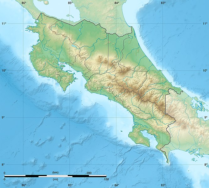
English: Blank relief map of Costa Rica for geo-location purpose.
Note : The Isla del Coco, out of the map, is not shown. Scale : 1:1,856,000 (accuracy : 464 m) Français : Carte du relief vierge du Costa Rica destinée à la géolocalisation.
Note : L´Isla del Coco, hors carte, n'est pas représentée. Échelle : 1:1 856 000 (précision : 464 m) Equirectangular projection centered on 9° 30' N – 84° 15' W, WGS84 datum * West : 86° 30' W * East : 82° W * North : 11° 30' N * South : 7° 30' N |
||
| ದಿನಾಂಕ | 2008-06, updated 2022-03 | ||
| ಆಕರ |
ಸ್ವಂತ ಕೆಲಸ
|
||
| ಕರ್ತೃ | Eric Gaba (Sting - fr:Sting) | ||
| ಅನುಮತಿ (ಈ ಕಡತವನ್ನು ಮರುಬಳಕೆ ಮಾಡಲಾಗುತ್ತಿದೆ) |
|
||
| ಇತರೆ ಆವೃತ್ತಿಗಳು |
|

ಪರವಾನಗಿ
Eric Gaba (user Sting) for Wikimedia Commons using GEBCO_2021 Grid data, the copyright holder of this work, hereby publishes it under the following licenses:

|
GNU ಉಚಿತ ಡಾಕ್ಯುಮೆಂಟೇಶನ್ ಪರವಾನಗಿ, ಆವೃತ್ತಿಯ ನಿಯಮಗಳ ಅಡಿಯಲ್ಲಿ ಈ ಡಾಕ್ಯುಮೆಂಟ್ ಅನ್ನು ನಕಲಿಸಲು, ವಿತರಿಸಲು ಮತ್ತು/ಅಥವಾ ಮಾರ್ಪಡಿಸಲು ಅನುಮತಿಯನ್ನು ನೀಡಲಾಗಿದೆ. 1.2 ಅಥವಾ ಯಾವುದೇ ನಂತರದ ಆವೃತ್ತಿಯನ್ನು ಉಚಿತ ಸಾಫ್ಟ್ವೇರ್ ಫೌಂಡೇಶನ್ ಪ್ರಕಟಿಸಿದೆ; ಯಾವುದೇ ಅಸ್ಥಿರ ವಿಭಾಗಗಳಿಲ್ಲದೆ, ಮುಖ ಪಠ್ಯಗಳಿಲ್ಲ ಮತ್ತು ಹಿಂದಿನ ಕವರ್ ಪಠ್ಯಗಳಿಲ್ಲ. ಪರವಾನಗಿಯ ಪ್ರತಿಯನ್ನು GNU ಉಚಿತ ಡಾಕ್ಯುಮೆಂಟೇಶನ್ ಪರವಾನಗಿ ಎಂಬ ವಿಭಾಗದಲ್ಲಿ ಸೇರಿಸಲಾಗಿದೆ. |
This file is licensed under the Creative Commons Attribution-Share Alike 4.0 International, 3.0 Unported, 2.5 Generic, 2.0 Generic and 1.0 Generic license.
ವೈಶಿಷ್ಟ್ಯ: Eric Gaba (user Sting) for Wikimedia Commons using GEBCO_2021 Grid data
- ನೀವು ಮುಕ್ತ:
- ಹಂಚಿಕೆಗೆ – ಕೆಲಸವನ್ನು ನಕಲು ಮಾಡಲು, ವಿತರಣೆ ಮತ್ತು ಸಾಗಿಸಲು
- ರೀಮಿಕ್ಸ್ ಮಾಡಲು – ಕೆಲಸವನ್ನು ಬಳಸಿಕೊಳ್ಳಲು
- ಈ ಕೆಳಗಿನ ಷರತ್ತುಗಳಲ್ಲಿ:
- ವೈಶಿಷ್ಟ್ಯ – ನೀವು ಸೂಕ್ತವಾದ ಕ್ರೆಡಿಟ್ ನೀಡಬೇಕು, ಪರವಾನಗಿಗೆ ಲಿಂಕ್ ಅನ್ನು ಒದಗಿಸಬೇಕು ಮತ್ತು ಯಾವುದೇ ಬದಲಾವಣೆಗಳನ್ನು ಮಾಡಿದ್ದರೆ ಸೂಚಿಸಬೇಕು. ನೀವು ಯಾವುದೇ ಸಮಂಜಸವಾದ ರೀತಿಯಲ್ಲಿ ಮಾಡಬಹುದು, ಆದರೆ ಪರವಾನಗಿದಾರರು ನಿಮ್ಮನ್ನು ಅಥವಾ ನಿಮ್ಮ ಯಾವುದೇ ಬಳಕೆಯನ್ನು ಅನುಮೋದಿಸಿದಂತೆ ರೀತಿಯಲ್ಲಿ ಉಪಯೋಗಿಸಬಾರದು.
- ಇರುವುದರಂತೆಯೇ ಹಂಚು – ನೀವು ರೀಮಿಕ್ಸ್ ಮಾಡಿದರೆ, ರೂಪಾಂತರಗೊಳಿಸಿದರೆ ಅಥವಾ ವಸ್ತುವಿನ ಮೇಲೆ ನಿರ್ಮಿಸಿದರೆ, ನಿಮ್ಮ ಕೊಡುಗೆಗಳನ್ನು ನೀವು ಮೂಲದಂತೆ ಅದೇ ಅಥವಾ ಹೊಂದಾಣಿಕೆಯ ಪರವಾನಗಿ ಅಡಿಯಲ್ಲಿ ವಿತರಿಸಬೇಕು.
ನಿಮ್ಮಿಚ್ಛೆಯ ಪರವಾನಗಿಯನ್ನು ನೀವು ಆರಿಸಿಕೊಳ್ಳಬಹುದು.
ಕಡತದ ಇತಿಹಾಸ
ದಿನ/ಕಾಲ ಒತ್ತಿದರೆ ಆ ಸಮಯದಲ್ಲಿ ಈ ಕಡತದ ವಸ್ತುಸ್ಥಿತಿ ತೋರುತ್ತದೆ.
| ದಿನ/ಕಾಲ | ಕಿರುನೋಟ | ಆಯಾಮಗಳು | ಬಳಕೆದಾರ | ಟಿಪ್ಪಣಿ | |
|---|---|---|---|---|---|
| ಪ್ರಸಕ್ತ | ೦೪:೨೧, ೩೧ ಮಾರ್ಚ್ ೨೦೨೨ | | ೧,೧೪೮ × ೧,೦೩೪ (೮೪೧ KB) | Sting | New map using new data |
| ೦೭:೦೨, ೪ ನವೆಂಬರ್ ೨೦೨೧ |  | ೧,೧೪೮ × ೧,೦೩೪ (೯೦೬ KB) | RoboQwezt0x7CB | hand edited to remove non-existing waterbodies, used lower elevation green shade to bucket fill (best I can do without the tools to generate the map) particulary in the south of the country (probably an altitude render/clipping error), kept some that are hydroelectric plant's reservoirs | |
| ೧೭:೪೧, ೧೯ ಜುಲೈ ೨೦೧೦ |  | ೧,೧೪೮ × ೧,೦೩೪ (೫೦೦ KB) | Sting | Color profile | |
| ೨೦:೩೫, ೩೦ ಜುಲೈ ೨೦೦೮ |  | ೧,೧೪೮ × ೧,೦೩೪ (೪೯೧ KB) | Sting | - border | |
| ೨೦:೧೦, ೧೩ ಜೂನ್ ೨೦೦೮ |  | ೧,೧೪೮ × ೧,೦೩೪ (೪೯೯ KB) | Sting | Several improvements | |
| ೦೬:೫೧, ೧೨ ಜೂನ್ ೨೦೦೮ |  | ೧,೧೪೮ × ೧,೦೩೪ (೫೦೧ KB) | Sting | Correction on shaded layer | |
| ೦೬:೩೯, ೧೨ ಜೂನ್ ೨೦೦೮ |  | ೧,೧೪೮ × ೧,೦೩೪ (೫೦೪ KB) | Sting | == Summary == {{Location|10|00|00|N|84|00|00|W|scale:2000000}} <br/> {{Information |Description={{en|Blank relief map of Costa Rica for geo-location purpose.<br/>''Note :'' The ''Isla del Coco'', out of the map, is not shown.<br/>Scale |
ಕಡತ ಬಳಕೆ
ಈ ಕೆಳಗಿನ ಪುಟವು ಈ ಚಿತ್ರಕ್ಕೆ ಸಂಪರ್ಕ ಹೊಂದಿದೆ:
ಜಾಗತಿಕ ಕಡತ ಉಪಯೋಗ
ಈ ಕಡತವನ್ನು ಕೆಳಗಿನ ಬೇರೆ ವಿಕಿಗಳೂ ಉಪಯೋಗಿಸುತ್ತಿವೆ:
- ar.wikipedia.org ಮೇಲೆ ಬಳಕೆ
- ast.wikipedia.org ಮೇಲೆ ಬಳಕೆ
- azb.wikipedia.org ಮೇಲೆ ಬಳಕೆ
- az.wikipedia.org ಮೇಲೆ ಬಳಕೆ
- ban.wikipedia.org ಮೇಲೆ ಬಳಕೆ
- ba.wikipedia.org ಮೇಲೆ ಬಳಕೆ
- be.wikipedia.org ಮೇಲೆ ಬಳಕೆ
- bg.wikipedia.org ಮೇಲೆ ಬಳಕೆ
- bn.wikipedia.org ಮೇಲೆ ಬಳಕೆ
- bs.wikipedia.org ಮೇಲೆ ಬಳಕೆ
- ca.wikipedia.org ಮೇಲೆ ಬಳಕೆ
- ceb.wikipedia.org ಮೇಲೆ ಬಳಕೆ
- ce.wikipedia.org ಮೇಲೆ ಬಳಕೆ
- ckb.wikipedia.org ಮೇಲೆ ಬಳಕೆ
- cs.wikipedia.org ಮೇಲೆ ಬಳಕೆ
ಈ ಫೈಲ್ನ ಹೆಚ್ಚು ಜಾಗತಿಕ ಬಳಕೆಯನ್ನು ವೀಕ್ಷಿಸಿ.