
ಚಿತ್ರ:Cocos (Keeling) Islands location map.svg

Size of this PNG preview of this SVG file: ೨೯೫ × ೬೦೦ ಪಿಕ್ಸೆಲ್ಗಳು. ಇತರ ರೆಸಲ್ಯೂಶನ್ಗಳು: ೧೧೮ × ೨೪೦ ಪಿಕ್ಸೆಲ್ಗಳು | ೨೩೬ × ೪೮೦ ಪಿಕ್ಸೆಲ್ಗಳು | ೩೭೮ × ೭೬೮ ಪಿಕ್ಸೆಲ್ಗಳು | ೫೦೪ × ೧,೦೨೪ ಪಿಕ್ಸೆಲ್ಗಳು | ೧,೦೦೭ × ೨,೦೪೮ ಪಿಕ್ಸೆಲ್ಗಳು | ೭೭೨ × ೧,೫೬೯ ಪಿಕ್ಸೆಲ್ಗಳು.
ಮೂಲ ಕಡತ (SVG ಫೈಲು, ಸುಮಾರಾಗಿ ೭೭೨ × ೧,೫೬೯ ಚಿತ್ರಬಿಂದುಗಳು, ಫೈಲಿನ ಗಾತ್ರ: ೧೯೩ KB)
ಈ ಫೈಲು ವಿಕಿಮೀಡಿಯ ಕಾಮನ್ಸ್ನಲ್ಲಿ ಇರುವುದು. ಅಲ್ಲಿನ ವಿವರಣೆ ಪುಟವನ್ನೇ ಕೆಳಗೆ ತೋರಿಸಲಾಗಿದೆ. ಕಾಮನ್ಸ್ ಕೃತಿಸ್ವಾಮ್ಯತೆಯಿಂದ ಮುಕ್ತ ಫೈಲುಗಳ ಒಂದು ಆಗರ. ಅಲ್ಲಿ ನೀವೂ ಸಹಕರಿಸಬಹುದು. |
_Islands_location_map.svg)
ಸಾರಾಂಶ
| ವಿವರ |
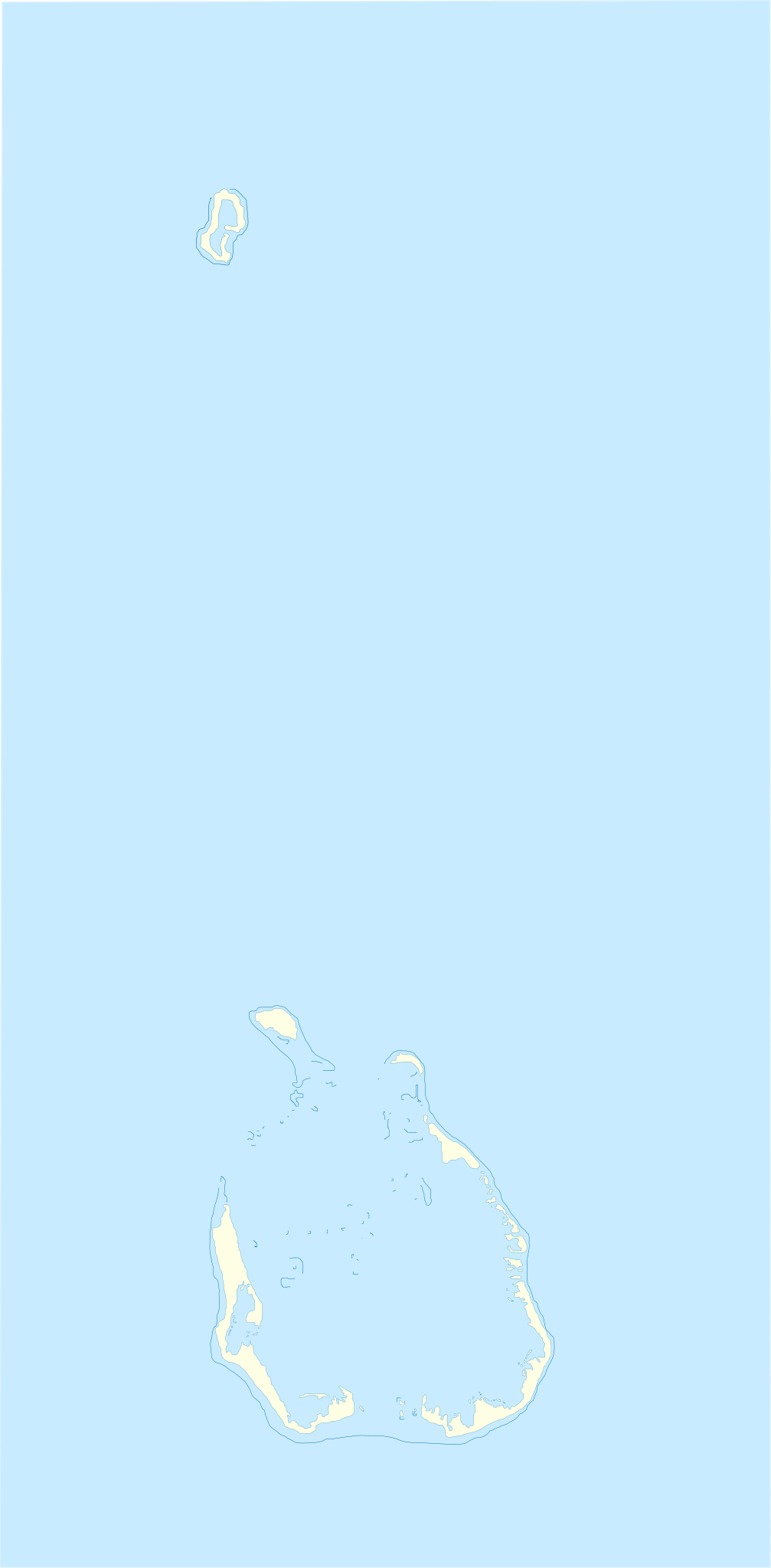
English: Location map of Cocos_(Keeling)_Islands
Equirectangular projection. Geographic limits of the map:
Français : Carte de localisation des Îles Cocos
projection equirectangulaire. Les limites géographiques sont
|
| ದಿನಾಂಕ | |
| ಆಕರ | ಸ್ವಂತ ಕೆಲಸ |
| ಕರ್ತೃ | Xfigpower |
la vectorisation à main levée s'est appuyé sur Image:Cocos(keeling)_76.jpg
_76.jpg)
ಪರವಾನಗಿ
I, the copyright holder of this work, hereby publish it under the following licenses:

|
GNU ಉಚಿತ ಡಾಕ್ಯುಮೆಂಟೇಶನ್ ಪರವಾನಗಿ, ಆವೃತ್ತಿಯ ನಿಯಮಗಳ ಅಡಿಯಲ್ಲಿ ಈ ಡಾಕ್ಯುಮೆಂಟ್ ಅನ್ನು ನಕಲಿಸಲು, ವಿತರಿಸಲು ಮತ್ತು/ಅಥವಾ ಮಾರ್ಪಡಿಸಲು ಅನುಮತಿಯನ್ನು ನೀಡಲಾಗಿದೆ. 1.2 ಅಥವಾ ಯಾವುದೇ ನಂತರದ ಆವೃತ್ತಿಯನ್ನು ಉಚಿತ ಸಾಫ್ಟ್ವೇರ್ ಫೌಂಡೇಶನ್ ಪ್ರಕಟಿಸಿದೆ; ಯಾವುದೇ ಅಸ್ಥಿರ ವಿಭಾಗಗಳಿಲ್ಲದೆ, ಮುಖ ಪಠ್ಯಗಳಿಲ್ಲ ಮತ್ತು ಹಿಂದಿನ ಕವರ್ ಪಠ್ಯಗಳಿಲ್ಲ. ಪರವಾನಗಿಯ ಪ್ರತಿಯನ್ನು GNU ಉಚಿತ ಡಾಕ್ಯುಮೆಂಟೇಶನ್ ಪರವಾನಗಿ ಎಂಬ ವಿಭಾಗದಲ್ಲಿ ಸೇರಿಸಲಾಗಿದೆ. |
This file is licensed under the Creative Commons Attribution 3.0 Unported license.
- ನೀವು ಮುಕ್ತ:
- ಹಂಚಿಕೆಗೆ – ಕೆಲಸವನ್ನು ನಕಲು ಮಾಡಲು, ವಿತರಣೆ ಮತ್ತು ಸಾಗಿಸಲು
- ರೀಮಿಕ್ಸ್ ಮಾಡಲು – ಕೆಲಸವನ್ನು ಬಳಸಿಕೊಳ್ಳಲು
- ಈ ಕೆಳಗಿನ ಷರತ್ತುಗಳಲ್ಲಿ:
- ವೈಶಿಷ್ಟ್ಯ – ನೀವು ಸೂಕ್ತವಾದ ಕ್ರೆಡಿಟ್ ನೀಡಬೇಕು, ಪರವಾನಗಿಗೆ ಲಿಂಕ್ ಅನ್ನು ಒದಗಿಸಬೇಕು ಮತ್ತು ಯಾವುದೇ ಬದಲಾವಣೆಗಳನ್ನು ಮಾಡಿದ್ದರೆ ಸೂಚಿಸಬೇಕು. ನೀವು ಯಾವುದೇ ಸಮಂಜಸವಾದ ರೀತಿಯಲ್ಲಿ ಮಾಡಬಹುದು, ಆದರೆ ಪರವಾನಗಿದಾರರು ನಿಮ್ಮನ್ನು ಅಥವಾ ನಿಮ್ಮ ಯಾವುದೇ ಬಳಕೆಯನ್ನು ಅನುಮೋದಿಸಿದಂತೆ ರೀತಿಯಲ್ಲಿ ಉಪಯೋಗಿಸಬಾರದು.
ನಿಮ್ಮಿಚ್ಛೆಯ ಪರವಾನಗಿಯನ್ನು ನೀವು ಆರಿಸಿಕೊಳ್ಳಬಹುದು.
ಕಡತದ ಇತಿಹಾಸ
ದಿನ/ಕಾಲ ಒತ್ತಿದರೆ ಆ ಸಮಯದಲ್ಲಿ ಈ ಕಡತದ ವಸ್ತುಸ್ಥಿತಿ ತೋರುತ್ತದೆ.
| ದಿನ/ಕಾಲ | ಕಿರುನೋಟ | ಆಯಾಮಗಳು | ಬಳಕೆದಾರ | ಟಿಪ್ಪಣಿ | |
|---|---|---|---|---|---|
| ಪ್ರಸಕ್ತ | ೧೫:೪೭, ೪ ಆಗಸ್ಟ್ ೨೦೧೦ | | ೭೭೨ × ೧,೫೬೯ (೧೯೩ KB) | Xfigpower | {{Information |Description={{en|1=Location map of Cocos_(Keeling)_Islands}} Equirectangular projection. Geographic limits of the map: * N: 11°45' S * S: 12°15' S * W: 96°45' E * E: 97°00 E}} {{fr|1=Carte de lo |
ಕಡತ ಬಳಕೆ
ಈ ಕೆಳಗಿನ ಪುಟವು ಈ ಚಿತ್ರಕ್ಕೆ ಸಂಪರ್ಕ ಹೊಂದಿದೆ:
ಜಾಗತಿಕ ಕಡತ ಉಪಯೋಗ
ಈ ಕಡತವನ್ನು ಕೆಳಗಿನ ಬೇರೆ ವಿಕಿಗಳೂ ಉಪಯೋಗಿಸುತ್ತಿವೆ:
- af.wikipedia.org ಮೇಲೆ ಬಳಕೆ
- an.wikipedia.org ಮೇಲೆ ಬಳಕೆ
- ar.wikipedia.org ಮೇಲೆ ಬಳಕೆ
- ast.wikipedia.org ಮೇಲೆ ಬಳಕೆ
- ba.wikipedia.org ಮೇಲೆ ಬಳಕೆ
- bn.wikipedia.org ಮೇಲೆ ಬಳಕೆ
- bs.wikipedia.org ಮೇಲೆ ಬಳಕೆ
- ceb.wikipedia.org ಮೇಲೆ ಬಳಕೆ
- Plantilya:Location map Cocos (Keeling) Islands
- West Cay
- East Cay
- Ross Island
- Ross
- Selma
- North Lagoon
- South Island
- Western Entrance
- West Island
- Wreck Point
- Possession Point
- Direction Island
- Gooseberry Island
- Burial Island
- Burton Point
- Home Island
- Prison Island
- Selma Island
- Cocos Islands (pagklaro)
- Keeling Islands
- Pulo Panjang
- Ujong Tanjong
- Port Refuge
- Teluk Jambu
- Pulo Maria
- Horsburgh Island
- Pulu Belan
- Telok Semberang
- Cocos Islands
- Wreck Point (punta sa Kapupud-ang Cocos)
- Workhouse Island
- Gumagamit:Lsjbot/Duplicates/Cocos Islands (kapuloan sa Cocos Islands, lat -12,00, long 96,83)
- West Island (pulo sa Kapupud-ang Cocos, lat -12,18, long 96,83)
- Western Entrance (agianan nga nabigasyon)
- Turk Reef
- Ujong Tanjong (punta sa Kapupud-ang Cocos)
- South Lagoon (lanaw sa Kapupud-ang Cocos)
- South Keeling Islands
ಈ ಫೈಲ್ನ ಹೆಚ್ಚು ಜಾಗತಿಕ ಬಳಕೆಯನ್ನು ವೀಕ್ಷಿಸಿ.
_Islands_location_map.svg)
_Islands_location_map.svg)